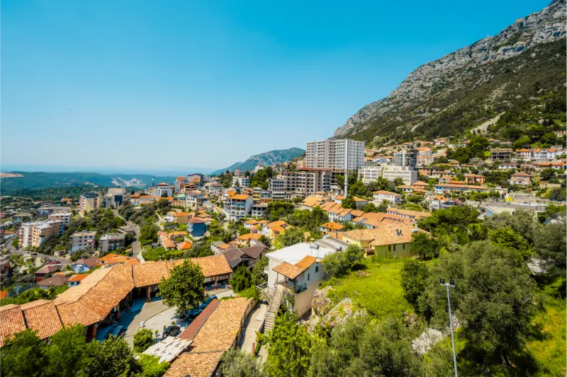
Category: Mountains & Nature

Guides to Theth, the Albanian Alps, lakes, hiking routes and nature-focused travel across Albania.

  • Where to Stay in Theth: Village Center, Gjelaj, Nderlysa and Mountain Guesthouses

    Where to Stay in Theth: Village Center, Gjelaj, Nderlysa and Mountain Guesthouses

    Theth does not have hotel districts in the normal sense. It is a mountain valley of scattered homes and family guesthouses, and the practical difference is how close you are to the church, the main trailheads, your transfer drop-off point and the route toward the Blue Eye. For a first visit without a car, the village center is usually easiest. Gjelaj offers a quieter rural feel, Nderlysa suits travelers focused on the Blue Eye, and higher or more remote guesthouses reward you with views at the cost of extra walking.

    If you are still deciding how Theth fits into the wider trip, start with Theth and the Albanian Alps Travel Guide. For the country-wide comparison, see Where to Stay in Albania. When you are ready to compare live availability, check accommodation in Theth on Booking.com.

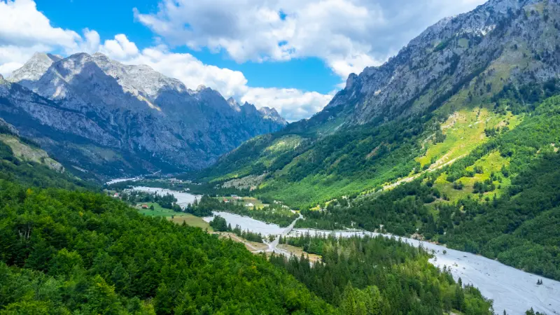
    Aerial Drone View Rustic Homes Hotels Theth National Park Albania Albanian Alps

    Where to stay in Theth: quick comparison

    AreaBest forMain trade-off
    Village center around the churchfirst-time visitors, car-free stays and straightforward hiking logisticsIt is the most popular area in high season and can feel busier than outlying hamlets.
    Gjelajquiet mountain atmosphere, views and travelers who still want reasonable access to the centerYou may add a walk before and after every activity.
    NderlysaBlue Eye-focused itineraries, canyon walks and travelers seeking a remote feelIt is farther from the church and the usual center.
    Higher slopes and isolated guesthousesviews, stargazing, quiet and travelers happy to eat at the guesthouseThe trade-off is access.

    How Theth is laid out

    The valley stretches along the river with small hamlets and guesthouses distributed over a much larger area than a conventional village center. Distances that look short on a map can involve uneven paths, gradients or a road walk. That matters when you arrive with luggage or when you need to start the Valbona Pass hike early. In Theth, I would choose the guesthouse based on the next day’s walking plan before comparing décor.

    This is why I would not filter only by review score and price. Open the map, zoom in until you can see the street pattern, then check the route to the place you expect to visit most often. In Albania, a short distance can hide a steep lane, a busy coastal road, a pedestrian-only old-town section or a location that is perfectly convenient by car but annoying on foot. A slightly lower-rated property in the right micro-location can make the whole stay easier.

    Village center around the church

    Best for: first-time visitors, car-free stays and straightforward hiking logistics.

    This is the easiest base because the church, Lock-in Tower area, shops and several walking routes are close. Shared transfers from Shkodër commonly focus on the central part of the valley, so it reduces uncertainty when arriving without your own vehicle.

    It is the most popular area in high season and can feel busier than outlying hamlets. Book ahead if your dates fall in the main hiking months.

    In the mountains, location and meals are linked. A remote guesthouse can be wonderful precisely because there is little around it, but that also means dinner, breakfast, transport and the next morning’s trail plan should be clear before you arrive. The most scenic room is not automatically the most practical base for an early hiking start.

    Gjelaj

    Best for: quiet mountain atmosphere, views and travelers who still want reasonable access to the center.

    Gjelaj gives you the sense of staying in the valley rather than in its small visitor hub. Guesthouses are scattered among meadows and homes, and the setting can feel peaceful even when Theth itself is busy.

    You may add a walk before and after every activity. That is pleasant if you are fit and traveling light, less appealing after a long hiking day or with heavy luggage.

    In the mountains, location and meals are linked. A remote guesthouse can be wonderful precisely because there is little around it, but that also means dinner, breakfast, transport and the next morning’s trail plan should be clear before you arrive. The most scenic room is not automatically the most practical base for an early hiking start.

    Nderlysa

    Best for: Blue Eye-focused itineraries, canyon walks and travelers seeking a remote feel.

    Nderlysa sits lower in the valley toward the Blue Eye route. If that hike is the main purpose of the stay, sleeping nearby can reduce backtracking and give you a quieter base than the central village.

    It is farther from the church and the usual center. Do not choose it simply because the guesthouse looks idyllic; choose it because its location matches your hiking plan.

    In the mountains, location and meals are linked. A remote guesthouse can be wonderful precisely because there is little around it, but that also means dinner, breakfast, transport and the next morning’s trail plan should be clear before you arrive. The most scenic room is not automatically the most practical base for an early hiking start.

    Higher slopes and isolated guesthouses

    Best for: views, stargazing, quiet and travelers happy to eat at the guesthouse.

    Some of the most memorable stays are above the valley floor, where the landscape becomes the reason for booking. These work best when dinner and breakfast are available on site and you are comfortable spending the evening where you sleep.

    The trade-off is access. After dark, or after a full day hike, an additional uphill walk can feel significant. Ask about luggage transfer, road access and meal arrangements before confirming.

    In the mountains, location and meals are linked. A remote guesthouse can be wonderful precisely because there is little around it, but that also means dinner, breakfast, transport and the next morning’s trail plan should be clear before you arrive. The most scenic room is not automatically the most practical base for an early hiking start.

    Do you need a car for this base?

    You do not need a car once you are based in central Theth; most classic sights are reached on foot. A car gives flexibility for outlying guesthouses but is not a substitute for checking road and weather conditions. Mountain access is seasonal, and transport arrangements can change, so confirm current conditions close to your travel dates.

    If you will have a rental car, do not treat the word “parking” as enough information. Private on-site parking, reserved street space, a public garage and ‘parking nearby’ are four very different things. Ask the property where the vehicle will actually stay, whether access is suitable for a normal rental car and whether you need to reserve the space in advance.

    Hotel, apartment or guesthouse?

    In Theth, the guesthouse is part of the destination. Family-run accommodation gives you a room, local knowledge and often meals in a setting where independent restaurant choice is limited. I would compare meal arrangements, trail position, luggage transfer and transport help before comparing cosmetic details such as room style.

    A more hotel-like property can provide extra comfort, but do not assume it has the same logistical knowledge as a long-established hiking guesthouse. If your trip depends on an early trail start, weather advice or moving luggage to the next valley, ask those questions before booking.

    Where I would stay in Theth by travel style

    • First visit: Village center around the church is the default because it minimizes friction and keeps the main experience close.
    • Quieter stay: Gjelaj is worth comparing when you value atmosphere or calm more than maximum centrality.
    • With a car: Nderlysa can make more sense when parking and regional exploration matter.
    • Experience-first choice: Higher slopes and isolated guesthouses is the option to choose deliberately for its setting, not just because the room rate looks attractive.
    • One-night stop: prioritize easy arrival, simple luggage handling and the place you need to reach the next morning.
    • Longer stay: prioritize laundry, refrigerator or kitchen access, nearby groceries and a street you are happy to walk every day.

    These are starting points, not rigid rules. The right answer changes with season, transport and who is traveling. A couple on a two-night break can enjoy a lively central street that would be tiring for a family staying a week; a road-tripper may happily sleep outside the center because parking saves time every morning.

    Booking checks that prevent the most common mistakes

    • Ask exactly where the guesthouse is relative to your transfer drop-off point and intended trailhead.
    • Confirm whether dinner and breakfast are available; this matters more in remote parts of the valley than in a city.
    • Bring enough cash for mountain expenses unless your property explicitly confirms card payment.
    • For the Valbona hike, ask about luggage transfer options before arrival if you do not want to carry your full bag over the pass.
    • Check seasonal opening dates and road conditions for spring and autumn stays rather than assuming summer access applies year-round.

    I also recommend checking the cancellation terms after you have chosen the location. Albania’s coastal and mountain demand is strongly seasonal, and plans involving ferries, hiking weather or long road transfers can change. A slightly more flexible rate can be valuable when the itinerary contains several moving parts.

    How many nights in Theth?

    Two nights is the minimum I would plan for a first visit if you want to see the valley rather than simply sleep before a hike. Three nights is much better for the Blue Eye, Grunas Waterfall and a slower day. If you are crossing to Valbona, your Theth stay may be shorter but the logistics need to be more precise.
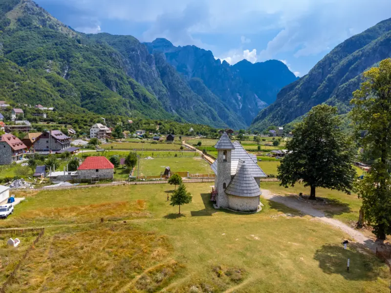
    Aerial View Catholic Church Valley Theth National Park Albania Albanian Alps

    Avoid adding a night simply because the room is inexpensive. Add it because the extra day reduces driving, creates a real rest day, or lets you experience the place at a better time of day. Likewise, do not cut a destination to one night if arrival and departure logistics leave only a few usable hours.

    Useful related guides

    For more detailed planning, continue with Theth with Kids and Theth to Valbona Hike Guide. These pages help you decide what you will actually do after checking in, which is the best way to test whether the accommodation area fits your itinerary.

    Frequently asked questions

    Where is the best place to stay in Theth for a first visit?

    The village center around the church is the easiest because the main sights, transfers and walking routes are close.

    Should I stay in Nderlysa?

    Yes if the Blue Eye and canyon area are central to your plan. It is less convenient for travelers who want to be near the church and the main village hub.

    Do I need a car in Theth?

    No for the classic central stay. Walking is the main way to move around the valley, and shared transfers from Shkoder are common in season.

    What kind of accommodation is typical?

    Family-run guesthouses, often called bujtina, dominate. Meals are an important part of the experience and should be confirmed when booking.

    How far ahead should I book?

    For the main summer hiking period, early booking is sensible because the most convenient and best-reviewed guesthouses can fill quickly.

    Final advice on where to stay in Theth

    The best accommodation decision in Theth is usually the one that removes the most repeated inconvenience. If you will walk to dinner every night, stay where that walk is pleasant. If you are carrying luggage over cobblestones, pay attention to access. If the beach is the whole point, verify the real path to the water. If you are leaving early for a ferry, hike or road trip, choose for the morning departure rather than the sunset photo.
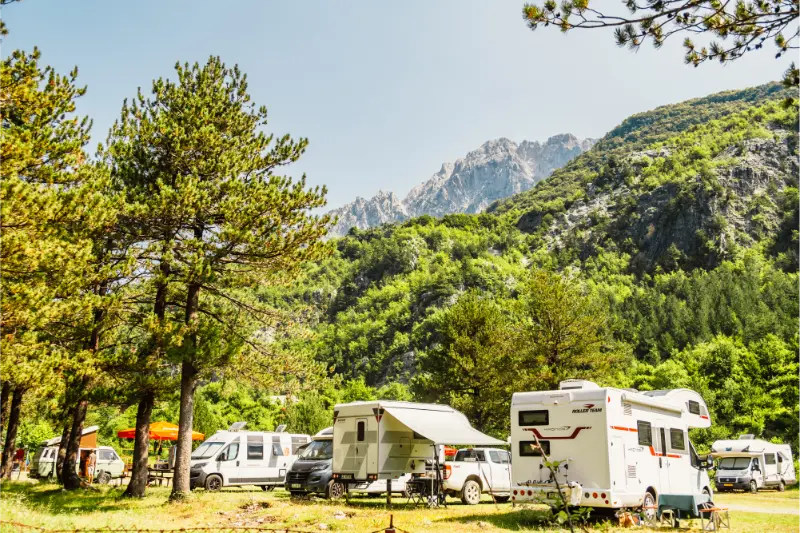
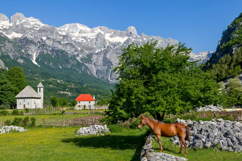
    Theth Church And Albanian Alps Albania

    Once those practical questions are solved, compare room quality and price. That order sounds simple, but it prevents the most common mistake in Albania accommodation planning: booking the prettiest or cheapest property first and only later discovering that its location does not match the trip.

    For couples: this destination couples guide explains which area works best for evenings, views, shared activities and a slower stay.

    Arriving by car: Driving and Parking in Theth: Mountain Road, Guesthouses and Hiking Logistics explains access, parking strategy, hotel logistics and when the car is actually useful.

    Planning excursions: See the best day trips from this base before choosing an area to stay if you plan to drive or use local transport every day.

    Short stay: Use the one-day itinerary if you are choosing accommodation for only one night or a day trip.
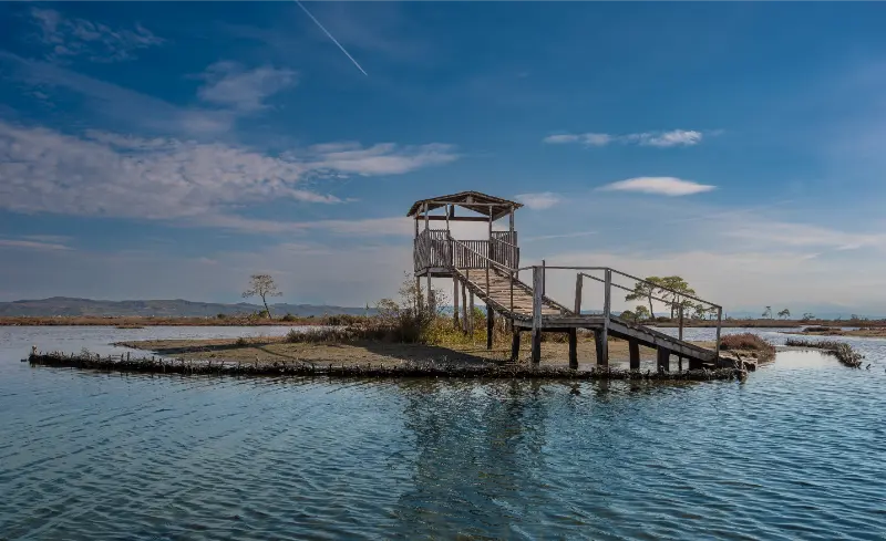
  • Divjake-Karavasta National Park Guide: Lagoon, Pelicans and Adriatic Nature

    Divjake-Karavasta National Park Guide: Lagoon, Pelicans and Adriatic Nature

    Divjake-Karavasta National Park is one of the easiest places in Albania to combine wetlands, forest and the Adriatic coast in a single day. The landscape is low and open rather than mountainous: lagoon water, reeds, pine woodland, salt-influenced habitats and a long sandy shoreline sit close together. It is a useful counterpoint to the more famous Riviera.

    Divjakekaravasta National Park Albania Landscape

    The official Albanian tourism portal describes Karavasta as the country’s largest lagoon and highlights more than 200 bird species, including the Dalmatian pelican. The area is also recognised under the Ramsar Convention. For travellers, this means the park is not simply a beach with some trees; it is an internationally important wetland that should be visited quietly and respectfully.

    Why visit Divjake-Karavasta

    The park is especially worthwhile for birdwatchers, families who want a gentle nature day and road trippers moving between Tirana, Durres, Berat or Vlore. You can walk in the pine forest, look across the lagoon, climb a panoramic tower where access is available and finish the day near the beach.

    Because the terrain is flatter than Albania’s mountain parks, it can also suit travellers who do not want a strenuous hike.

    The Karavasta Lagoon

    The lagoon is the ecological heart of the park. Water levels, salinity and bird activity change through the year, so every visit is different. Do not expect wildlife to appear on demand at the closest viewpoint; binoculars reward patience.

    Morning and late afternoon are generally more comfortable for observing birds and avoiding harsh summer light. Keep voices low and stay away from nesting or restricted areas.

    Dalmatian pelicans and birdwatching

    The Dalmatian pelican is the emblematic species of Karavasta, but the park’s value goes far beyond one bird. Herons, cormorants, flamingos and migratory species may be present depending on season and conditions.

    Bring binoculars rather than trying to approach birds for phone photographs. A guided nature visit can be worthwhile for serious birdwatchers because local knowledge is far more useful than wandering randomly around a large wetland.

    Pine forest and easy walks

    The coastal pine forest creates shade and makes a pleasant break from the lagoon’s exposed viewpoints. In warm weather, alternate open areas with forest walks rather than staying in direct sun for hours.

    Use marked or established paths and check for any seasonal access restrictions. Wetland and dune systems are easily damaged by vehicles and shortcuts.

    Divjake Beach

    Divjake’s beach is very different from Ksamil or the rocky Ionian coves. It is broad, sandy and backed by the park landscape. Families may appreciate the space, but sea conditions and facilities vary by area and season.

    Treat the beach as one part of the nature day rather than the only reason to visit. If your priority is classic turquoise Riviera scenery, use my Albania beaches guide for comparison.

    A good family day

    Children often enjoy the combination of tower, forest, birds and beach because the day changes setting without requiring long drives between each activity. Bring snacks, water, hats and insect repellent during warmer months.

    Do not promise children that they will definitely see pelicans close up. Wildlife viewing is better framed as exploration than as a guaranteed show.

    How long to spend

    A half day works for a forest walk, lagoon viewpoint and lunch. A full day allows birdwatching, beach time and a slower pace. Travellers interested in photography or ecology can stay overnight and use the cooler morning and evening periods.

    The park is easy to underestimate on a map. Moving slowly is part of the point, so avoid combining it with two major cities on the same day.

    Where to stay and eat

    Divjake has local accommodation and restaurants, while travellers on a broader route may stay in Berat or Durres. Staying locally is better if sunrise birdwatching matters to you.

    Local menus often reflect fish and produce from the surrounding agricultural and coastal area. Ask what is seasonal rather than searching only for one famous dish.

    When to visit

    Spring and autumn are excellent for bird activity and comfortable walking. Summer is useful if you want to combine nature with the beach, but shade, water and insect protection become more important. Winter can be rewarding for dedicated birdwatchers, though services may be quieter.

    Check recent weather before driving onto minor access roads because heavy rain can affect wetland surroundings.

    Photography without disturbing wildlife

    A telephoto lens is more useful than getting physically close. Avoid playback calls, feeding or any behaviour that changes how birds move or feed. If a guide asks you to remain behind a boundary, treat that as part of the experience, not an obstacle to the photograph.

    For landscapes, sunrise and sunset produce softer reflections across the lagoon than midday light.

    Use the official park context

    The official tourism page for Divjake-Karavasta describes the park’s wetland, pine forest and biodiversity. Use it as a current reference rather than relying entirely on old travel posts.

    The best visit is one where you leave with a stronger sense of how coastal Albania functions as an ecosystem, not only a collection of beaches.

    Final planning tips

    Divjake-Karavasta fits naturally between Durres and Berat, or as a nature break on the way south.

    Bring binoculars if you have them, avoid loud behaviour near the lagoon and leave enough time that wildlife observation does not become a rushed stop.

    Extra practical advice

    One final way to improve a trip focused on Divjake-Karavasta National Park is to leave deliberate margin in the day. Albania often looks compact on a map, but mountain roads, seasonal traffic, weather and informal stops can make travel times variable. I prefer to choose one important objective for the day and treat smaller viewpoints, cafés or short walks as optional. That prevents the itinerary from becoming a race and gives you room to follow useful local advice. Keep essential addresses, reservation numbers and route notes available offline. Confirm any service that would cause a major problem if it were unavailable, but avoid over-booking ordinary experiences. Carry water, some cash, a charged phone and a basic layer for changing weather. These small preparations are more valuable than trying to predict every detail weeks in advance. When conditions differ from what an old guide promised, trust current signs, local staff and official information. Protected areas, transport services and seasonal businesses evolve. A flexible traveller usually sees more because a changed plan becomes an alternative experience rather than a failed day.

    National Park Ranger Domesticated Pelican Johnny Divjakekaravasta National Park Albania

    Build extra time into transfers, check current conditions locally, and keep the day simple enough that weather or traffic does not force you to rush. Albania rewards travellers who combine planning with flexibility, especially outside major cities and on mountain or coastal roads.

    Build extra time into transfers, check current conditions locally, and keep the day simple enough that weather or traffic does not force you to rush. Albania rewards travellers who combine planning with flexibility, especially outside major cities and on mountain or coastal roads.

    Build extra time into transfers, check current conditions locally, and keep the day simple enough that weather or traffic does not force you to rush. Albania rewards travellers who combine planning with flexibility, especially outside major cities and on mountain or coastal roads.

    Build extra time into transfers, check current conditions locally, and keep the day simple enough that weather or traffic does not force you to rush. Albania rewards travellers who combine planning with flexibility, especially outside major cities and on mountain or coastal roads.

    Build extra time into transfers, check current conditions locally, and keep the day simple enough that weather or traffic does not force you to rush. Albania rewards travellers who combine planning with flexibility, especially outside major cities and on mountain or coastal roads.

    Build extra time into transfers, check current conditions locally, and keep the day simple enough that weather or traffic does not force you to rush. Albania rewards travellers who combine planning with flexibility, especially outside major cities and on mountain or coastal roads.

    Build extra time into transfers, check current conditions locally, and keep the day simple enough that weather or traffic does not force you to rush. Albania rewards travellers who combine planning with flexibility, especially outside major cities and on mountain or coastal roads.

    Build extra time into transfers, check current conditions locally, and keep the day simple enough that weather or traffic does not force you to rush. Albania rewards travellers who combine planning with flexibility, especially outside major cities and on mountain or coastal roads.

    Build extra time into transfers, check current conditions locally, and keep the day simple enough that weather or traffic does not force you to rush. Albania rewards travellers who combine planning with flexibility, especially outside major cities and on mountain or coastal roads.

    Build extra time into transfers, check current conditions locally, and keep the day simple enough that weather or traffic does not force you to rush. Albania rewards travellers who combine planning with flexibility, especially outside major cities and on mountain or coastal roads.

    Build extra time into transfers, check current conditions locally, and keep the day simple enough that weather or traffic does not force you to rush. Albania rewards travellers who combine planning with flexibility, especially outside major cities and on mountain or coastal roads.

    \n\n

    Related guide: Birdwatching in Albania: Karavasta, Narta, Prespa, Lake Shkodra and More expands this topic with a broader route and practical planning advice.

    \n

    Explore more of Albania beyond the main route

    \n

    Wildlife deep dives: Dalmatian Pelicans in Albania and Flamingos in Albania add species-specific viewing and photography advice.

  • Best Hikes in Theth: Grunas Waterfall, Blue Eye, Valbona Pass and Easy Valley Walks

    Best Hikes in Theth: Grunas Waterfall, Blue Eye, Valbona Pass and Easy Valley Walks

    Theth is a hiking destination first and a sightseeing village second. The valley contains easy walks that almost anyone with reasonable mobility can enjoy, but it also connects to serious Alpine routes where snow, storms and navigation matter. The most important planning decision is not “which trail is most famous?” but “which trail matches today’s conditions and my experience?”

    This guide uses “hike” broadly enough to include easier nature walks and tougher mountain days, but it does not pretend those activities carry the same risk. Distances, weather, trail markings and access roads can change. For remote or high routes, confirm conditions locally before leaving and carry a navigation method that works offline.

    Quick comparison

    RouteDifficultyBest forAccess
    Grunas WaterfallEasy to moderateBest first hike in ThethOn foot from village
    Blue Eye of Theth from NderlysaModerateBest half-day nature hikeWalk/transfer to Nderlysa + trail
    Theth to Valbona PassStrenuousBest classic point-to-point hikeOne-way hike with transport/luggage logistics
    Village, church and lower valley walkEasyBest recovery or arrival-day walkOn foot
    Okol springs / upper valley walkEasy to moderateBest quieter valley sceneryOn foot or guesthouse transfer-assisted

    Which hike should you choose?

    If this is your first outdoor day in the area, choose the route with the simplest access and an obvious turnaround point. Save the highest or most remote objective for a day when the forecast, transport and your energy all line up. I would rather complete a shorter route comfortably than turn a holiday into a rescue problem by chasing a summit because it was on the original itinerary.

    Grunas Waterfall

    Best first hike in Theth. Difficulty: Easy to moderate. Access: On foot from village. Grunas is the easiest classic. The official tourism portal places the waterfall roughly a 30-minute walk from the village, though your total time depends on the guesthouse location and stops. Use the Grunas Waterfall guide and add the canyon viewpoint only if footing and weather are good.

    Man Hat Stays Streams Waterfall Grunas Waterfall Site Inside National Park Theth Albania

    Blue Eye of Theth from Nderlysa

    Best half-day nature hike. Difficulty: Moderate. Access: Walk/transfer to Nderlysa + trail. The Blue Eye route is longer and rougher than Grunas, with rocky terrain near the water. The Blue Eye of Theth guide explains the Nderlysa approach. Start early in peak summer and do not rely on the pool as your drinking-water source.

    Theth to Valbona Pass

    Best classic point-to-point hike. Difficulty: Strenuous. Access: One-way hike with transport/luggage logistics. The Valbona Pass crossing is the famous route, but it is not a casual village walk. Snow can remain into shoulder season, storms arrive quickly and the one-way finish creates luggage/transport issues. Read the Theth–Valbona hike guide and confirm current trail conditions locally.

    Village, church and lower valley walk

    Best recovery or arrival-day walk. Difficulty: Easy. Access: On foot. Link the church, traditional houses and riverside/valley lanes into a gentle loop. This is the right choice after a long transfer or before a major hike, and it gives you a much better sense of the settlement than rushing straight to a trailhead.

    Okol springs / upper valley walk

    Best quieter valley scenery. Difficulty: Easy to moderate. Access: On foot or guesthouse transfer-assisted. The upper valley toward Okol gives you a quieter nature walk among fields, forest and cold springs. The exact route from your guesthouse varies, so ask the host for the current local path and bridge conditions.

    Do you need a guide?

    For an obvious low-elevation walk with clear local directions, most experienced travelers can usually walk independently. A guide becomes much more valuable when the route is high, remote, poorly signed, seasonally snow-covered, canyon-based or dependent on a vehicle pickup at a different endpoint. A guide can also turn a simple walk into a better cultural/nature experience because local place names and private-land boundaries are not always obvious on online maps.

    Never use “there are reviews online” as a substitute for current conditions. A route can be straightforward in July and inappropriate after an October storm or during late spring snowmelt.

    Getting to the trailheads

    A car is unnecessary for most Theth hikes once you are in the valley. In fact, a car can complicate the one-way Valbona Pass because it remains in Theth. Use the Theth driving guide if self-driving.

    Tourist Walking Road Valbona Valley Enjoying Freedom Theth National Park Albanian Alps Valbona Albania

    Best hikes for families

    Grunas and the village/upper-valley walks are best for families. Blue Eye suits active older children. The Valbona Pass should be evaluated as a mountain crossing, not a family attraction.

    Best time of year

    The main hiking period is broadly late spring through early autumn, but high routes do not follow a guaranteed calendar. The official tourism portal notes maintained hiking trails, yet current snow, rain and storm forecasts should decide Valbona Pass and other high objectives. Lower valley walks remain possible in a wider range of conditions.

    Heat, storms and mountain safety

    Start early in warm weather and carry more water than you expect to need. On exposed ridges, thunder is a reason to turn around, not an invitation to wait under the tallest tree. In canyons and near waterfalls, heavy rain upstream can change conditions even if the sky above you looks better. In the Alps and other high ranges, snow, fog and wind can make a familiar summer route a completely different undertaking.

    Tell someone where you are going when the route is remote, keep your phone charged, download offline mapping and do not count on mobile coverage. If the trail is beyond your navigation or scrambling experience, choose a local guide rather than learning those skills in a place you do not know.

    What to pack

    • Shoes with reliable grip rather than smooth city sneakers.
    • At least one extra layer, even on a warm valley day if the route gains altitude.
    • Sun protection: hat, sunscreen and sunglasses.
    • Enough water plus a small snack; do not assume every spring is safe to drink.
    • Offline map, charged phone and small power bank on longer routes.
    • Compact rain/wind shell.
    • Basic first-aid items and any personal medication.
    • Cash for rural cafés, taxis or guesthouse transfers where cards may not be practical.

    Where to stay for hiking

    Compare current accommodation in Theth on Booking.com.

    For area-by-area accommodation advice, read the local Where to Stay guide. For hiking trips I care more about early breakfast, vehicle access, luggage storage and the host’s current trail knowledge than about a small difference in room decoration.

    Guided hikes and outdoor tours

    Guided options are most useful when transport and hiking are bundled together, especially from a city base or on routes where the start and finish are different. Compare the current activity description carefully rather than assuming every tour includes the same trail or difficulty.

    How to plan a two-hike stay

    I use the first outdoor day for the easier route. That gives me a real sense of local heat, trail surfaces, driving and my own energy after travel. I put the harder objective on the second day with a backup plan. If the weather is poor, I swap the order rather than forcing the mountain day. This simple strategy is especially useful in Theth, Valbona, Tomorr, Nëmërçka and the higher Korçë/Pogradec ranges.

    Panoramic Aerial Drone View Valbona Valley Theth National Park Albanian Alps Albania 2

    Common hiking mistakes

    • Starting too late because the route looks short on a map.
    • Using road-driving time as if it were guaranteed trailhead access.
    • Following an old GPX track without checking closures, private land or changed paths.
    • Carrying too little water on exposed summer routes.
    • Treating a canyon, waterfall or river crossing as safe after heavy rain.
    • Assuming a famous high pass is snow-free because the valley is warm.
    • Wearing sandals on loose rock because the hike ends at a beach or thermal spring.
    • Booking an onward bus or flight too tightly after a mountain day.

    Official and related planning resources

    For the destination overview, see the official Albania tourism page. The national trail overview Best Hiking Trails in Albania is useful for comparing this area with the rest of the country.

    Frequently asked questions

    Can I hike here without a car?

    At least one of the routes in this guide can usually be done without owning a car, but the answer depends on your accommodation and the exact trail. City-adjacent walks are easiest; remote national-park and high-mountain trailheads often require a taxi, driver, shuttle or rental car.

    Do I need hiking boots?

    For easy dry paths, good trail shoes can be enough. For loose rock, wet canyon terrain, snow or a major mountain route, more supportive footwear is a better choice. Grip matters more than brand.

    Can I hike in July and August?

    Yes, but start early, carry substantial water and reduce exposed midday walking. Higher mountain routes may be cooler, while low canyon and coastal paths can become extremely hot.

    Is hiking safe after rain?

    It depends on the route. Rain can make stone, clay and roots slippery, and canyon or river conditions can change rapidly. Choose a lower-risk route or wait when conditions are uncertain.

    Should I download an offline map?

    Yes for anything beyond an obvious short walk. Mobile signal is not a reliable navigation strategy in mountain and canyon terrain.

    Final recommendation

    Build the hiking day around conditions rather than ambition. Choose one route that matches your transport, fitness and the forecast, start earlier than you think you need to, and keep a lower-risk alternative ready. Albania’s best outdoor experiences are not improved by rushing them.

  • Lake Koman and Valbona Travel Guide: How to Plan Albania’s Classic Northern Mountain Route

    Lake Koman and Valbona Travel Guide: How to Plan Albania’s Classic Northern Mountain Route

    The journey from Shkodër through Lake Koman to Valbona is one of the routes that turns transport into part of the attraction. Instead of simply taking a road from one mountain valley to another, you combine vans, a boat journey through steep-sided water landscapes and another transfer into the Albanian Alps. It is beautiful, but it works best when you plan the connections carefully.

    I see this route as an extension of Shkodër and Theth, not as an isolated ferry excursion. If you only have a few days, a simple Shkodër–Theth return is easier. If you have four to six days for the north, Koman and Valbona can make the journey much richer.

    What is the Lake Koman route?

    Lake Koman is a reservoir in northern Albania surrounded by steep mountain terrain. Passenger boats and ferries operate along the water, most famously connecting the Koman area with Fierza. Travellers often use this as the middle section of a longer transfer from Shkodër toward Valbona Valley.

    The appeal is the scenery: narrow sections of water between mountains, changing light and the feeling of travelling through terrain that would be much less memorable by road. But the boat does not magically solve every transport problem—you still need to reach the departure point and continue from the arrival side.

    The classic Shkoder–Koman–Valbona sequence

    1. Sleep in Shkodër the night before.
    2. Take an early transfer from Shkodër toward the Koman departure area.
    3. Board the booked passenger boat or ferry for the journey toward Fierza.
    4. Continue by pre-arranged van, taxi or local transfer into Valbona Valley.
    5. Stay in Valbona rather than trying to add a major hike on arrival day.

    Exact operators, departure times and seasonal schedules can change. I confirm the complete chain with my guesthouse or transport provider shortly before travel and avoid relying on a screenshot from a previous year.

    Should you book the ferry in advance?

    In the main hiking season, I would book the key boat connection and overnight accommodation in advance, especially if the route is essential to a fixed itinerary. Ask exactly where check-in takes place, whether the ticket includes any road transfer and how luggage is handled. Similar-sounding products may include very different services.

    What to expect on the boat

    The journey is scenic rather than luxurious. Depending on the vessel, shade, seating, toilets and food options can vary. Bring water, a light layer for wind, sun protection and something small to eat even if refreshments are advertised. Keep important documents and electronics in a day bag rather than buried in luggage.

    If you are prone to motion sickness, the reservoir is often calmer than open sea, but boat movement and road transfers can still affect you. Prepare based on your own experience rather than assuming a lake journey cannot cause discomfort.

    Valbona Valley: why stay at least two nights

    Valbona is not just a place to sleep before walking to Theth. The valley itself deserves time for shorter walks, mountain views and quiet evenings. Staying two nights gives you a buffer for weather and lets you experience the landscape without every moment being organised around the famous pass.

    Panoramic Aerial Drone View Valbona Valley Theth National Park Albanian Alps Albania 2

    Guesthouses are a major part of the experience. Many include or offer home-cooked meals, and staying near your planned trail access can simplify the morning. Ask about cash payment, packed lunches and luggage arrangements before arrival.

    The Valbona to Theth hike

    The crossing between Valbona and Theth is one of Albania’s best-known hikes, but it is a genuine mountain route rather than a casual sightseeing walk. Distance, elevation, heat, weather and carrying luggage all matter. Trail conditions can change seasonally, and snow may remain or arrive outside peak summer.

    My Theth and Albanian Alps guide covers the hike in more detail. I would not attempt the crossing in poor weather or simply because it is “the famous thing to do.” There are many ways to enjoy both valleys without completing the full route.

    Luggage on the mountain route

    This is where good planning makes the biggest difference. Carrying a full suitcase or heavy travel backpack over a mountain pass can turn a beautiful day into a miserable one. Leave non-essential luggage in Shkodër if you are returning, or arrange a luggage-transfer service when available and reliable.

    Can you do Lake Koman without hiking?

    Absolutely. You can use the boat as a scenic journey and spend time in Valbona without crossing to Theth. This works for families, travellers with limited hiking experience or anyone who simply prefers shorter walks. The north should not be reduced to one famous trek.

    Panoramic Aerial Drone View Valbona Valley Theth National Park Albanian Alps Albania

    Lake Koman as a day trip

    A day trip from Shkodër is possible with the right transport product, but it can involve very early starts and long road transfers around the boat journey. I would choose it only if you cannot dedicate nights to Valbona. The classic multi-day route makes the travel feel purposeful rather than repetitive.

    Best time for the route

    Late spring through early autumn is the main period for most travellers, but mountain conditions are not identical from year to year. The ferry may operate on a different seasonal pattern from hiking conditions. That means “the boat is running” does not automatically mean “the Valbona–Theth pass is safe and snow-free.”

    In midsummer, heat becomes a hiking concern even when the trail is clear. Start early, carry enough water and avoid treating a mountain crossing as an afternoon activity.

    Where to stay in Valbona

    Choose accommodation based on trail access and transport, not just the prettiest photo. Valbona Valley is spread out, and two guesthouses listed under the same destination can be far apart on foot. Ask where your incoming transfer will drop you and how you will reach the next day’s trail.

    You can compare guesthouses in Valbona on Booking.com. This is a sponsored link. Recent reviews about location, meals, heating, road access and host communication are especially useful in a mountain destination.

    Where to stay before the route

    I strongly prefer sleeping in Shkodër the night before rather than arriving from Tirana on the same morning. It gives you a buffer, lets you confirm the pickup and provides somewhere to store extra luggage.

    What to pack

    • A small backpack rather than your full travel luggage.
    • Rain protection even when the forecast looks good.
    • A warm layer for early mornings and changing mountain weather.
    • Sun protection and enough water capacity for the hike you actually plan.
    • Offline maps and accommodation contact details.
    • Cash for guesthouses, meals and local transfers.
    • Proper hiking shoes if crossing the pass.

    A 4-day northern loop

    Day 1: Shkoder

    Explore Shkodër, visit Rozafa Castle and sleep in the city. Confirm the next morning’s pickup before dinner.

    Day 2: Lake Koman to Valbona

    Take the early transfer, complete the boat journey and continue into Valbona. Keep the afternoon light: check in, walk locally and rest.

    Day 3: Valbona

    Use the day for a shorter hike or valley exploration. If your plan is to cross to Theth the next day, prepare your pack and confirm weather.

    Day 4: Valbona to Theth

    Start early for the pass only if conditions are appropriate. Once in Theth, stay overnight rather than expecting a long same-day transfer back to Tirana.

    Common mistakes

    • Booking a ferry ticket without understanding the road transfers on both sides.
    • Arriving in Shkodër the same morning as an early boat connection.
    • Carrying unnecessary luggage over the pass.
    • Assuming published summer hiking advice applies in spring or late autumn.
    • Planning a tight flight immediately after leaving the mountains.

    The Lake Koman–Valbona route works because the transport is part of the story. Give each connection breathing room and the journey becomes one of northern Albania’s highlights.

    Build the route around Shkodër, then continue with Theth. For the rest of the country, use my transport guide and first-time Albania planning guide.

    Final planning checklist

    Before publishing a final itinerary around Lake Koman Valbona travel guide, I recheck three things: the weather, the transport for the next day and the exact location of my accommodation. These small checks prevent most avoidable problems in Albania, especially in summer when traffic is heavier and in mountain regions where conditions can change quickly.

    • Save accommodation addresses and phone numbers offline.
    • Carry some Albanian lek for small businesses and transport.
    • Confirm parking before driving into historic centres or beach resorts.
    • Download offline maps before mountain or rural days.
    • Leave margin between a long transfer and any fixed tour or ferry.

    I also avoid planning every meal, beach and café in advance. Albania is still a destination where local advice can improve the trip significantly. Guesthouse owners often know the current road condition, the best departure time or whether a supposedly quiet beach has become crowded that week.

    Is this destination suitable for a first trip to Albania?

    Yes if it fits the wider route and your interests. The mistake is not choosing the “wrong” destination; it is combining too many good destinations into too few days. Two or three well-planned bases usually create a better first trip than six rushed overnight stops.

    Do I need to book everything in advance?

    In July and August I book accommodation in popular coastal areas and any essential transport connection. Outside peak season I keep more flexibility, while still reserving special guesthouses or small properties that I would be disappointed to miss. Activities that depend on sea or mountain weather are often better confirmed closer to the day when cancellation terms allow it.

    Cash or card?

    Carry both. Cards are increasingly common in larger hotels, supermarkets and restaurants, but cash remains useful for buses, rural guesthouses, parking and small family businesses. Having a backup payment method is more important than trying to make the entire trip cashless.

    For the bigger picture, return to the Albania travel guide and use the travel-cost guide to check how this stop fits your time and budget.

    Related guide: If you want a water-focused day rather than a through ferry journey, read our Shala River guide.

    Related guide: For detailed ferry logistics, tickets and onward connections, use our Lake Koman ferry guide.

    Mountain transport: Shkoder to Theth and Shkoder to Valbona explain the shuttle, ferry and car logistics before you commit to the classic Alps route.

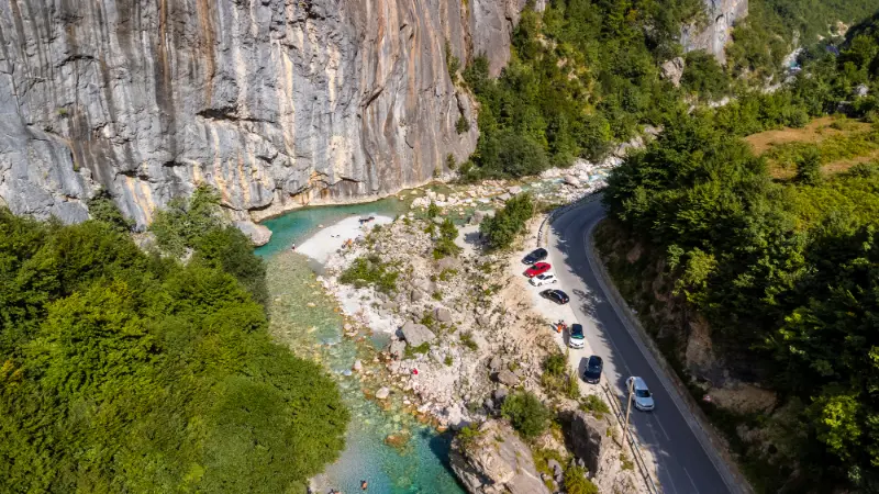
    Aerial Drone View Small Beach Turquoise River Valbona Valley Theth National Park Albanian Alps

    Route planning: Shkodër to Koman Lake: Shuttle, Car, Ferry Connection and What to Book explains bus/shuttle, car, transfer, luggage and seasonal logistics.

    Route planning: Tirana to Valbona: Koman Ferry Route, Direct Road, Shuttle and Car Options explains bus/shuttle, car, transfer, luggage and seasonal logistics.

    Northern Albania route guides

  • Spile Cave Himarë Guide: Marine Karst, Riviera Legends and Safe Coastal Viewing

    Spile Cave Himarë Guide: Marine Karst, Riviera Legends and Safe Coastal Viewing

    Spile Cave is a small marine cave on the Himarë coast whose appeal comes from geology, water and local legend rather than scale. The official tourism source describes a limestone cave shaped by wave action, with small chambers and rare stalactites, and notes its designation as a Natural Monument. It is a good example of why the Riviera is worth exploring beyond beach loungers—but only when sea conditions make coastal access sensible.

    Himare Beach Sunny Albanian Riviera Coastline
    • Best for: travelers interested in nature, photography and active travel.
    • Time needed: usually 1–2 hours for the focused site, more when combined with nearby attractions.
    • Best base: Himarë for the widest choice of accommodation and transport.
    • Planning rule: verify access, weather and opening/guide arrangements close to your visit rather than relying on an old social-media post.
    • What to bring: water, shoes with grip, sun protection and an offline map; add specialist safety equipment where relevant.

    Why this place is worth adding to your Albania itinerary

    Spile Cave Himarë works best as a focused addition to a broader Himarë itinerary. It is specific enough to reward travelers who enjoy going beyond headline attractions, but close enough to established destinations that you do not need to restructure an entire trip around it.

    At this stage of planning, the most useful question is not whether a place is ‘famous enough’ but whether it adds a different layer to the day. This site does: it can explain architecture, archaeology, geology, religious life or landscape in a way that the main city highlights do not. That is exactly why smaller, well-chosen stops can make a mature Albania itinerary feel more complete.

    Historical, cultural or natural context

    The cave belongs to Himarë’s coastal karst landscape. Repeated wave action has enlarged openings and chambers in the limestone, producing a feature that is both geological and scenic.

    Local stories add another layer to the site, but legends should be treated as cultural context rather than literal history unless supported by archaeology. The most reliable fact is the cave’s protected natural-monument status and its wave-cut origin.

    Marine caves change character dramatically with swell. A calm morning can make an entrance look easy, while wind later in the day can create rebound waves against rock. That variability should shape every visit decision.

    What to look for when you visit

    Watch how waves shape the cave

    Even from a safe position, you can see how repeated wave energy works on limestone. The cave is a living coastal process, not simply a static hole in the rock.

    Notice the transition from bright water to dark chambers

    The contrast between Ionian sunlight and the shaded interior is the cave’s strongest visual effect. Let your eyes adjust rather than using harsh flash.

    Keep legends in context

    Ask local guides about the stories attached to Spile Cave. Oral tradition is part of the experience, but distinguish it from verified geological and historical information.

    How to get there from Himarë

    Access depends on the exact shoreline route and sea conditions. Do not assume you can safely swim into a cave because it appears close from the beach. A local boat operator or knowledgeable Himarë guide can explain the current safest viewing option. If waves are breaking at the entrance, stay out.

    Panoramic Jale Beach Himare Albanian Riviera Resorts Construction Background

    For small sites, transport should be planned around the return as carefully as the outward journey. If you use a taxi or driver, agree whether they will wait, how long you expect to stay and how you will contact them if mobile coverage is weak. If you drive yourself, avoid blocking village lanes, farm access or emergency routes.

    How much time should you allow?

    A rushed stop can be as short as 30–45 minutes, but one to two hours is a better default because it allows time to understand the setting, take photographs without hurrying and deal with minor access delays. If the site is part of a rural or coastal excursion, build margin into the day rather than scheduling every stop to the minute.

    For most travelers, this is not an all-day attraction on its own. Its value comes from pairing it intelligently with one major nearby site, a meal and perhaps a scenic walk. That creates a day with variety instead of a checklist of ten brief stops.

    Best time to visit

    Spring and autumn are usually the easiest seasons for walking and photography because temperatures are moderate and the landscape has more texture. Summer is workable, but start early or visit later in the day when the site is exposed. Winter can be atmospheric and very quiet, yet short daylight, rain and changing road conditions make conservative planning more important.

    For natural sites, recent weather matters more than the calendar. Heavy rain can change river flow, trail grip, cave conditions and coastal swell. Check the forecast for the wider catchment or sea area, not only the nearest town.

    Safety and responsible visiting

    Marine caves can trap swell, create rebound waves and reduce escape options. Never enter alone, in rough water, after drinking alcohol or without a clear exit plan. Do not climb wet cave walls. If using a kayak or SUP, only do so in conditions and areas appropriate to your experience and with local guidance.

    A second responsibility is preservation. Do not remove stones, carve names, touch frescoes or geological formations, fly a drone close to people or religious buildings without permission, or leave litter. Small sites often have fewer staff and barriers, which means visitors need to exercise more—not less—care.

    Photography tips

    Use the first few minutes to understand the site before taking out a camera. Wide views are usually strongest when they show the monument or natural feature in context. Details—masonry, painted fragments, water textures or erosion patterns—work better once you have established the larger scene.

    Early morning and late afternoon usually provide softer light, but never trade safety or respect for a composition. Avoid flash on fragile interiors, do not step beyond barriers, and ask before photographing worshippers, guides or local residents at close range.

    Where to stay

    For convenience, base yourself in Himarë rather than moving accommodation for a single attraction. That gives you more flexibility if weather, access or opening arrangements change. Compare current accommodation on Booking.com, then check the exact map location, parking and cancellation terms before booking.

    Food, water and practical services

    Do not assume a café, toilet, ticket office or drinking-water point exists at a small attraction. Carry enough water for the outing and plan your main meal in the nearest town or village. Cash is useful in rural Albania, but avoid carrying large amounts unnecessarily.

    If a local guesthouse, café or guide helps you with access or information, buying a meal or service locally is one of the simplest ways to make tourism more useful to the community. It also gives you better context than visiting the site as an isolated photo stop.

    What to combine with this visit

    These guides fit naturally into the same regional cluster:

    Choose two or three complementary stops rather than trying to visit everything in the area. A strong combination usually includes one major attraction, one smaller site like this, and time for a local meal or unstructured walk.

    A realistic half-day plan

    Start from Himarë after breakfast, travel to the site while conditions are still comfortable, and spend enough time to understand the setting rather than only taking a photograph. Keep the second half of the outing flexible: add one nearby attraction if time and conditions are good, or return early for lunch and explore the base town on foot.

    If you are relying on a driver, boat operator or guide, confirm the return plan before beginning. If you are self-driving, aim to complete unfamiliar rural or mountain roads in daylight. This simple rule prevents many avoidable problems on otherwise easy Albania day trips.

    Common mistakes to avoid

    • assuming old opening-hour or access information is still current
    • wearing beach sandals on polished stone, rough trails or cave approaches
    • trying to squeeze the stop into an already overloaded day
    • following an unverified map shortcut onto private or poor-quality roads
    • treating a religious, archaeological or protected natural site as a photo prop
    • visiting in unsafe weather because the itinerary feels fixed

    The best solution is simple: keep the plan flexible, ask locally when something is unclear and be willing to skip a section when conditions are not right. Albania rewards adaptable travelers far more than rigid schedules.

    Who will enjoy this stop most?

    This stop suits travelers interested in geology, hiking, landscape photography and quieter nature experiences. It is best for people comfortable adapting plans to weather and terrain. Travelers wanting guaranteed facilities, lifeguards, marked paths or commercial infrastructure should choose a more developed attraction.

    Tours and activities

    A private regional tour can sometimes be customized to include this stop, especially when you are already exploring around Himarë. For broader activities and day-trip ideas, compare current options below and read the inclusions carefully before booking.

    Official information and last-minute checks

    For background, use Albanian National Tourism Agency – Spile Cave. Official tourism pages are useful for heritage and geography, but local access, opening arrangements, weather, road surfaces, boat schedules and guide availability can change. Recheck time-sensitive details close to your travel date.

    Frequently asked questions

    Where is Spile Cave?

    On the Himarë coast in southern Albania, near the modern coastal settlement.

    Is it a natural monument?

    Yes. The official tourism source lists it as a Natural Monument.

    Can I swim into the cave?

    Only if local conditions are clearly safe and you have the necessary experience. Marine-cave water can become dangerous quickly.

    What formed the cave?

    Wave action eroding limestone over time.

    How long should I plan?

    It is best treated as a short coastal stop or part of a Himarë beach/boat day, not a full-day destination.

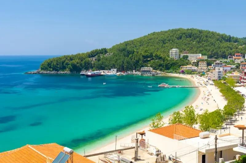
    Himare Bay And Beach Albania

    Is it good in bad weather?

    No. Rough sea conditions make marine caves a poor choice; switch to inland Himarë attractions instead.

    Final thoughts

    Spile Cave Himarë is most rewarding when treated as part of a coherent Himarë itinerary rather than a standalone trophy stop. Give yourself enough time to notice the details, respect the site and adapt to current conditions. That approach produces a better experience and helps protect the smaller places that make travel in Albania so interesting.

  • Best Hiking Trails in Albania: Theth, Valbona, Korab, Llogara and Tomorr

    Best Hiking Trails in Albania: Theth, Valbona, Korab, Llogara and Tomorr

    Hiking in Albania ranges from gentle village walks to demanding alpine passes and high peaks. The country’s official tourism portal highlights the Albanian Alps, historic routes such as Via Egnatia, Mount Korab, Llogara, Tomorr and many other mountain areas for walking and trekking. That variety is exactly why a single “best trail” ranking is not very useful: the right hike depends on season, fitness, navigation experience and whether you want a village-to-village journey or a summit day.

    The most important planning habit is to separate scenic reputation from current conditions. A route that is famous on social media can still be unsuitable after snow, storms, extreme heat or trail damage. Ask locally, start early and be willing to choose a shorter walk.

    Theth to Valbona Pass

    The Theth–Valbona crossing is Albania’s classic mountain hike, linking two valleys across the Albanian Alps. It belongs in a multi-day northern itinerary rather than as a casual add-on from Tirana. Use our Theth guide and Lake Koman and Valbona guide to organize both sides.

    Aerial Drone View Rustic Homes Hotels Theth National Park Albania Albanian Alps 2

    Snow can remain on higher terrain outside the core hiking season. Confirm the pass condition with guesthouses or guides before setting out and do not assume that an open road into the valley means the high trail is also clear.

    Shorter walks around Theth

    You do not need to cross the pass to enjoy Theth. Grunas Waterfall, canyon viewpoints, village paths and other local walks can create a full mountain stay. The official tourism portal lists Grunas Waterfall and the wider valley among Theth’s major natural attractions.

    Read our waterfall guide if you want a lower-commitment hiking day.

    Mount Korab

    Mount Korab is Albania’s highest summit and a serious mountain objective. Official tourism information describes it as a major destination for mountaineers and hikers on the border with North Macedonia. Use the official Korab page for geographic context.

    A high summit requires an early start, stable weather, sufficient water and navigation confidence. If you are not experienced in mountain terrain, use a local guide rather than choosing the route only from a GPS track.

    Llogara and the coastal mountains

    Llogara offers the unusual combination of mountain walking and Ionian-coast views. Trails and old paths can be incorporated into a Riviera road trip, which makes the area especially attractive for travellers who do not want a separate alpine expedition.

    Summer heat can be intense at lower elevations even when the pass feels cooler. Carry more water than a city walk would require and avoid exposed midday sections during heat waves.

    Mount Tomorr

    Mount Tomorr, above the Berat and Skrapar region, combines hiking with cultural and spiritual significance. The official tourism portal describes a summit area above 2,400 metres and annual religious pilgrimage traditions. See the official Mount Tomorr page.

    Base yourself in Berat or the wider region and confirm road access before planning the approach. Some mountain roads may be more suitable for high-clearance vehicles or local transport.

    Via Egnatia and lower-level hiking

    Not every Albania hike needs to be alpine. The official tourism portal mentions historic routes such as the Via Egnatia, which can offer a combination of walking, archaeology and village landscapes.

    For a cultural walker, these routes can be preferable in spring or autumn when high mountains are snowy. Use local trail information because historic routes may have road crossings and sections with varying waymarking.

    Best seasons for hiking

    Late spring through early autumn is generally the broadest hiking window, but altitude matters. Spring can still mean snow high in the Alps, while summer can be excessively hot on exposed southern routes. Read spring, summer and autumn guides.

    Start times matter as much as month. In hot weather, an early trailhead can transform the experience and reduce exposure to afternoon storms or heat.

    Navigation and mobile coverage

    Download offline maps before leaving your accommodation. Carry a power bank and do not depend on a single phone for a long remote route. A paper overview or second device is useful on major mountain days.

    Trail markings can vary. When a junction is unclear, stop and confirm rather than continuing downhill simply because the path looks more used.

    Gear that is actually useful

    Sturdy footwear, water, sun protection, layers, a rain shell, basic first aid and a charged headlamp cover many day-hike needs. Trekking poles can be helpful on loose descents but are not a substitute for suitable shoes.

    For long alpine routes, add enough food, emergency insulation and navigation backup. If the route may require technical equipment, it is no longer an ordinary hiking day and should be planned accordingly.

    Solo hiking and guides

    If travelling alone, read our solo travel guide and use a more conservative standard in remote terrain. Tell your guesthouse your plan and expected return time.

    A guide is especially valuable for winter conditions, lesser-known trails, summit routes or travellers who want interpretation of local geography and culture rather than only navigation.

    Final planning tips

    The official Albania hiking and trekking overview is a useful starting point, but current trail conditions should always be checked locally.

    Choose the hike that fits the weather and your experience, not the one with the most famous photograph. Albania rewards both ambitious mountain days and slow walks between villages.

    Extra practical advice

    For major hikes, ask your accommodation three questions the evening before: what are conditions now, what time should I start, and where do most visitors make navigation mistakes? Local answers can be more valuable than a generic trail description written months earlier.

    Theth Valley And Albanian Alps

    Keep the itinerary flexible enough to respond to weather, transport changes and local advice. Confirm any service that would materially affect the day, carry offline directions and avoid adding another major stop simply because the map distance looks short. Albania rewards travellers who leave time for the road, the landscape and unplanned discoveries between headline attractions.

    Keep the itinerary flexible enough to respond to weather, transport changes and local advice. Confirm any service that would materially affect the day, carry offline directions and avoid adding another major stop simply because the map distance looks short. Albania rewards travellers who leave time for the road, the landscape and unplanned discoveries between headline attractions.

    Keep the itinerary flexible enough to respond to weather, transport changes and local advice. Confirm any service that would materially affect the day, carry offline directions and avoid adding another major stop simply because the map distance looks short. Albania rewards travellers who leave time for the road, the landscape and unplanned discoveries between headline attractions.

    Keep the itinerary flexible enough to respond to weather, transport changes and local advice. Confirm any service that would materially affect the day, carry offline directions and avoid adding another major stop simply because the map distance looks short. Albania rewards travellers who leave time for the road, the landscape and unplanned discoveries between headline attractions.

    Keep the itinerary flexible enough to respond to weather, transport changes and local advice. Confirm any service that would materially affect the day, carry offline directions and avoid adding another major stop simply because the map distance looks short. Albania rewards travellers who leave time for the road, the landscape and unplanned discoveries between headline attractions.

    Keep the itinerary flexible enough to respond to weather, transport changes and local advice. Confirm any service that would materially affect the day, carry offline directions and avoid adding another major stop simply because the map distance looks short. Albania rewards travellers who leave time for the road, the landscape and unplanned discoveries between headline attractions.

    Keep the itinerary flexible enough to respond to weather, transport changes and local advice. Confirm any service that would materially affect the day, carry offline directions and avoid adding another major stop simply because the map distance looks short. Albania rewards travellers who leave time for the road, the landscape and unplanned discoveries between headline attractions.

    Keep the itinerary flexible enough to respond to weather, transport changes and local advice. Confirm any service that would materially affect the day, carry offline directions and avoid adding another major stop simply because the map distance looks short. Albania rewards travellers who leave time for the road, the landscape and unplanned discoveries between headline attractions.

    Keep the itinerary flexible enough to respond to weather, transport changes and local advice. Confirm any service that would materially affect the day, carry offline directions and avoid adding another major stop simply because the map distance looks short. Albania rewards travellers who leave time for the road, the landscape and unplanned discoveries between headline attractions.

    Keep the itinerary flexible enough to respond to weather, transport changes and local advice. Confirm any service that would materially affect the day, carry offline directions and avoid adding another major stop simply because the map distance looks short. Albania rewards travellers who leave time for the road, the landscape and unplanned discoveries between headline attractions.

    Keep the itinerary flexible enough to respond to weather, transport changes and local advice. Confirm any service that would materially affect the day, carry offline directions and avoid adding another major stop simply because the map distance looks short. Albania rewards travellers who leave time for the road, the landscape and unplanned discoveries between headline attractions.

    Related guide: For rafting, paragliding, kayaking and more, see our broader Albania adventure guide.

    Related guide: For a serious multi-day challenge, see our Peaks of the Balkans trail guide.

    Related guide: For a quieter alpine base in Kelmend, see our Lepushe travel guide.

    Related guide: Experienced hikers considering the highest peak of the Albanian Alps should read our Jezerca guide.

    Aerial Drone View Rustic Homes Hotels Theth National Park Albania Albanian Alps

    Related guide: For a serious southern mountain objective, read our dedicated Mount Nemërçkë hiking guide.

    Hiking guides by base

    These local hiking hubs compare easy nature walks, day hikes and major mountain objectives around the bases travelers use most often.

    Useful Albanian phrases: Albanian Hiking Phrases: Trails, Guesthouses, Water, Weather and Mountain Help.

  • Best Hikes in Valbona: Rragam, Kukaj, Xhema Lake and the Valbona Pass

    Best Hikes in Valbona: Rragam, Kukaj, Xhema Lake and the Valbona Pass

    Valbona is a long Alpine valley rather than one compact village, and that geography changes hiking planning. Your guesthouse location determines whether a trail begins at the door or requires a taxi/transfer first. The valley offers relaxed riverside walks, village routes and one of Albania’s most famous high crossings to Theth.

    This guide uses “hike” broadly enough to include easier nature walks and tougher mountain days, but it does not pretend those activities carry the same risk. Distances, weather, trail markings and access roads can change. For remote or high routes, confirm conditions locally before leaving and carry a navigation method that works offline.

    Quick comparison

    RouteDifficultyBest forAccess
    Rragam and upper-valley walkEasy to moderateBest first Valbona hikeOn foot or short transfer depending on hotel
    Rragam waterfall outingModerateBest waterfall objectiveWalk + local directions
    Kukaj village walkModerateBest quiet side-valley experienceOn foot/short transfer
    Xhema LakeEasy to moderateBest short nature stopShort walk from road area
    Valbona to Theth via Valbona PassStrenuousBest classic one-way mountain crossingOne-way hike with transport/luggage logistics
    Dragobi area walksEasy to moderateBest lower-valley alternativeCar/taxi + walking

    Which hike should you choose?

    If this is your first outdoor day in the area, choose the route with the simplest access and an obvious turnaround point. Save the highest or most remote objective for a day when the forecast, transport and your energy all line up. I would rather complete a shorter route comfortably than turn a holiday into a rescue problem by chasing a summit because it was on the original itinerary.

    Rragam and upper-valley walk

    Best first Valbona hike. Difficulty: Easy to moderate. Access: On foot or short transfer depending on hotel. Rragam sits toward the upper inhabited end of the valley and gives you the most direct sense of Valbona’s mountain scale. The official tourism material identifies Rragam and its waterfall area as a major natural feature. Keep the day flexible because snowmelt controls water flow.

    Aerial Shot Valbona Valley National Park Reflecting Waters Albania

    Rragam waterfall outing

    Best waterfall objective. Difficulty: Moderate. Access: Walk + local directions. The official tourism portal notes the waterfall west of Rragam and recommends spring after snowmelt for stronger flow, while also warning that cold-season terrain can be difficult. Treat this as a local-conditions hike and ask your guesthouse about the current route.

    Kukaj village walk

    Best quiet side-valley experience. Difficulty: Moderate. Access: On foot/short transfer. Kukaj is a rewarding alternative to the main valley road and gives you a more rural mountain day. Route choices differ depending on where you start, so use current guesthouse directions instead of assuming one online track is universal.

    Xhema Lake

    Best short nature stop. Difficulty: Easy to moderate. Access: Short walk from road area. Xhema Lake is formed by rainfall and snowmelt and can be reached by a relatively short walk from the main road area. Its appearance changes through the year, making spring and autumn especially attractive.

    Valbona to Theth via Valbona Pass

    Best classic one-way mountain crossing. Difficulty: Strenuous. Access: One-way hike with transport/luggage logistics. This is the signature hike and the most demanding logistics problem. Use the Theth–Valbona hike guide. Confirm snow and weather shortly before hiking and avoid committing because an old blog says the pass was clear on the same date in another year.

    Dragobi area walks

    Best lower-valley alternative. Difficulty: Easy to moderate. Access: Car/taxi + walking. The lower valley around Dragobi gives you forest, river and village scenery when high trails are not appropriate. It is also useful on arrival/departure days when you do not have time for a full mountain objective.

    Do you need a guide?

    For an obvious low-elevation walk with clear local directions, most experienced travelers can usually walk independently. A guide becomes much more valuable when the route is high, remote, poorly signed, seasonally snow-covered, canyon-based or dependent on a vehicle pickup at a different endpoint. A guide can also turn a simple walk into a better cultural/nature experience because local place names and private-land boundaries are not always obvious on online maps.

    Never use “there are reviews online” as a substitute for current conditions. A route can be straightforward in July and inappropriate after an October storm or during late spring snowmelt.

    Getting to the trailheads

    A car is useful for moving through the long valley but can be awkward if you hike one-way to Theth. If the pass is central to the trip, leave the car in Shkodër/Bajram Curri or solve retrieval before setting out. Read the Valbona driving guide.

    Small Mosque Dragobi Valbona Valley Theth National Park Albanian Alps Albania

    Best hikes for families

    Xhema Lake, lower-valley walks and short Rragam sections are best for families. Kukaj can work for active older children. The Valbona Pass belongs in a separate category and should only be attempted when conditions and experience fit.

    Best time of year

    The official tourism portal identifies May–September as the most visited period. That does not guarantee a snow-free pass at either edge of the season. Lower valley walking has a wider window; high routes require current mountain information.

    Heat, storms and mountain safety

    Start early in warm weather and carry more water than you expect to need. On exposed ridges, thunder is a reason to turn around, not an invitation to wait under the tallest tree. In canyons and near waterfalls, heavy rain upstream can change conditions even if the sky above you looks better. In the Alps and other high ranges, snow, fog and wind can make a familiar summer route a completely different undertaking.

    Tell someone where you are going when the route is remote, keep your phone charged, download offline mapping and do not count on mobile coverage. If the trail is beyond your navigation or scrambling experience, choose a local guide rather than learning those skills in a place you do not know.

    What to pack

    • Shoes with reliable grip rather than smooth city sneakers.
    • At least one extra layer, even on a warm valley day if the route gains altitude.
    • Sun protection: hat, sunscreen and sunglasses.
    • Enough water plus a small snack; do not assume every spring is safe to drink.
    • Offline map, charged phone and small power bank on longer routes.
    • Compact rain/wind shell.
    • Basic first-aid items and any personal medication.
    • Cash for rural cafés, taxis or guesthouse transfers where cards may not be practical.

    Where to stay for hiking

    Compare current accommodation in Valbona on Booking.com.

    For area-by-area accommodation advice, read the local Where to Stay guide. For hiking trips I care more about early breakfast, vehicle access, luggage storage and the host’s current trail knowledge than about a small difference in room decoration.

    Guided hikes and outdoor tours

    Guided options are most useful when transport and hiking are bundled together, especially from a city base or on routes where the start and finish are different. Compare the current activity description carefully rather than assuming every tour includes the same trail or difficulty.

    How to plan a two-hike stay

    I use the first outdoor day for the easier route. That gives me a real sense of local heat, trail surfaces, driving and my own energy after travel. I put the harder objective on the second day with a backup plan. If the weather is poor, I swap the order rather than forcing the mountain day. This simple strategy is especially useful in Theth, Valbona, Tomorr, Nëmërçka and the higher Korçë/Pogradec ranges.

    Panoramic Aerial Drone View Valbona Valley Theth National Park Albanian Alps Albania 2

    Common hiking mistakes

    • Starting too late because the route looks short on a map.
    • Using road-driving time as if it were guaranteed trailhead access.
    • Following an old GPX track without checking closures, private land or changed paths.
    • Carrying too little water on exposed summer routes.
    • Treating a canyon, waterfall or river crossing as safe after heavy rain.
    • Assuming a famous high pass is snow-free because the valley is warm.
    • Wearing sandals on loose rock because the hike ends at a beach or thermal spring.
    • Booking an onward bus or flight too tightly after a mountain day.

    Official and related planning resources

    For the destination overview, see the official Albania tourism page. The national trail overview Best Hiking Trails in Albania is useful for comparing this area with the rest of the country.

    Frequently asked questions

    Can I hike here without a car?

    At least one of the routes in this guide can usually be done without owning a car, but the answer depends on your accommodation and the exact trail. City-adjacent walks are easiest; remote national-park and high-mountain trailheads often require a taxi, driver, shuttle or rental car.

    Do I need hiking boots?

    For easy dry paths, good trail shoes can be enough. For loose rock, wet canyon terrain, snow or a major mountain route, more supportive footwear is a better choice. Grip matters more than brand.

    Can I hike in July and August?

    Yes, but start early, carry substantial water and reduce exposed midday walking. Higher mountain routes may be cooler, while low canyon and coastal paths can become extremely hot.

    Is hiking safe after rain?

    It depends on the route. Rain can make stone, clay and roots slippery, and canyon or river conditions can change rapidly. Choose a lower-risk route or wait when conditions are uncertain.

    Should I download an offline map?

    Yes for anything beyond an obvious short walk. Mobile signal is not a reliable navigation strategy in mountain and canyon terrain.

    Final recommendation

    Build the hiking day around conditions rather than ambition. Choose one route that matches your transport, fitness and the forecast, start earlier than you think you need to, and keep a lower-risk alternative ready. Albania’s best outdoor experiences are not improved by rushing them.

    \n

    More local Albania guides

    \n
  • Where to Stay in Valbona: Central Valley, Rragam, Dragobi and Mountain Guesthouses

    Where to Stay in Valbona: Central Valley, Rragam, Dragobi and Mountain Guesthouses

    Valbona is not a compact village where every guesthouse sits beside the same square. Accommodation is spread along a mountain valley, and the difference between the lower and upper sections directly affects hiking, transfers and how much road walking you do.

    For hikers crossing the Valbona Pass, location near the upper valley or Rragam side can save useful morning time. For families and travelers arriving late, a more central or lower-valley guesthouse may be easier.

    Quick answer: which area should you choose?

    AreaBest for
    Central Valbona valleyBest all-round choice for first-time visitors
    Upper valley / Rragam sideBest for the Valbona Pass and serious hiking
    Lower valley / Dragobi areaBest for easy arrival, road access and a quieter base
    Bajram Curri as a practical alternativeBest for logistics, supplies and off-season travel

    How I choose accommodation here

    I start with the activity that will happen most often. If the trip is mostly beach time, walking distance to the water matters more than a slightly cheaper room inland. If the destination is a base for road trips, parking and quick access to the main road can be more valuable than a central balcony.

    I also check the route, not only the straight-line distance. In Albania, a property that looks close can sit above a steep road, behind a pedestrian section or on the opposite side of a busy coastal corridor. The map should be read together with recent reviews and the property’s own arrival instructions.

    Central Valbona valley

    Best all-round choice for first-time visitors. The middle part of the valley gives you the most balanced setup: dramatic scenery, access to guesthouses and restaurants, and a position that works for local walks without feeling completely remote. This is where I would stay if I wanted Valbona itself rather than treating it only as the beginning of the pass hike. Ask the guesthouse whether dinner is included or available because restaurant choice is not like a city.

    Upper valley / Rragam side

    Best for the Valbona Pass and serious hiking. Staying farther up-valley can reduce the road section before the classic hike toward Theth. That advantage matters when you want an early start. The trade-off is less flexibility for shops, transport and non-hiking activities. Confirm whether the guesthouse can arrange luggage transfer, packed breakfast or an early meal if you are crossing the pass.

    Aerial Drone View Small Beach Turquoise River Valbona Valley Theth National Park Albanian Alps

    Lower valley / Dragobi area

    Best for easy arrival, road access and a quieter base. Lower-valley accommodation can be practical for travelers arriving by road, families or anyone who prefers a gentler base. It can also be useful for short local walks and river scenery. The disadvantage is obvious for the pass: you are farther from the upper trail access and may need a transfer in the morning.

    Bajram Curri as a practical alternative

    Best for logistics, supplies and off-season travel. Bajram Curri is not Valbona Valley, but it can be the practical place to sleep if you arrive late, need shops, or travel outside the main hiking season. I would not choose it instead of the valley when scenery and mountain atmosphere are the purpose of the trip. Use it as a logistics base, not a substitute.

    If you are driving

    A car can reach the valley, but many travelers arrive by transfers connected with the Lake Koman route or Shkodër. If you drive, ask the guesthouse about parking and whether you should leave the car there during a Theth crossing. One-way hiking creates vehicle logistics that must be solved before arrival.

    For road trips, I value confirmed parking more than the phrase “parking available.” Ask whether the space is private, reserved, on-site or simply public parking nearby. If the old town or village has narrow streets, ask for the exact final approach before following navigation blindly.

    If you are traveling without a car

    Valbona is very manageable without a car if you pre-arrange transfers. The key is knowing exactly where your guesthouse sits along the valley and whether the driver drops you at the property or at a common point.

    Without a car, I would pay a little more for a walkable location rather than save money on the room and spend the difference on repeated taxis. A central base also makes evenings easier because you can eat, walk and return without thinking about the last bus.

    Best area for families

    Families should prioritize easy road access, meals and short walks over being as close as possible to the Valbona Pass trail. A guesthouse with outdoor space can be more valuable than saving twenty minutes on a hike you are not doing.

    How many nights to stay

    Two nights is ideal for a first valley stay. One night is enough only if Valbona is mainly the staging point for the pass. Three nights works for slower hiking, rest or family travel.

    I would add a night only when it creates a different kind of day: a full beach day, a mountain excursion, a village visit or enough time to enjoy the destination after day-trippers leave. Adding nights simply because accommodation is inexpensive can make a trip slower without making it richer.

    Best season for booking

    Late spring through early autumn is the main hiking season, but snow and storms do not follow fixed calendar dates. In shoulder season, confirm that your chosen guesthouse, transfer and trail plan are operating before paying for a remote property.

    In peak season, location, parking and air-conditioning become more valuable. In low season, year-round restaurants, heating and road access matter more. I therefore do not use the same accommodation criteria for August and December.

    Hotel, guesthouse or apartment?

    • Hotel: easiest for short stays, late arrivals and travelers who value reception and breakfast.
    • Guesthouse: best when local meals, personal advice and atmosphere matter more than standardized facilities.
    • Apartment: useful for families, longer stays and beach trips where a kitchen or washing machine adds real value.
    • Rural stay: worth choosing when scenery and food are part of the experience, but only after checking road access and meals.
    • Beachfront room: valuable only if you will actually use the immediate beach access; a sea view alone is not always worth the premium.

    How to book smarter

    I filter by location first, then read the newest reviews for noise, parking, air-conditioning or heating, mattress comfort and hot-water reliability. Those details affect the trip more than decorative photos. I also compare cancellation conditions because weather-sensitive mountain or coastal plans sometimes need to change.

    Check current accommodation in Valbona on Booking.com.

    Common booking mistakes

    • Booking the cheapest guesthouse without checking where it sits along the long valley.
    • Assuming every Valbona property is near the pass trail.
    • Driving in without a plan for the car if you hike one-way to Theth.
    • Booking a guesthouse without confirming dinner and breakfast arrangements.
    • Treating seasonal trail conditions as guaranteed by the month name.

    Useful related guides

    Frequently asked questions

    Where should hikers stay in Valbona?

    The upper valley or Rragam side is most convenient for the Valbona Pass.

    Where should families stay?

    A central or lower-valley guesthouse with easy road access, meals and outdoor space.

    Do I need a car?

    No. Many travelers use transfers, especially when combining Valbona with Lake Koman and Theth.

    Red Bridge Along River Valbona Valley Theth National Park Albanian Alps Albania

    How many nights are best?

    Two nights for a first visit; one only if you are immediately crossing to Theth.

    Can I stay in Bajram Curri instead?

    Yes for logistics, but it does not provide the same mountain-valley experience.

    Final recommendation

    Choose the area that removes the most repeated friction from your trip. A better location can mean fewer taxi rides, less parking stress, easier dinners and a calmer morning. That practical value is usually worth more than a slightly larger room in the wrong part of the destination.

    What I check before confirming the room

    Before paying, I open the property on a map and trace three real routes: the first sightseeing stop, the place I am most likely to eat dinner, and the road or bus point I will use on departure. If all three require awkward transfers, the room is probably not as convenient as the listing suggests. I also look at street-view-style photos or guest photos when available to understand slopes, stairs and road width.

    I then read recent negative reviews first, not because I expect perfection but because recurring complaints reveal the property’s weak point. One person mentioning noise means little; ten recent guests mentioning nightclub noise, difficult parking or unreliable hot water is a pattern worth taking seriously.

    Budget versus location

    The cheapest room is not always the cheapest stay. A remote apartment can add daily taxi costs, paid parking or wasted driving time. Conversely, a premium first-row hotel may not be worth it if you are leaving early every morning for road trips. I compare the total practical cost of the location, not only the nightly rate.

    For two-night stays I usually pay more for convenience. For a week-long stay, I am more willing to move a little away from the center in exchange for a larger room, kitchen, washing machine or reliable parking. The ideal location changes with trip length.

    Arriving by car: Driving and Parking in Valbona: Valley Road, Guesthouses and Theth Hike Logistics explains access, parking strategy, hotel logistics and when the car is actually useful.

    Aerial View Valbona Valley Theth National Park Albanian Alps Albania

    Planning excursions: See the best day trips from this base before choosing an area to stay if you plan to drive or use local transport every day.

    Short stay: Use the one-day itinerary if you are choosing accommodation for only one night or a day trip.

  • Best Hikes Near Krujë: Sari Salltik, Mount Kruja, Qafë Shtamë and Forest Walks

    Best Hikes Near Krujë: Sari Salltik, Mount Kruja, Qafë Shtamë and Forest Walks

    Krujë is already a hillside destination, so hiking begins almost at the edge of the old town. The strongest routes combine the historic city with Mount Kruja and the forested Qafë Shtamë area. This is not a place where you need to chase ten named trails: two or three well-chosen walks give you the best views and leave enough time for the castle and bazaar.

    Traditional Ottoman Bazaar Kruja Albania

    This guide uses “hike” broadly enough to include easier nature walks and tougher mountain days, but it does not pretend those activities carry the same risk. Distances, weather, trail markings and access roads can change. For remote or high routes, confirm conditions locally before leaving and carry a navigation method that works offline.

    Quick comparison

    RouteDifficultyBest forAccess
    Krujë to Sari SalltikModerate to strenuousBest panoramic hike above townOn foot or taxi up / walk down
    Mount Kruja ridge viewpointsModerateBest for wide plain-and-Adriatic viewsOn foot with local route knowledge
    Qafë Shtamë National Park walksEasy to moderateBest forest day near KrujëCar/taxi required for practical access
    Castle to old-town viewpointsEasy to moderateBest short walk without a carOn foot
    Foothill village walksEasy to moderateBest for quiet rural sceneryCar/taxi + walking

    Which hike should you choose?

    If this is your first outdoor day in the area, choose the route with the simplest access and an obvious turnaround point. Save the highest or most remote objective for a day when the forecast, transport and your energy all line up. I would rather complete a shorter route comfortably than turn a holiday into a rescue problem by chasing a summit because it was on the original itinerary.

    Krujë to Sari Salltik

    Best panoramic hike above town. Difficulty: Moderate to strenuous. Access: On foot or taxi up / walk down. The classic mountain objective above Krujë is Sari Salltik, a Bektashi pilgrimage site high on Mount Kruja. The ascent is sustained and exposed in hot weather, while a taxi/driver can reduce the climb if you mainly want the ridge views. Read the Sari Salltik and Mount Kruja guide before choosing the full ascent.

    Kruja Kroja Kruja Kruj Kruja Panorama Town Municipality North Central Albania

    Mount Kruja ridge viewpoints

    Best for wide plain-and-Adriatic views. Difficulty: Moderate. Access: On foot with local route knowledge. The slopes above Krujë open toward the central plain and, on clear days, the Adriatic. Rather than inventing a summit circuit, I treat this as an extension of the Sari Salltik hike and turn around according to daylight, weather and navigation confidence.

    Qafë Shtamë National Park walks

    Best forest day near Krujë. Difficulty: Easy to moderate. Access: Car/taxi required for practical access. Qafë Shtamë changes the scenery completely: forest, springs and mountain roads instead of the dry exposed slopes above town. The Qafë Shtamë guide is the place to plan a picnic, short forest walk or longer nature day. It is also a better summer option when shade matters.

    Castle to old-town viewpoints

    Best short walk without a car. Difficulty: Easy to moderate. Access: On foot. For a lower-effort day, use the steep lanes between the Old Bazaar, castle and upper viewpoints as a cultural hike. It is not wilderness, but the gradient is real and the views explain Krujë’s strategic position. Good shoes matter on polished cobbles.

    Foothill village walks

    Best for quiet rural scenery. Difficulty: Easy to moderate. Access: Car/taxi + walking. The villages and springs around Krujë provide shorter rural walks away from the main visitor flow. Ask locally for the best current approach rather than following an unverified online GPX track through private land.

    Do you need a guide?

    For an obvious low-elevation walk with clear local directions, most experienced travelers can usually walk independently. A guide becomes much more valuable when the route is high, remote, poorly signed, seasonally snow-covered, canyon-based or dependent on a vehicle pickup at a different endpoint. A guide can also turn a simple walk into a better cultural/nature experience because local place names and private-land boundaries are not always obvious on online maps.

    Never use “there are reviews online” as a substitute for current conditions. A route can be straightforward in July and inappropriate after an October storm or during late spring snowmelt.

    Getting to the trailheads

    A car is unnecessary for the town and Sari Salltik if you are happy to walk, but very useful for Qafë Shtamë and rural foothill routes. Parking in historic Krujë is a separate issue from mountain access, so read the Krujë driving and parking guide.

    Best hikes for families

    Families should start with the castle/old-town walk or Qafë Shtamë. A full Sari Salltik ascent is better for active older children. In summer, do not underestimate the combination of steep grade and reflected heat from rock.

    Best time of year

    Spring and autumn are ideal. Summer works with an early start; winter can bring cold, wind and occasional snow on higher slopes. Qafë Shtamë is often the better warm-weather choice because of forest shade.

    Heat, storms and mountain safety

    Start early in warm weather and carry more water than you expect to need. On exposed ridges, thunder is a reason to turn around, not an invitation to wait under the tallest tree. In canyons and near waterfalls, heavy rain upstream can change conditions even if the sky above you looks better. In the Alps and other high ranges, snow, fog and wind can make a familiar summer route a completely different undertaking.

    Tell someone where you are going when the route is remote, keep your phone charged, download offline mapping and do not count on mobile coverage. If the trail is beyond your navigation or scrambling experience, choose a local guide rather than learning those skills in a place you do not know.

    What to pack

    • Shoes with reliable grip rather than smooth city sneakers.
    • At least one extra layer, even on a warm valley day if the route gains altitude.
    • Sun protection: hat, sunscreen and sunglasses.
    • Enough water plus a small snack; do not assume every spring is safe to drink.
    • Offline map, charged phone and small power bank on longer routes.
    • Compact rain/wind shell.
    • Basic first-aid items and any personal medication.
    • Cash for rural cafés, taxis or guesthouse transfers where cards may not be practical.

    Where to stay for hiking

    Compare current accommodation in Kruje on Booking.com.

    Castle Kruja Albania Skanderbeg 4

    For area-by-area accommodation advice, read the local Where to Stay guide. For hiking trips I care more about early breakfast, vehicle access, luggage storage and the host’s current trail knowledge than about a small difference in room decoration.

    Guided hikes and outdoor tours

    Guided options are most useful when transport and hiking are bundled together, especially from a city base or on routes where the start and finish are different. Compare the current activity description carefully rather than assuming every tour includes the same trail or difficulty.

    How to plan a two-hike stay

    I use the first outdoor day for the easier route. That gives me a real sense of local heat, trail surfaces, driving and my own energy after travel. I put the harder objective on the second day with a backup plan. If the weather is poor, I swap the order rather than forcing the mountain day. This simple strategy is especially useful in Theth, Valbona, Tomorr, Nëmërçka and the higher Korçë/Pogradec ranges.

    Common hiking mistakes

    • Starting too late because the route looks short on a map.
    • Using road-driving time as if it were guaranteed trailhead access.
    • Following an old GPX track without checking closures, private land or changed paths.
    • Carrying too little water on exposed summer routes.
    • Treating a canyon, waterfall or river crossing as safe after heavy rain.
    • Assuming a famous high pass is snow-free because the valley is warm.
    • Wearing sandals on loose rock because the hike ends at a beach or thermal spring.
    • Booking an onward bus or flight too tightly after a mountain day.

    Official and related planning resources

    For the destination overview, see the official Albania tourism page. The national trail overview Best Hiking Trails in Albania is useful for comparing this area with the rest of the country.

    Frequently asked questions

    Can I hike here without a car?

    At least one of the routes in this guide can usually be done without owning a car, but the answer depends on your accommodation and the exact trail. City-adjacent walks are easiest; remote national-park and high-mountain trailheads often require a taxi, driver, shuttle or rental car.

    Do I need hiking boots?

    For easy dry paths, good trail shoes can be enough. For loose rock, wet canyon terrain, snow or a major mountain route, more supportive footwear is a better choice. Grip matters more than brand.

    Can I hike in July and August?

    Yes, but start early, carry substantial water and reduce exposed midday walking. Higher mountain routes may be cooler, while low canyon and coastal paths can become extremely hot.

    Is hiking safe after rain?

    It depends on the route. Rain can make stone, clay and roots slippery, and canyon or river conditions can change rapidly. Choose a lower-risk route or wait when conditions are uncertain.

    Should I download an offline map?

    Yes for anything beyond an obvious short walk. Mobile signal is not a reliable navigation strategy in mountain and canyon terrain.

    Final recommendation

    Build the hiking day around conditions rather than ambition. Choose one route that matches your transport, fitness and the forecast, start earlier than you think you need to, and keep a lower-risk alternative ready. Albania’s best outdoor experiences are not improved by rushing them.

  • Geology of the Albanian Alps: Karst Peaks, Glacial Valleys and Alpine Lakes

    Geology of the Albanian Alps: Karst Peaks, Glacial Valleys and Alpine Lakes

    The Albanian Alps look dramatic because several geological stories overlap in the same small area. High relief exposes limestone ridges and karst caves, while past glaciers deepened valleys and left cirques, troughs and dozens of alpine lakes. Rivers such as the Valbona and Shala then reworked the valley floors with gravel and seasonal flow.

    Aerial Shot Valbona Valley National Park Reflecting Waters Albania

    AKZM describes the Albanian Alps National Park as 82,844.65 hectares and highlights both karstic and glacial relief as defining values. The agency notes roughly 30 glacial lakes grouped around areas such as Gashi, Dobërdol, Sylbicë, Runicë and the Jezercë block. That makes the Alps a superb place to understand geology while doing ordinary travel activities: hiking, village stays, scenic drives and photography.

    You do not need to climb Jezercë to appreciate the geology. Theth, Valbona, Qafë e Thorës, Dragobi and the high pastures all reveal different parts of the same mountain system.

    Quick planning summary

    QuestionPractical answer
    Best beginner baseTheth for easy access to valley scenery, Grunas and Blue Eye hikes.
    Best broad valley viewValbona, where steep peaks frame a wide glacially influenced valley floor.
    Best high-mountain geologyJezercë block, Dobërdol and Sylbicë for experienced hikers.
    Main rock storyExtensive limestone karst combined with strong relict glacial landforms.
    Best seasonLate spring through early autumn for most hiking; winter requires specialist planning.

    A mountain range shaped by karst and ice

    AKZM describes the Alps as Albania’s most mountainous region and emphasizes a dome-like relief with radial ridges and valleys. Limestone karst produces caves, fissures, springs and sharp rock scenery, while glaciation carved cirques and valleys at high elevation. The combination explains why water can disappear underground in one place and erupt as a powerful spring elsewhere.

    The phrase “Albanian Alps” is therefore more than a visual comparison. The landscape genuinely contains alpine geomorphology: steep rock peaks, high cirques, glacial lakes, avalanche tracks and deep valleys that concentrate settlements and roads.

    Theth: a valley where geology is easy to see

    Theth is an ideal first base because geological features sit close to village life. Grunas Waterfall drops through a steep valley setting, the Blue Eye hike leads to a spring-fed pool in rugged limestone terrain, and the surrounding peaks reveal exposed pale rock above forested slopes.

    Walk slowly enough to notice changes underfoot. Valley-floor gravels, spring water, cliff bands and cave entrances each reflect different processes. The famous scenery becomes more interesting when you stop treating every feature as simply “mountain.”

    Valbona: river, gravel and underground flow

    Valbona shows the relationship between a high mountain river and karstic substrate. Official tourism material notes that water can disappear beneath gravel in seasonal sections because of the valley’s karst character. The broad pale riverbed is therefore part of the hydrology, not merely an empty space beside the visible channel.

    The valley is also useful for seeing how steep tributaries deliver rock and sediment from the mountains. After storms, these systems can change quickly, which is why hikers should treat dry channels and gravel fans as active landforms rather than permanent paths.

    Jezercë and the high cirques

    Jezercë rises to 2,694 metres and sits among some of the most rugged terrain in the range. Official tourism material describes deep glacial valleys and steep ridges around the peak. Reaching the summit is a serious mountain objective, but you can understand the high-alpine geology from lower routes and valley viewpoints without climbing it.

    Experienced hikers who go higher should think in terms of terrain rather than destination alone: scree, exposed rock, snow patches, weather and route finding matter. A geological interest is never a reason to push into conditions beyond your skills.

    Caves and karst drainage

    AKZM notes large karst caves in the Alps, including systems extending for kilometres. Dragobi Cave is a more approachable named example in the Valbona area and is protected for geomorphological and speleological value. Caves are evidence that much of the water story happens inside the mountain.

    Most large cave systems are not casual tourist attractions. Do not equate a mapped cave symbol with safe independent access. Professional speleology involves route knowledge, lights, helmets, vertical equipment in some caves and a very different risk profile from hiking.

    Glacial lakes and old ice

    Around 30 glacial lakes are identified across the Albanian Alps by AKZM, with groups around Dobërdol, Sylbicë and Jezercë. These lakes occupy basins related to past glacial erosion and deposition. Their presence helps reconstruct a colder landscape in which ice extended through valleys that are now pasture or hiking terrain.

    For travelers, the lakes are best appreciated as part of multi-day mountain routes. Their remoteness protects their atmosphere but also means that navigation, weather and leave-no-trace behavior matter more than at developed attractions.

    Best time of year

    June through September is the core practical window for most hiking, though snow can persist on high routes and autumn weather can turn quickly. May can be beautiful in lower valleys but high passes may still be affected by snow. Winter transforms the park into a specialist environment; access and avalanche conditions require local expertise.

    Getting there and transport

    Shkodër is the main logistics base. Theth is reached by mountain road and seasonal shuttles; Valbona is commonly combined with the Koman ferry or reached by road via Kosovo-facing northern routes. Do not schedule a tight same-day connection after a major hike. Mountain transport is more resilient when you leave margin for weather and road delays.

    Red Bridge Along River Valbona Valley Theth National Park Albanian Alps Albania

    Safety and responsible geotourism

    The geology itself creates hazards: loose scree below limestone cliffs, sudden drop-offs, hidden karst holes, fast mountain water and snow-filled gullies. Stay on established routes, carry offline navigation and tell someone your plan for longer hikes. Water that looks clear is not automatically safe to drink without treatment.

    Geological sites often look robust because they are made of rock, but caves, spring margins, alpine soils and fossil-bearing outcrops can be surprisingly fragile. Stay on established paths, leave formations in place and avoid scratching, stacking or removing material. In protected areas, the best souvenir is a photograph and a better understanding of the landscape.

    Photography tips

    The best geology photographs often use layered depth: valley floor in the foreground, limestone walls in the middle and high cirques behind. Qafë e Thorës, Valbona valley viewpoints and village approaches are excellent without requiring technical climbs. Cloud can improve texture on pale rock, while midday sun tends to flatten relief.

    Families, senior travelers and accessibility

    Theth and Valbona villages work well for families who choose short walks and avoid ambitious passes. Children can learn to identify waterfall, spring, gravel fan and cliff. Reduced-mobility visitors can still experience the mountain scale from valley roads, guesthouses and scenic stops, though many classic paths are rough and steep.

    Aerial View Valbona Valley Theth National Park Albanian Alps Albania

    Where to stay

    For this theme, I would choose accommodation that reduces early driving and makes it easy to ask about current road or trail conditions. Compare places to stay in Shkoder on Booking.com. Check parking, breakfast times and whether the host can recommend a local guide for natural sites.

    Guides and organized experiences

    A knowledgeable local guide can add far more than transport. For caves, canyons, remote mountain terrain and boat-based geology, the useful questions are about current access, water or sea conditions, protected-area rules and realistic turnaround points. Avoid operators who treat safety limits as optional.

    How this fits into a wider Albania trip

    I would keep geology as a thread through the trip rather than the only purpose of every day. Pair a natural site with a historic town, village meal, beach or museum. That rhythm leaves room for weather changes and makes the itinerary enjoyable even for companions who are less interested in rocks and landforms.

    Official sources and further reading

    Official tourism and protected-area pages are useful for geological context, but road surfaces, trail access, boat departures, water levels, parking arrangements and local restrictions can change. Recheck time-sensitive information shortly before travel.

    Frequently asked questions

    Are the Albanian Alps mainly limestone?

    Limestone and karst landforms are major parts of the scenery, but the range is geologically varied. For a traveler, the most visible recurring features are pale carbonate cliffs, caves, springs and glacial landforms.

    Do I need to hike the Theth–Valbona Pass to understand the geology?

    No. Both valleys show glacial relief, river gravels, springs and limestone walls from easier walks and viewpoints. The pass adds a high-level perspective but is not essential.

    Why does the Valbona River sometimes seem to disappear?

    Official tourism material notes that water can sink beneath gravel in karstic sections, especially seasonally. Underground and subsurface flow are part of the valley’s natural hydrology.

    Final planning approach

    The Albanian Alps reward travelers who look at the whole valley, not just the summit. Karst controls where water moves, glaciers explain many of the basin shapes, and modern rivers keep rearranging the valley floors. Once those three ideas are visible, every hike becomes more legible.

    Practical checklist before departure

    • Download offline maps for rural and mountain areas.
    • Check the latest weather for the exact region, not only Tirana.
    • Carry water, sun protection and footwear suitable for uneven rock.
    • Do not enter caves or narrow canyons after heavy rain.
    • Use safe parking and formal viewpoints rather than roadside improvisation.
    • Leave rocks, fossils, cave formations and spring habitats undisturbed.