Category: Mountains & Nature

Guides to Theth, the Albanian Alps, lakes, hiking routes and nature-focused travel across Albania.

  • Devoll River Guide: Southeast Albania Landscapes, Hydropower and Rural Road Trips

    Devoll River Guide: Southeast Albania Landscapes, Hydropower and Rural Road Trips

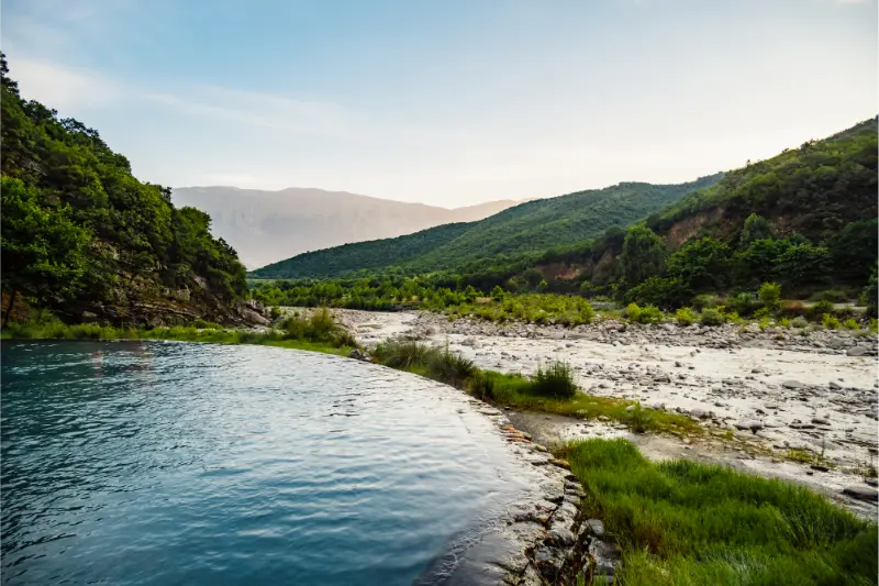
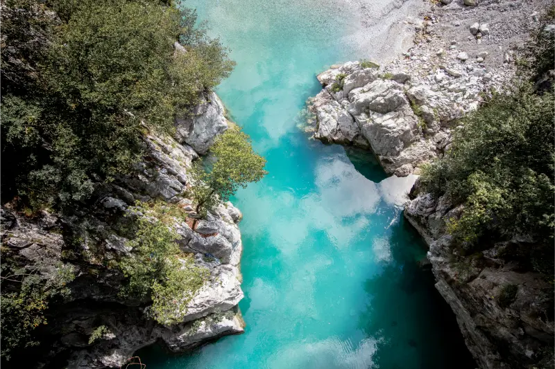
    The Devoll River is one of the major rivers shaping southeastern Albania. The official tourism portal highlights its importance for hydropower, regional development, biodiversity and landscape. For travelers, the river is less a single attraction than a geographic thread linking parts of the Korçë and Devoll countryside with reservoirs, valleys and agricultural settlements.

    • Best for: travelers who enjoy river landscapes, rural roads and nature photography.
    • Best base: Korçë for accommodation, food and easier transport.
    • Time needed: about 1–3 hours for a focused stop; half a day when combined with nearby villages or attractions.
    • Transport: a car, taxi or private driver gives the most flexibility outside the main towns.
    • Planning rule: treat water level, track condition, access and local restrictions as changeable details rather than permanent facts.

    Why visit Devoll River?

    A Devoll-focused road trip is useful if you want to understand southeast Albania beyond Korçë’s historic center. The river shows how mountain water, farming, energy infrastructure and village life interact. This is landscape tourism rather than a classic sightseeing stop, and it works best when combined with Bilisht, Maliq or wider rural routes.

    Divjakekaravasta National Park Albania Landscape

    I would not build an entire Albania itinerary around this one place. The better strategy is to use it as a high-quality supporting stop inside a regional day: one strong landscape, one cultural or village visit and enough time for an unhurried meal. That is usually more satisfying than collecting five small map pins and spending most of the day in the car.

    What to expect on the ground

    Expect a real Albanian landscape rather than a polished attraction with a ticket office, marked parking bays and fixed opening hours. Signage can be limited, facilities may be absent and the best viewpoint can depend on the season, vegetation and water level. That lack of infrastructure is part of the appeal, but it also means visitors need to be self-sufficient and conservative about access.

    A common mistake is to judge small natural places from one dramatic photograph. Water can look very different after rain, during drought or under harsh midday light. I plan these stops for the overall setting and the route, not for a promise that one exact social-media angle will look the same on the day.

    How to get to Devoll River

    Use Korçë or Bilisht as practical bases and follow public roads through the valley. Hydropower areas may have restricted infrastructure and roads that are not tourist access points. Respect gates and signs, and never stop on a narrow bridge or active work zone for a photograph.

    Download the destination and surrounding roads before leaving reliable mobile coverage. I also save the name in Albanian and take a screenshot of the wider map because it is easier to ask a local person for help when you can point to the correct village or road. If two navigation apps disagree, I choose the safer obvious road rather than the shortest line.

    Road, parking and navigation

    Do not assume that a line on a digital map is suitable for a rental car. Minor Albanian roads can change quickly from asphalt to gravel, narrow farm lane or rough track. Check your rental agreement before driving off paved roads, avoid deep ruts after rain and turn around early if the surface is worse than expected. A ten-minute walk from a safe parking place is better than damaging a vehicle.

    Park only where you can leave space for residents, tractors and emergency access. I avoid gateways, irrigation channels and soft verges. In small villages, a brief polite question about where to leave the car can solve the problem faster than circling with the hazard lights on.

    Best time to visit

    Spring gives green fields and strong contrast between river and mountains. Autumn can be excellent for clear air and harvest landscapes. Summer is warm but works for road trips with early starts, while winter requires more attention to fog, snow and icy roads in the southeast.

    For most small nature stops, morning and late afternoon are easier than the hottest part of the day. The light is softer, roads are quieter and you have more margin if the approach takes longer than expected. In shoulder season I carry a light waterproof layer because a short shower can change an exposed track or riverbank surprisingly fast.

    What to do

    Drive scenic sections, stop in villages, photograph the valley and combine the route with food, markets or mountain side trips. Hiking opportunities depend on the specific area rather than the river as a whole. Avoid treating dams, channels or power facilities as informal attractions.

    I prefer a simple visit with a clear purpose: one short walk, a few photographs, time to observe the landscape and then a nearby lunch or village stop. That pace leaves room to notice birds, farming, geology and local architecture instead of treating the place as a background for a quick photo.

    A practical half-day itinerary

    Start from Korçë after breakfast and travel to the site while temperatures and traffic are still manageable. Spend enough time to explore the obvious public-access area without rushing, then continue to one of the related destinations listed later in this guide. If the road or weather is poor, reverse the order and use the small nature stop only if conditions improve.

    Keep the second half of the day flexible. Albania’s smaller attractions often work best when you can stop for a village café, roadside produce or an unexpected viewpoint without worrying about a timed reservation. I only book a fixed lunch or tour when it is the main reason for the day.

    Walking and footwear

    Even a short visit can involve loose gravel, mud, grass, uneven stone or an unprotected bank. Closed shoes with reasonable grip are more useful than sandals away from developed beaches. I carry a small daypack with water, sunscreen, a basic first-aid kit and an extra layer. Hiking poles are optional but can be useful after rain or on steep rural paths.

    If the route becomes exposed, overgrown or difficult to follow, turning back is the correct decision. A small destination is not worth pushing into unsafe terrain. Offline tracks are helpful references, but they are not proof that a path is public, maintained or currently passable.

    Photography tips

    Look for broad valley views, agricultural patterns and the way roads and settlements follow the water. Industrial infrastructure can be part of the story if photographed from legal public areas. Never climb barriers or enter restricted zones to improve a composition.

    A useful approach is to take one wide establishing image, one medium landscape and several details such as reeds, rock, reflections, old walls or agricultural textures. That tells a more complete story than repeating the same panorama. I keep tripods and bags out of roads and never ask other visitors to move through unsafe ground for a picture.

    Visiting with children

    A river-valley driving day can work with children if you keep stops short and include a town, meal and playground break. Avoid unprotected banks and industrial areas. Pack layers because weather can change quickly between low valleys and higher southeast roads.

    For a family day, I would combine this stop with one predictable attraction or town where you know there are toilets, shade and food. Children usually enjoy a short nature break more when it is not the third remote location of the day. A change of shoes and dry clothes in the car can be useful after muddy ground or unexpected splashes.

    Food, water and practical services

    Do not count on finding a café, public toilet or shop beside a small natural site. Carry drinking water and a snack, then spend money in the nearest village or town. If you see a local restaurant, farm shop or producer that fits the route, that is often a better way to support the area than arriving with everything purchased in a large city.

    Cash is still useful in rural Albania. I keep small-denomination lek for cafés, produce, parking where a local arrangement exists and family-run businesses. Card acceptance is improving, but a remote day should not depend on it.

    Safety around water

    Clear water is not automatically safe water. Depth, current, cold temperature, algae, submerged objects and sudden changes after rain can all create risk. I never recommend swimming simply because other people are doing it. If swimming is locally accepted, assess conditions on the day and keep children and weak swimmers especially conservative.

    After thunderstorms or prolonged rain, river and reservoir margins deserve extra caution. Fast current, soft banks and hidden debris can appear where the same place looked calm a week earlier. In hot weather, the opposite problem is dehydration and sun exposure, so carry more drinking water than the short distance might suggest.

    Responsible travel

    The Devoll is a working river system, not an outdoor theme park. Respect energy infrastructure, farmland and private property. Use established picnic places when possible, carry waste out and do not assume fishing or swimming is permitted everywhere.
    Theater Amphitheater Archaeological Ruins Butrint Butrinto National Park Albania

    Natural places with little formal management can be damaged by only a small increase in visitors. I keep to durable ground, avoid picking plants, do not feed wildlife and leave stones or archaeological fragments where they are. If there is no bin, rubbish goes back in the car. If access is clearly private, I do not argue that a map app shows a route.

    Where to stay

    For the widest choice of accommodation and services, I would normally use Korçë as the base for this visit. Compare current accommodation on Booking.com. On a road trip, map location matters more than a slightly lower headline price if an early start or easy parking will save time.

    For rural guesthouses, check recent reviews for road access, parking, heating or air-conditioning, breakfast times and whether the host can provide current local directions. A good local host is often the best source for last-minute information about a track, water level or temporary closure.

    Nearby places to combine with the visit

    Choose one or two of these links rather than trying to fit all of them into the same day. Driving times in Albania can be misleading when traffic, mountain roads, village stops and parking are involved. The best itinerary usually has fewer stops and more time at each one.

    Tours and local guides

    A dedicated tour to a small lake or river may not exist every day, but private regional tours can sometimes be adapted. Before booking, ask for the exact route, pickup point, walking level, vehicle type and what happens if weather or access changes. A knowledgeable local guide is most valuable when the destination has limited signage or environmental sensitivity.

    Aerial Drone View Spille Beach Albania Pine Forest 3

    Official information and last-minute checks

    For the destination-specific facts used in this guide, see Albanian National Tourism Agency – Devoll River. Official tourism pages are a useful starting point, but rural access, water levels, path condition and local restrictions can change. Recheck time-sensitive details close to departure.

    Frequently asked questions

    Is Devoll River worth visiting?

    Yes if you are already exploring the surrounding region and enjoy quiet nature, landscape photography or rural Albania. I would treat it as a complementary stop rather than a headline attraction for a very short first-time itinerary.

    Do I need a car?

    A car, taxi or prearranged driver is usually the easiest option. Public transport may reach the wider town or village, but small natural sites rarely have a convenient stop at the exact access point. If you rent a car, stay within the road-use rules of your contract.

    How long should I allow?

    For the site itself, one to three hours is normally enough. Allow half a day when you include the drive, route-finding, photographs and a nearby meal. Remote mountain locations may need more time because access is slower than the map distance suggests.

    Can I swim?

    Do not assume so. Conditions and permissions vary by place, season and water use. Reservoirs, working rivers and protected wetlands can have hazards that are not obvious from the bank. Follow current local guidance and choose safety over an unofficial online recommendation.

    Are there toilets and cafés?

    Often not at the immediate site. Use the nearest town or village for food, fuel and toilets, and carry drinking water. This is one reason I prefer combining small natural attractions with a larger nearby destination.

    Final perspective

    Devoll River is valuable because it adds detail to an Albania itinerary rather than because it competes with the country’s famous sights. Visit with realistic expectations, respect the landscape and local access, and combine it with the surrounding region. Small places are often where a road trip starts to feel personal instead of simply efficient.
  • Blue Eye Albania Guide: How to Visit Syri i Kaltër from Saranda or Gjirokaster

    Blue Eye Albania Guide: How to Visit Syri i Kaltër from Saranda or Gjirokaster

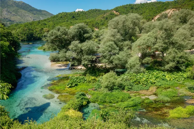
    The Blue Eye, or Syri i Kaltër, is one of the easiest natural sights to add to a southern Albania itinerary, but it is much more enjoyable when you understand what the visit actually involves. It is a karst spring near Muzinë, surrounded by forest and intensely coloured water that can look almost unreal in bright light. The official Albanian tourism portal describes it as one of the most visited natural attractions in the south and highlights the spring’s ecological and hydro-geological value. See the official Blue Eye tourism page before travelling for any updated visitor information.

    I would treat the Blue Eye as a half-day nature stop, not as an all-day destination on its own. It works especially well between Saranda and Ksamil and Gjirokaster, or as a break on a road trip through southern Albania. The key is to arrive with realistic expectations: you come for the spring, the shade, the walk and the colour of the water, not for a huge park full of attractions.

    What makes the Blue Eye special

    The spring rises through limestone and creates a deep, circular blue centre surrounded by lighter turquoise and green tones. The visual effect is strongest when sunlight reaches the water, while the surrounding trees make the area feel cooler than the exposed coast in summer. It is a good example of why southern Albania is more than beaches: within a relatively short drive you can move from the Ionian coast into a greener inland landscape.

    The spring is also a protected natural feature, so I would approach it as a place to observe rather than a swimming spot. Rules and access arrangements can change, especially in protected or heavily visited areas. Respect barriers, signs and staff instructions even if you see old travel posts showing people doing something different.

    How to get to the Blue Eye

    By car, the Blue Eye fits naturally on the road corridor between Saranda and Gjirokaster. A rental car gives you the most flexibility because you can combine the visit with other stops and avoid building the whole day around a single transfer. If you are considering driving more widely, read my guide to getting around Albania first, especially the sections on road times and rental-car planning.

    Travellers without a car can normally arrange a taxi, private transfer or organised excursion from Saranda and sometimes from Gjirokaster. Rather than relying on an old fixed fare from a blog, ask for the total price before departure and confirm whether waiting time is included. Public transport in Albania is useful for city-to-city travel, but it is less convenient for attractions located away from town centres.

    When to go during the day

    In high summer, early morning is the most comfortable choice. You get cooler walking conditions and usually a calmer atmosphere before many day-trippers arrive from the coast. Late afternoon can also be pleasant, but do not cut the visit too close to closing or sunset because access arrangements and seasonal hours can change.

    Spring and early autumn are excellent if you prefer a slower visit. The forest feels fresh, the walk is easier in milder temperatures and the Blue Eye can be paired with a longer road-trip day without the intensity of July or August traffic.

    How much time to allow

    For most travellers, two to three hours from arrival to departure is a sensible planning window. That gives you time to walk in, stop for viewpoints, enjoy the spring without rushing and take a break. If you are visiting with children, older relatives or in hot weather, build in more time because the walk can feel longer than it looks on a map.

    Do not schedule a tightly timed museum ticket or ferry immediately after the Blue Eye. Southern Albania journeys can be slowed by seasonal traffic, road works or parking queues, and a nature stop is more enjoyable when you are not watching the clock.

    What to bring

    • Comfortable shoes rather than beach flip-flops for the walk
    • Water, especially from late spring to early autumn
    • Sun protection even though parts of the route are shaded
    • A light layer outside midsummer because the spring area can feel cooler
    • A small amount of cash as a backup for local services or parking

    Blue Eye with Saranda and Ksamil

    If you are based on the coast, the Blue Eye is an easy contrast to beach days. I would not combine it with every major southern attraction in one rushed day. A better plan is Blue Eye plus Saranda in the evening, or Blue Eye plus one cultural stop. For beaches and coastal logistics, use the best beaches in Albania guide and the Butrint guide separately.

    Panoramic View Saranda Beach Cityscape Albanian Riviera Coast

    For accommodation, staying in Saranda is convenient if you want restaurants, ferries and a broad choice of hotels. You can compare places to stay in Saranda and then make the Blue Eye a morning excursion.

    Blue Eye with Gjirokaster

    Gjirokaster makes a stronger combination if your trip is focused on culture and inland landscapes. Spend the night in the stone city, visit the castle and old bazaar, then stop at the Blue Eye while travelling toward Saranda. This avoids unnecessary backtracking. My Gjirokaster travel guide explains how much time the UNESCO-listed historic centre deserves.

    Aerial View Of Lekuresi Castle And Saranda Albania

    If you are travelling slowly, one night in Gjirokaster and two or more on the coast creates a much better rhythm than trying to see the city, Blue Eye, Butrint and Ksamil all in a single day.

    Is the Blue Eye suitable for families?

    Yes, for many families it is a manageable nature outing, but it is not a playground or a beach. The main practical issues are heat, walking distance and keeping young children close near water and viewpoints. A stroller may be less convenient than expected on uneven sections, so parents should check current access conditions before going.

    For a broader family route, see Albania with kids, which covers beach choices, driving days and how to avoid overloading children with long transfers.

    My suggested southern Albania sequence

    A balanced route is Gjirokaster → Blue Eye → Saranda → Butrint/Ksamil → Riviera. That sequence follows the geography well and connects naturally with the Albanian Riviera road trip guide. If you are driving north afterward, continue through Himare and Vlore instead of returning inland.

    Blue Eye Water Spring Clear Blue Water View Muzine Vlore Albania

    The Blue Eye is memorable because it is simple: a short nature stop built around one extraordinary spring. Give it enough time to feel peaceful, but do not design an entire day around it unless you specifically want a slow forest outing.

    Final planning notes

    Check the official tourism page shortly before your visit because parking, shuttle arrangements and access rules can evolve as visitor numbers increase. I also recommend downloading an offline map before leaving Saranda or Gjirokaster, since mobile coverage can vary in rural valleys.

    If the Blue Eye is one stop in a larger trip, plan the route first and accommodation second. That prevents unnecessary backtracking and usually saves more time than chasing the cheapest room in a town that does not fit your direction of travel.

    Extra practical advice

    If you are photographing the spring, polarising filters can reduce glare but do not let photography turn the visit into a queue. Move away from the most obvious viewpoint and let other visitors have space. Drones may be restricted in protected or crowded areas, so check current rules before flying one.

    A picnic can work if local rules permit it, but pack out everything you bring. The area receives heavy visitor pressure in summer, and small choices such as carrying a reusable bottle and staying on paths matter when multiplied by thousands of visitors.

    When planning Blue Eye Albania, I would also keep the wider route in mind. Albania rewards travellers who leave realistic margins between stops, confirm seasonal services directly and avoid basing an entire day on one old timetable or price. Save addresses and confirmations offline, carry some cash as a backup, and ask accommodation hosts for current local conditions when roads, weather or opening times could affect the plan. The most useful approach is to separate fixed decisions from flexible ones: book transport or accommodation that would be difficult to replace, but leave ordinary meals, viewpoints and minor stops open. That balance keeps the trip organised without making it rigid. It also allows you to change direction when a beach is crowded, a mountain road is slow or a local recommendation sounds better than the original plan.

    When planning Blue Eye Albania, I would also keep the wider route in mind. Albania rewards travellers who leave realistic margins between stops, confirm seasonal services directly and avoid basing an entire day on one old timetable or price. Save addresses and confirmations offline, carry some cash as a backup, and ask accommodation hosts for current local conditions when roads, weather or opening times could affect the plan. The most useful approach is to separate fixed decisions from flexible ones: book transport or accommodation that would be difficult to replace, but leave ordinary meals, viewpoints and minor stops open. That balance keeps the trip organised without making it rigid. It also allows you to change direction when a beach is crowded, a mountain road is slow or a local recommendation sounds better than the original plan.

    More local Albania guides

    \n

    Parking and arriving by car

    \n

    If you are driving, see Blue Eye Albania Parking Guide for current access strategy, parking advice and rental-car tips.

    \n

    Geology deep dive: The Blue Eye is also part of a much wider karst system. Karst Landscapes of Albania.

  • Langarica Canyon Guide: Benja Springs, Hiking and Permet Nature

    Langarica Canyon Guide: Benja Springs, Hiking and Permet Nature

    Langarica Canyon is the wild landscape immediately beyond the famous Benja thermal pools near Përmet. Many visitors stop at the stone bridge, soak in warm water, take a photo and leave. That misses the larger setting: a narrow limestone canyon, river walking, mountain walls and one of the easiest ways to combine geology, water and hiking in southern Albania.

    Stream Hot Sulfuric Water Thermal Baths Permet Albania Langarica Canyon Kadiut Bridge 3

    The official Langarica Canyon page highlights the high rock walls, clear water, hiking and nature-photography potential. I would treat the canyon and thermal pools as one integrated half-day or day, with the exact plan determined by weather and water level rather than by a rigid itinerary made months in advance.

    Start at Benja and the Kadiut Bridge

    The Ottoman-era stone bridge and thermal pools create the classic entrance scene. Arrive early in busy months because the small area can feel crowded quickly. Wear sandals or water shoes for the pools, but keep proper walking shoes available if you plan to continue into the canyon.

    The water is warm rather than spa-resort hot, and the pools are natural outdoor features. Facilities and cleanliness vary with visitor pressure. Do not use soap or cosmetics in the river, and take every piece of rubbish away.

    Walking into Langarica Canyon

    The canyon invites exploration, but conditions change with water level. In dry, stable weather, visitors may walk sections in and beside the river. After rain, the same narrow corridor can become unsafe. Flash floods are the critical risk in any gorge, so never enter when storms are possible upstream.

    Use a local guide if you want to go beyond the obvious first section or if you are not confident judging river terrain. Shoes with grip, a waterproof bag and a small towel make the experience much easier. Do not take a heavy camera setup unless you can protect it securely.

    How Langarica differs from Osum Canyon

    Osum is larger and strongly associated with seasonal rafting; Langarica feels more intimate and is naturally combined with the Benja pools. If you have time for both, they offer different experiences. If you only have one nature day from Përmet, Langarica is the easier fit because it is close to town.

    Our Osum Canyon guide explains the rafting option, while the thermal springs guide compares Benja with other thermal areas. Avoid trying to visit both canyons in one day.

    Përmet as your base

    Përmet is one of Albania’s most pleasant small-town bases, with the Vjosa River, restaurants, guesthouses and access to the wider valley. Stay there rather than turning Langarica into an exhausting detour from Gjirokastër. An overnight also gives you flexibility to choose the better-weather morning.

    Use our Përmet travel guide for the town and Vjosa guide for the wider river landscape. Two or three nights in the region are easy to justify if you enjoy nature and food.

    Këlcyrë Gorge and the wider valley

    The road toward Këlcyrë adds another dramatic river-and-mountain corridor. Rather than treating every viewpoint as a separate attraction, use the journey to understand the landscape linking Përmet with the rest of southern Albania. Pull over only where it is safe and legal; narrow mountain roads are not places for spontaneous photo stops.

    Local produce, honey, gliko and slow meals are part of the region’s appeal. Leave time for them. A day of canyon walking followed by a traditional dinner is more coherent than driving several extra hours to collect another town.

    When not to enter the canyon

    Do not enter Langarica during or soon after heavy rain, when thunderstorms are forecast, or when local guides advise against it. Clear skies above you do not guarantee safe conditions upstream. Water temperature and current can also make a route harder than it looks from the first pool.

    If conditions are unsuitable, the thermal area, stone bridge and valley still make a worthwhile visit. Flexibility is a core outdoor skill; changing the plan because of weather is exactly what responsible travel looks like.

    How long I would spend in Langarica Canyon

    I would plan Langarica Canyon around the experience you actually want rather than a fixed number of attractions. For a first look, one well-paced day can work if you are already based nearby. If you enjoy water, canyon landscapes and easy-to-moderate outdoor exploration, staying one or two nights is much better because you gain the quieter early morning and evening hours that day trippers miss. Albania often looks compact on a map, but parking, mountain roads, beach traffic and meal stops make rushed schedules less efficient than they appear.

    Build the day around one main activity and one secondary stop. Pair Langarica Canyon naturally with Benja thermal springs, Përmet, Këlcyrë and the Vjosa Valley, but avoid adding a third distant destination simply because the driving distance looks short. The strongest itineraries leave room for a local lunch, a viewpoint, changing weather or a recommendation from your host.

    Stream Hot Sulfuric Water Thermal Baths Permet Albania Langarica Canyon Kadiut Bridge

    Getting there and moving around

    For this destination, a car or taxi from Përmet is convenient, but the final exploration is on foot and conditions inside the canyon must be judged locally. Download offline maps before leaving a major town and keep the accommodation phone number available. Bus and shared-van departure points can shift, minor roads can be slower than expected, and summer traffic around the coast can add meaningful time to short journeys.

    If you drive, treat narrow village streets, livestock, cyclists and pedestrians conservatively. Do not assume every road shown on a navigation app is suitable for an ordinary rental car. If a route becomes rough or weather deteriorates, turning around is a sensible travel decision rather than a failure to complete the plan.

    Where to stay

    Permet, Albania is the most practical base for the plan described in this guide. Check the exact map position before booking because a property can use the destination name while sitting several kilometers away or high above the beach or village center. Prioritize recent reviews, parking if you drive, air-conditioning or heating for the season, and realistic luggage access. Check current accommodation on Booking.com.

    I also check whether breakfast starts early enough for hiking or transfers, whether late check-in is genuinely available and whether the road to the property is paved. These small details matter more in Albania than choosing between two hotels with nearly identical review scores.

    Best time to go

    late spring to early autumn often provides the easiest access, but rainfall upstream matters more than the calendar; never enter a narrow gorge in unstable weather. Shoulder season often gives the best balance between comfortable temperatures, easier parking and a more local atmosphere, but mountain villages and beach resorts can have reduced services outside their main season. Recheck weather and opening patterns close to departure rather than relying on an old annual schedule.

    Costs, cash and practical details

    Access to natural areas may involve small local parking or service costs rather than a standardized ticket, and guided canyon experiences should be compared for safety and inclusions. Card acceptance is improving, but I still carry some Albanian lek for small cafés, parking, local transport, guesthouses or rural purchases. Use bank-operated ATMs where possible and review any conversion prompt before accepting it. Our money in Albania guide explains cash, cards and ATMs in more detail.

    Keep water and a small snack in the car or daypack, especially when moving between rural sights. Mobile coverage is generally useful, but a screenshot of the hotel address and the day route is still valuable when signal drops in mountain or canyon areas.

    Families and accessibility

    The thermal pools can suit families, while deeper canyon walking is appropriate only when water, footing and children’s abilities are suitable; do not pressure a child to continue in slippery terrain. Families should build more shade, toilet and food breaks into the day than a couple travelling alone. Travelers with reduced mobility should confirm the exact walking surface, steps and parking distance directly with the accommodation or attraction because historic villages and nature sites may be much less accessible than city hotels.

    A final planning note

    Langarica Canyon is worth visiting for what makes it different, not because you need another pin on the map. Give the place enough time to develop a rhythm: coffee, a walk, a meal and one memorable landscape usually create a better travel day than five hurried stops. Keep the core plan simple and let current local information improve the details once you arrive.

    A simple day from Përmet

    Leave town after breakfast and reach Benja before the busiest part of the day. Walk the bridge area, soak briefly if the pools are comfortable, then decide whether canyon conditions suit further exploration. Return to Përmet for a late lunch and spend the afternoon by the Vjosa or resting. This is deliberately modest: water, heat and slippery terrain make a four-hour outdoor day more tiring than the same number of hours in a city.

    What to bring

    Water shoes are helpful in the pools, but proper trail shoes are better for approach paths and dry canyon edges. Bring a swimsuit, towel, waterproof bag, drinking water and sun protection. Avoid glass bottles near the pools. A walking pole can help on uneven ground but is awkward in deeper water. If you carry a camera, use a sealed dry bag and keep both hands free whenever footing becomes uncertain.

  • Best Hikes Near Përmet: Langarica Canyon, Hotova-Dangëlli, Leusë and Nëmërçka

    Best Hikes Near Përmet: Langarica Canyon, Hotova-Dangëlli, Leusë and Nëmërçka

    Përmet is one of Albania’s best small-town bases for walkers because the Vjosa Valley gives you everything from easy village paths to canyon exploration and serious mountain objectives. The mistake is treating them as equivalent. Walking to Leusë is a relaxed cultural outing; entering Langarica depends on water and weather; Nëmërçka is a genuine mountain day.

    Stream Hot Sulfuric Water Thermal Baths Permet Albania Langarica Canyon Kadiut Bridge

    This guide uses “hike” broadly enough to include easier nature walks and tougher mountain days, but it does not pretend those activities carry the same risk. Distances, weather, trail markings and access roads can change. For remote or high routes, confirm conditions locally before leaving and carry a navigation method that works offline.

    Quick comparison

    RouteDifficultyBest forAccess
    Bënja Thermal Baths and Langarica CanyonModerate / condition-dependentBest signature nature walkCar/taxi to Bënja + walking
    Përmet to LeusëModerateBest walk directly from townOn foot
    Hotova–Dangëlli National ParkEasy to strenuous depending on routeBest forest hikingCar/driver required
    Frashër village walksEasy to moderateBest history-and-nature combinationCar + walking
    Mount NëmërçkaStrenuous / expert mountain hikeBest major summit objectiveGuide/experienced mountain planning recommended

    Which hike should you choose?

    If this is your first outdoor day in the area, choose the route with the simplest access and an obvious turnaround point. Save the highest or most remote objective for a day when the forecast, transport and your energy all line up. I would rather complete a shorter route comfortably than turn a holiday into a rescue problem by chasing a summit because it was on the original itinerary.

    Bënja Thermal Baths and Langarica Canyon

    Best signature nature walk. Difficulty: Moderate / condition-dependent. Access: Car/taxi to Bënja + walking. The Bënja–Langarica combination is the classic outdoor day. The canyon is about 4 km long with high rock walls, and the thermal springs/Kadiu Bridge sit at its entrance. Water depth and slippery rock change with recent weather, so do not force a canyon walk after heavy rain. Use the Langarica Canyon guide and the Bënja guide.

    Përmet to Leusë

    Best walk directly from town. Difficulty: Moderate. Access: On foot. The uphill route to Leusë gives you a satisfying walk without needing transport and ends at one of the region’s most important village churches. See the Leusë guide. It is a strong first-afternoon hike because you can turn back easily before dark.

    Hotova–Dangëlli National Park

    Best forest hiking. Difficulty: Easy to strenuous depending on route. Access: Car/driver required. Hotova–Dangëlli is a large mountain-and-forest park with meadows, springs and hiking opportunities. The Hotova–Dangëlli guide is a starting point, but exact trails should be confirmed locally because the park is extensive and mobile signal/navigation can be inconsistent.

    Frashër village walks

    Best history-and-nature combination. Difficulty: Easy to moderate. Access: Car + walking. Frashër adds cultural history to the forested landscape. I treat it as a village walking day rather than a summit mission: explore the settlement and surrounding paths, then combine it with Hotova if daylight allows.

    Mount Nëmërçka

    Best major summit objective. Difficulty: Strenuous / expert mountain hike. Access: Guide/experienced mountain planning recommended. Nëmërçka is for hikers who came to Përmet specifically for mountains, not a spontaneous add-on after the thermal baths. Route choice, weather, water and transport to the trailhead matter. Read the Mount Nëmërçka guide and use current local advice.

    Stream Hot Sulfuric Water Thermal Baths Permet Albania Langarica Canyon Kadiut Bridge 3

    Do you need a guide?

    For an obvious low-elevation walk with clear local directions, most experienced travelers can usually walk independently. A guide becomes much more valuable when the route is high, remote, poorly signed, seasonally snow-covered, canyon-based or dependent on a vehicle pickup at a different endpoint. A guide can also turn a simple walk into a better cultural/nature experience because local place names and private-land boundaries are not always obvious on online maps.

    Never use “there are reviews online” as a substitute for current conditions. A route can be straightforward in July and inappropriate after an October storm or during late spring snowmelt.

    Getting to the trailheads

    You can walk to Leusë from town, but a car/driver is valuable for Bënja, Hotova, Frashër and mountain trailheads. Keep rental-car ground clearance in mind on rural access roads.

    Best hikes for families

    Leusë and Bënja are the easiest family choices. Short forest walks in Hotova can also work if you know the exact route. Nëmërçka is not a casual family hike.

    Best time of year

    Spring and autumn are excellent. Summer heat in the Vjosa Valley makes early starts important, although forest and water routes can be rewarding. Canyon entry should always follow current water conditions. High Nëmërçka can have snow or storms outside the easy summer window.

    Heat, storms and mountain safety

    Start early in warm weather and carry more water than you expect to need. On exposed ridges, thunder is a reason to turn around, not an invitation to wait under the tallest tree. In canyons and near waterfalls, heavy rain upstream can change conditions even if the sky above you looks better. In the Alps and other high ranges, snow, fog and wind can make a familiar summer route a completely different undertaking.

    Tell someone where you are going when the route is remote, keep your phone charged, download offline mapping and do not count on mobile coverage. If the trail is beyond your navigation or scrambling experience, choose a local guide rather than learning those skills in a place you do not know.

    What to pack

    • Shoes with reliable grip rather than smooth city sneakers.
    • At least one extra layer, even on a warm valley day if the route gains altitude.
    • Sun protection: hat, sunscreen and sunglasses.
    • Enough water plus a small snack; do not assume every spring is safe to drink.
    • Offline map, charged phone and small power bank on longer routes.
    • Compact rain/wind shell.
    • Basic first-aid items and any personal medication.
    • Cash for rural cafés, taxis or guesthouse transfers where cards may not be practical.

    Where to stay for hiking

    Compare current accommodation in Permet on Booking.com.

    For area-by-area accommodation advice, read the local Where to Stay guide. For hiking trips I care more about early breakfast, vehicle access, luggage storage and the host’s current trail knowledge than about a small difference in room decoration.

    Guided hikes and outdoor tours

    Guided options are most useful when transport and hiking are bundled together, especially from a city base or on routes where the start and finish are different. Compare the current activity description carefully rather than assuming every tour includes the same trail or difficulty.

    How to plan a two-hike stay

    I use the first outdoor day for the easier route. That gives me a real sense of local heat, trail surfaces, driving and my own energy after travel. I put the harder objective on the second day with a backup plan. If the weather is poor, I swap the order rather than forcing the mountain day. This simple strategy is especially useful in Theth, Valbona, Tomorr, Nëmërçka and the higher Korçë/Pogradec ranges.

    Common hiking mistakes

    • Starting too late because the route looks short on a map.
    • Using road-driving time as if it were guaranteed trailhead access.
    • Following an old GPX track without checking closures, private land or changed paths.
    • Carrying too little water on exposed summer routes.
    • Treating a canyon, waterfall or river crossing as safe after heavy rain.
    • Assuming a famous high pass is snow-free because the valley is warm.
    • Wearing sandals on loose rock because the hike ends at a beach or thermal spring.
    • Booking an onward bus or flight too tightly after a mountain day.

    Official and related planning resources

    For the destination overview, see the official Albania tourism page. The national trail overview Best Hiking Trails in Albania is useful for comparing this area with the rest of the country.

    Frequently asked questions

    Can I hike here without a car?

    At least one of the routes in this guide can usually be done without owning a car, but the answer depends on your accommodation and the exact trail. City-adjacent walks are easiest; remote national-park and high-mountain trailheads often require a taxi, driver, shuttle or rental car.

    Do I need hiking boots?

    For easy dry paths, good trail shoes can be enough. For loose rock, wet canyon terrain, snow or a major mountain route, more supportive footwear is a better choice. Grip matters more than brand.

    Can I hike in July and August?

    Yes, but start early, carry substantial water and reduce exposed midday walking. Higher mountain routes may be cooler, while low canyon and coastal paths can become extremely hot.

    Is hiking safe after rain?

    It depends on the route. Rain can make stone, clay and roots slippery, and canyon or river conditions can change rapidly. Choose a lower-risk route or wait when conditions are uncertain.

    Should I download an offline map?

    Yes for anything beyond an obvious short walk. Mobile signal is not a reliable navigation strategy in mountain and canyon terrain.

    Final recommendation

    Build the hiking day around conditions rather than ambition. Choose one route that matches your transport, fitness and the forecast, start earlier than you think you need to, and keep a lower-risk alternative ready. Albania’s best outdoor experiences are not improved by rushing them.

  • Pogradec and Lake Ohrid Travel Guide: Albania’s Quiet Lakeside Escape

    Pogradec and Lake Ohrid Travel Guide: Albania’s Quiet Lakeside Escape

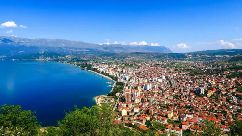
    Pogradec is one of the places I would choose when I want Albania to slow down. Instead of the intensity of a summer beach resort, you get a lakeside promenade, mountain views, small restaurants, swimming areas and easy day trips around the Albanian shore of Lake Ohrid. The city is particularly useful if your route already includes Korce, because the two destinations complement each other without requiring a long detour.

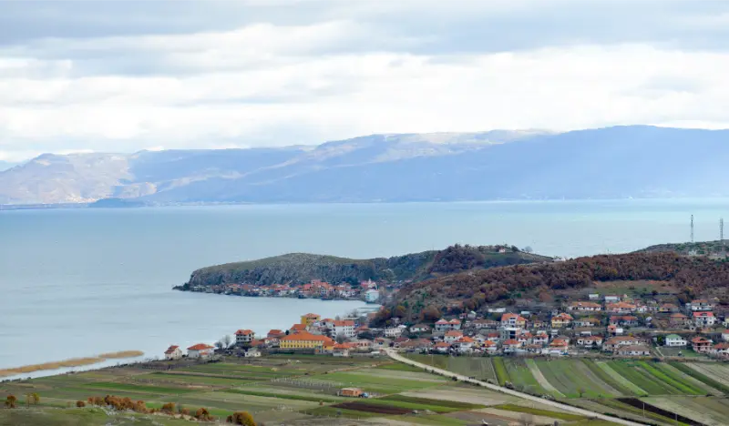
    Lake Ohrid is not simply a pretty border lake. UNESCO describes the wider region as a mixed natural and cultural World Heritage property, and the Albanian part was included in the World Heritage extension in 2019. The UNESCO Lake Ohrid page explains the lake’s exceptional biodiversity and cultural history, while the official Pogradec tourism page is useful for local orientation.

    Why Pogradec feels different

    Pogradec has a gentler rhythm than Tirana or the Riviera. The waterfront is central to daily life, and evenings are made for walking rather than rushing between attractions. In summer the lake creates a holiday atmosphere, while spring and autumn suit travellers who care more about scenery, food and day trips than swimming.

    It is also an excellent reset point on a longer road trip. After mountains, historic cities or busy beaches, two nights beside Lake Ohrid can make the whole itinerary feel less compressed.

    Walk the Pogradec waterfront

    Start with the promenade and lakeside parks. This is where you understand the town rather than simply ticking off sights. Cafés, families and evening walkers fill the shore, and the light changes dramatically as the sun moves behind the surrounding mountains.

    The centre is compact enough to explore on foot. I would use the car mainly for day trips, then leave it parked while enjoying the waterfront. This is one of the easiest Albanian destinations for a simple evening with no plan.

    Visit Tushemisht and Drilon

    South-east of Pogradec, Tushemisht and the Drilon area offer springs, greenery, restaurants and a village atmosphere close to the lake. They are popular in summer, so morning or late afternoon can feel calmer. The area works well for families because you can combine a short walk, lunch and time near the water without a demanding schedule.

    Do not expect untouched wilderness: these are accessible leisure areas. Their value is convenience and contrast with the town, especially if you are staying two nights or more.

    Lin Peninsula and UNESCO heritage

    North of Pogradec, the Lin Peninsula is one of the most important stops on the Albanian shore. UNESCO specifically mentions the remains of an Early Christian church at Lin and its mosaic tradition in the description of the World Heritage property. The setting itself is worth the detour, with village houses and water on multiple sides.

    Go respectfully because Lin is a lived-in community as well as a heritage landscape. Avoid blocking narrow lanes with a car and follow local signs when accessing archaeological areas.

    Swimming in Lake Ohrid

    In warm weather, swimming is part of the appeal, but lake beaches feel different from the Riviera. Water can be cooler, shorelines vary between pebbles, platforms and developed beach areas, and weather can change more quickly. Bring water shoes if you prefer them on stony access points.

    Choose designated and locally used swimming areas rather than jumping in wherever a road meets the shore. Conditions, access and water levels vary around the lake.

    What to eat in Pogradec

    Local menus often focus on lake fish, vegetables, cheeses and regional dishes. Koran, a trout associated with Lake Ohrid, is strongly connected with Pogradec’s food identity, but responsible travellers should pay attention to legal sourcing and seasonal availability rather than treating a protected ecosystem as an unlimited menu.

    For a broader introduction to regional dishes, pair this trip with my Albanian food guide, which explains what to look for in bakeries, traditional restaurants and agrotourism stays.

    How to get to Pogradec

    Pogradec is reachable by road from Tirana and from Korce. A car makes Lin, Tushemisht and scenic stops much easier, while buses are workable if you mainly want the town itself. See the transport guide before deciding whether the extra rental cost is worthwhile.

    If you are crossing toward North Macedonia, check current border requirements separately and confirm that any rental-car contract permits international travel. Never assume a cross-border trip is automatically covered by insurance.

    How many nights?

    One night gives you an evening by the lake, but two nights are much better. With two, you can dedicate one day to Lin or Tushemisht and still have time to enjoy Pogradec itself. Three nights makes sense for families, slow travellers or anyone using the lake as a base for both Albanian and cross-border exploration.

    You can compare places to stay in Pogradec and prioritise a location near the waterfront if walking in the evening matters to you.

    Best time to visit

    June to September suits swimming and long evenings. July and August are livelier and busier. May, June and September offer a good balance for road trips, while October can be beautiful for food and scenery if you do not need beach weather.

    Winter is quiet and can feel atmospheric, but some tourism services become seasonal. If a specific restaurant, boat trip or lakeside activity matters, verify it directly before building the day around it.

    A simple two-day plan

    Day one: arrive, walk the promenade, have a relaxed lunch, swim if conditions suit, and spend the evening in town. Day two: choose Lin in the morning, return via lakeside viewpoints, then visit Tushemisht or Drilon later in the day.

    From Pogradec, continue to Korce, Tirana or central Albania depending on your route. For a longer country-wide sequence, the 14-day Albania itinerary shows how the lake can fit without excessive backtracking.

    Final planning notes

    Lake Ohrid deserves the same respect as a national park: use marked access, avoid litter and treat wildlife and fish resources carefully. UNESCO’s description highlights both the extraordinary biodiversity and the pressures created by development and tourism.

    Pogradec is not the place I would visit for a long list of headline attractions. It is valuable precisely because the lake, food, villages and evening atmosphere become the experience.

    Extra practical advice

    Cycling can be enjoyable on quieter stretches around the lake, but main roads can carry fast traffic. Ask locally about suitable routes and use lights and visible clothing. Families should prioritise traffic-separated paths where available.

    Because Lake Ohrid is transboundary, a full circuit crosses an international border. That turns a simple scenic drive into a cross-border journey with passport, insurance and potentially rental-car requirements. Plan it as such.

    When planning Pogradec Lake Ohrid, I would also keep the wider route in mind. Albania rewards travellers who leave realistic margins between stops, confirm seasonal services directly and avoid basing an entire day on one old timetable or price. Save addresses and confirmations offline, carry some cash as a backup, and ask accommodation hosts for current local conditions when roads, weather or opening times could affect the plan. The most useful approach is to separate fixed decisions from flexible ones: book transport or accommodation that would be difficult to replace, but leave ordinary meals, viewpoints and minor stops open. That balance keeps the trip organised without making it rigid. It also allows you to change direction when a beach is crowded, a mountain road is slow or a local recommendation sounds better than the original plan.

    Lake Ohrid View from Pogradec Albania

    When planning Pogradec Lake Ohrid, I would also keep the wider route in mind. Albania rewards travellers who leave realistic margins between stops, confirm seasonal services directly and avoid basing an entire day on one old timetable or price. Save addresses and confirmations offline, carry some cash as a backup, and ask accommodation hosts for current local conditions when roads, weather or opening times could affect the plan. The most useful approach is to separate fixed decisions from flexible ones: book transport or accommodation that would be difficult to replace, but leave ordinary meals, viewpoints and minor stops open. That balance keeps the trip organised without making it rigid. It also allows you to change direction when a beach is crowded, a mountain road is slow or a local recommendation sounds better than the original plan.

    When planning Pogradec Lake Ohrid, I would also keep the wider route in mind. Albania rewards travellers who leave realistic margins between stops, confirm seasonal services directly and avoid basing an entire day on one old timetable or price. Save addresses and confirmations offline, carry some cash as a backup, and ask accommodation hosts for current local conditions when roads, weather or opening times could affect the plan. The most useful approach is to separate fixed decisions from flexible ones: book transport or accommodation that would be difficult to replace, but leave ordinary meals, viewpoints and minor stops open. That balance keeps the trip organised without making it rigid. It also allows you to change direction when a beach is crowded, a mountain road is slow or a local recommendation sounds better than the original plan.

    When planning Pogradec Lake Ohrid, I would also keep the wider route in mind. Albania rewards travellers who leave realistic margins between stops, confirm seasonal services directly and avoid basing an entire day on one old timetable or price. Save addresses and confirmations offline, carry some cash as a backup, and ask accommodation hosts for current local conditions when roads, weather or opening times could affect the plan. The most useful approach is to separate fixed decisions from flexible ones: book transport or accommodation that would be difficult to replace, but leave ordinary meals, viewpoints and minor stops open. That balance keeps the trip organised without making it rigid. It also allows you to change direction when a beach is crowded, a mountain road is slow or a local recommendation sounds better than the original plan.

    Related guide: For Lin and other rural stops, see our guide to beautiful Albanian villages.

    Related guide: For a quieter Lake Ohrid stay with archaeology, read our dedicated Lin village guide.

    Related guide: For an easy lakeside half-day, read our Tushemisht and Drilon guide.

    Related guide: Selca e Poshtme Tombs Guide adds a focused layer to this destination, with historical context and practical visiting advice.

    Family planning: Pogradec with Kids: Lake Ohrid, Drilon, Tushemisht and Family Travel Tips.

    Explore beyond the city: Best Day Trips from Pogradec: Lin, Korce, Voskopoje, Prespa and Lake Ohrid compares the most useful excursions, transport options and realistic timing.

    Local food: Pogradec Food Guide: Koran Fish, Lake Ohrid Dishes, Trahana and Local Flavours explains regional dishes, food shopping, what to order and how to plan a food-focused day.

    Where to stay: Where to Stay in Pogradec: Waterfront, City Center, Tushemisht and Lin compares the most practical areas, parking, no-car options and the best base for different types of trip.

    Explore on foot: Pogradec Lakefront Walking Tour: Promenade, City Center and Lake Ohrid Views gives you a practical stop-by-stop route, a shorter version and an easier alternative.

    Only one day? 1 Day in Pogradec: Lake Ohrid, Drilon, Tushemisht and a Waterfront Sunset gives you a selective, realistic route with timing, transport and what to skip if you start late.

    Getting here: Tirana to Pogradec: Bus, Car, Transfer and the Lake Ohrid Route compares public transport, driving and private-transfer options with arrival advice.

    When to go: Best Time to Visit Pogradec: Lake Ohrid, Swimming, Weather and the Best Months compares every season, crowds, weather-sensitive activities and the best months for different travel styles.

    Pogradec And Lake Ohrid Albania

    Arriving by air: Tirana Airport to Pogradec: Southeast Terminal, Transfer, Taxi and Rental Car compares the airport bus/connection, official taxi, transfer and rental-car options.

    What to do: 15 Best Things to Do in Pogradec: Lake Ohrid, Drilon, Tushemisht and Quiet Escapes is the attraction-focused hub with priorities, free activities, family options and nearby experiences.

    Go beyond the highlights: Hidden Gems in Pogradec: 9 Quiet Places Around Lake Ohrid and the Highlands focuses on lesser-known places, quiet neighborhoods and short regional detours.

    On a budget: Free Things to Do in Pogradec: 15 Lake Ohrid Walks, Views and Quiet Experiences shows what you can genuinely do without an admission ticket and where paid attractions are optional.

    Bad weather: Rainy Day in Pogradec: Lake Ohrid, Museums and What to Do When It Rains gives you a realistic museum, food and short-walk backup plan instead of forcing the normal outdoor itinerary.

    No car? Pogradec Without a Car: Lakefront Walking, Bicycles, Taxis and Drilon explains walking, public transport, taxis and realistic excursions without renting a vehicle.

    Traveling alone? Solo Travel in Pogradec: Lake Ohrid, Drilon, Safety and Slow Travel covers accommodation, transport, evenings, day trips and practical solo safety.

    Traveling as a couple? Couples Travel in Pogradec: Lake Ohrid, Drilon, Quiet Evenings and Slow Travel covers where to stay, relaxed experiences, food, sunsets and a two-day plan.

    Have three days? 3 Days in Pogradec: Lake Ohrid, Drilon, Tushemisht and Lin gives you a slower city plan plus the most logical regional excursion.

    Easier-paced planning: Senior Travel in Pogradec: Lakefront Walks, Drilon, Tushemisht and a Relaxed Stay covers terrain, taxis, hotel access, rest breaks and a relaxed two-day plan.

    Budget planning: Pogradec Travel Costs: How Much to Budget Per Day in 2026 breaks down accommodation, food, transport, attractions and realistic daily spending.

    Photography: Best Viewpoints and Photo Spots in Pogradec: Lake Ohrid, Lin and Mountain Panoramas compares the best panoramas, street-photo locations and light for sunrise, sunset and blue hour.

    Shopping: Shopping in Pogradec: Lake Ohrid Products, Local Food, Crafts and Souvenirs explains where to browse, what local products are worth buying, how to judge crafts and what is practical to take home.

    48-hour itinerary: 2 Days in Pogradec: Lake Ohrid, Drilon, Tushemisht and Lin.

    Comparing bases? Pogradec vs Korçë: Which Destination Should You Choose in Albania? explains the differences in atmosphere, sightseeing, transport, budget and ideal length of stay.

    Driving and parking: Driving and Parking in Pogradec: Lakefront, Drilon, Tushemisht and Lin explains access, parking strategy, hotel logistics and when the car is actually useful.

    Accessibility planning: Accessible Travel in Pogradec: Lakefront, Drilon, Hotels and Mobility Planning explains terrain, hotel access, transport, easier routes and the main barriers to verify before travel.

    Route planning: Korçë to Pogradec: Bus, Taxi, Rental Car and the Easy Lake Ohrid Connection explains bus/shuttle, car, transfer, luggage and seasonal logistics.

    First-time tips: Pogradec Travel Tips: 22 Things to Know Before Your First Lake Ohrid Stay covers practical mistakes, transport, where to stay, cash, timing and trip-planning details.

    Hiking: Best Hikes Near Pogradec: Guri i Kamjes, Lake Ohrid Walks, Lin and Highland Trails compares the best local walks and mountain routes by difficulty, access, season and transport.

    Backpacking: Backpacking Korçë and Pogradec: Budget Southeast Albania by Bus, Lake and Mountain Villages covers budget stays, buses, luggage, social travel and onward route planning for independent travelers.

    Premium planning: Luxury Travel in Pogradec: Lake Ohrid Stays, Private Excursions and Slow Southeast Albania covers where to stay, private transfers, high-value splurges and premium experiences.

    Working remotely here? Digital Nomad in Pogradec: Remote Work by Lake Ohrid, Wi-Fi and Slow Living covers neighborhoods, internet backup, long-stay apartments, transport and seasonality.

    How long should you stay? How Many Days in Pogradec? 1, 2 or 3 Days on Lake Ohrid compares one, two and three days and explains when an extra night is actually useful.

    Villages nearby: Best Villages Near Pogradec: Lin, Tushemisht, Pustec and Lake Ohrid Escapes compares the best rural and small-town escapes from this base.

    \n
    Lake Ohrid and Lin Village Albania

    More local Albania guides

    \n

    Arriving and leaving by bus

    For exact departure points, tickets, luggage and onward connections, see the Pogradec bus station guide.

    Exploring without a car

    For local buses, walking, taxis and day-trip planning, see Pogradec Without a Car.

    Taxi and private transfers

    For local taxi booking, luggage transfers, longer private rides and practical fare advice, see Pogradec Taxi Guide.

    Health and pharmacies

    For emergency numbers, pharmacies, prescriptions, insurance and practical local medical planning, see Pogradec health and pharmacy guide.

    Accessibility and reduced-mobility planning

    If stairs, gradients, wheelchair access or reduced stamina affect your trip, see Accessible Pogradec: Lakefront Promenade, Drilon and Reduced-Mobility Travel for practical local planning.

    SIM, eSIM and Wi-Fi

    For mobile data, roaming, hotel Wi-Fi and offline connectivity planning, see SIM Card, eSIM & Wi-Fi in Pogradec: Lake Ohrid Connectivity, Border Signals and Mobile Data.

    Travelling with a dog

    If you are bringing a dog, see Pogradec with a Dog: Lake Ohrid Walks, Drilon, Hotels and Pet Travel Tips for accommodation, walks, heat, transport and pet-specific planning.

    Travelling with older children? See Pogradec with Teenagers: Lake Ohrid, Swimming, Cycling and Family Travel Tips for teen-focused activities, independence, evenings and family pacing.

    Planning safety and avoiding common tourist problems? Read Is Pogradec Safe? Lakefront, Swimming, Border Trips and Night Safety Tips for local advice on valuables, night travel, transport, roads and emergency planning.

    Prefer a slower, comfort-focused itinerary? Read Pogradec for Senior Travelers: Lakefront Walks, Drilon, Hotels and Easy Day Trips for hotel location, walking effort, taxis, heat, health preparation and realistic pacing.

    Travelling with a motorhome or campervan? Read Campervan & Camping in Pogradec: Lake Ohrid, Lin, Tushemisht and Border-Trip Planning for overnight strategy, parking, road access, water/waste planning and protected-area camping rules.

    Scenic drive: Lake Ohrid Scenic Drive adds a road-trip route with viewpoints, stops and practical driving advice.

    \n

    Rural experience: Agrotourism around Pogradec and Lake Ohrid: Lin, Tushemisht, Farms and Lakeside Food adds farm stays, local food and practical countryside planning.

    \n

    Geology deep dive: For the lake’s tectonic origin and karst-spring context, see Lake Ohrid Geology.

  • Geology of the Albanian Riviera: Llogara, Çika, Karaburun, Gjipe and Sea Caves

    Geology of the Albanian Riviera: Llogara, Çika, Karaburun, Gjipe and Sea Caves

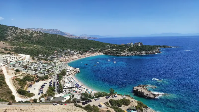
    The Albanian Riviera is famous for beaches, but the coastline is fundamentally a mountain-and-rock story. The Çika range rises abruptly above the Ionian Sea, Llogara marks a dramatic watershed, Gjipe Canyon cuts through coastal relief and the Karaburun Peninsula exposes limestone that has been fractured, dissolved and eroded by both groundwater and waves.

    Turquoise Beach On The Albanian Riviera

    AKZM’s description of Karaburun-Sazan identifies carbonate rocks, including limestone and limestone-dolomite, alongside flysch and younger deposits. It also notes karst springs and freshwater discharge along the coast. That geology explains the cliffs, sea caves, hidden bays and unusually sharp transition from mountain to sea.

    This guide helps you notice the geology while doing a normal Riviera trip. You can understand most of it from roads, beaches, boat trips and moderate hikes; no specialist fieldwork is required.

    Quick planning summary

    QuestionPractical answer
    Best panoramic geologyLlogara and Mount Çika for the mountain-to-sea relationship.
    Best coastal karstKaraburun Peninsula.
    Best canyon-to-beach exampleGjipe.
    Best sea-cave experienceHaxhi Ali Cave by boat in suitable sea conditions.
    Best baseVlorë for Karaburun; Himarë or Dhërmi for Gjipe and the central Riviera.

    Why the coast is so steep

    Southern Albania’s coast is not a broad lowland beach plain. Mountain blocks rise close to the Ionian shore, and resistant rock forms headlands and cliffs while shorter streams cut steep ravines toward the sea. The road repeatedly climbs and descends because the topography is structurally controlled rather than gently rolling.

    This steepness shapes travel as much as scenery. A beach visible directly below you may require a long descent, a boat or a road that loops far inland. Geology explains why straight-line distance is often misleading on the Riviera.

    Llogara and Mount Çika

    Llogara sits where high mountain terrain overlooks the coast, and Mount Çika rises to about 2,044 metres according to the national tourism authority. The viewpoint relationship is extraordinary: forested pass, pale rock, steep slopes and Ionian water fit within a single panorama.

    For geology, the old pass road and hiking trails are more informative than simply driving through the tunnel. Use safe viewpoints to study the abrupt relief and the way valleys descend toward Palasë and the coast. Do not stop on narrow road edges for photographs.

    Karaburun: limestone, fossils and karst springs

    AKZM describes Karaburun-Sazan as including Upper Cretaceous carbonate rocks with limestone and dolomitic limestone, and mentions fossil components such as rudists and foraminifera. The agency also notes karst groundwater and freshwater springs that discharge along the coast, including below sea level in places.

    For travelers, that translates into pale cliffs, caves, clear water and a rugged coastline with few road accesses. Boat travel is often the best way to read the peninsula’s geometry, because the cliff faces and cave entrances are visible from the sea as continuous landforms.

    Haxhi Ali and wave-cut caves

    Haxhi Ali Cave is the best-known sea cave in the area. Official tourism material describes it as a natural monument formed by marine erosion in limestone. The cave is visually dramatic because wave action has exploited rock weakness at the waterline, enlarging an opening that is now visited by boats.

    Sea-cave access must remain condition-dependent. Swell can make a calm-looking entrance dangerous, and boat captains should decide whether entry is appropriate. Swimming close to rock walls is not automatically safe simply because the water is clear.

    Gjipe: erosion from mountain to sea

    Gjipe Canyon demonstrates the land-to-sea connection beautifully. A short drainage system has incised a steep canyon through coastal rock before opening at the beach. Walking down from the upper access reveals a sequence from dry upland terrain to narrow gorge and marine shore.

    The canyon also explains why beaches here can feel isolated despite being near famous resorts: cliffed terrain restricts road access. That isolation is a geological consequence, not just a tourism branding idea.

    Beaches as sediment stories

    Not every Riviera beach is made of the same material. Pebble size, color and beach shape reflect the local rock supply, wave energy and nearby drainage. A pocket beach enclosed by resistant headlands behaves differently from a long open shore. After storms, the visible sediment can shift significantly.

    Avoid treating a single year’s beach width as permanent. Coastal systems move. This matters when choosing accommodation or planning access to small coves: a beach photographed in calm summer conditions may look very different after winter storms.

    Best time of year

    April to June and September to October are excellent for combining geology with hiking because temperatures are moderate and roads are less congested. July and August favor boat access but bring heat, traffic and crowded beaches. Winter reveals powerful coastal weather but limits marine excursions and can make cliff paths slippery.

    Getting there and transport

    Use Vlorë for Karaburun and Sazan boat logistics, and Himarë/Dhërmi for central-Riviera canyon and beach access. The Llogara tunnel speeds through-travel, while the old pass remains useful for panoramic stops when open and appropriate. Boat routes should be booked according to sea state, not merely the published departure time.

    Albania Riviera Beach Coast Ionian Sea Ksamil Greece Island Corfu Shpella E Pellumbave Beach 2

    Safety and responsible geotourism

    Cliffs, loose rock, heat and sea conditions are the main risks. Do not stand beneath unstable-looking faces, climb unprotected coastal rock for a photo or enter sea caves when the captain advises against it. On hikes such as Gjipe, carry more water than you expect to need and avoid the hottest hours.

    Geological sites often look robust because they are made of rock, but caves, spring margins, alpine soils and fossil-bearing outcrops can be surprisingly fragile. Stay on established paths, leave formations in place and avoid scratching, stacking or removing material. In protected areas, the best souvenir is a photograph and a better understanding of the landscape.

    Photography tips

    The strongest geology images on the Riviera usually include both mountain and sea. A wide view from Llogara shows relief, while boat-level photographs along Karaburun reveal bedding, cave openings and cliff height. Morning and late afternoon give more side light on rock texture; midday is best for water clarity.

    Families, senior travelers and accessibility

    Families can enjoy Llogara viewpoints, beach sediment, short coastal walks and a well-run boat trip. Gjipe’s hike is better for older children comfortable with heat and uneven ground. Reduced-mobility travelers can still experience excellent geology from Vlorë boat trips and selected Llogara viewpoints, though small coves often have difficult access.

    Where to stay

    For this theme, I would choose accommodation that reduces early driving and makes it easy to ask about current road or trail conditions. Compare places to stay in Vlore on Booking.com. Check parking, breakfast times and whether the host can recommend a local guide for natural sites.

    Guides and organized experiences

    A knowledgeable local guide can add far more than transport. For caves, canyons, remote mountain terrain and boat-based geology, the useful questions are about current access, water or sea conditions, protected-area rules and realistic turnaround points. Avoid operators who treat safety limits as optional.

    How this fits into a wider Albania trip

    I would keep geology as a thread through the trip rather than the only purpose of every day. Pair a natural site with a historic town, village meal, beach or museum. That rhythm leaves room for weather changes and makes the itinerary enjoyable even for companions who are less interested in rocks and landforms.

    Jale Beach Bay Albanian Riviera

    Official sources and further reading

    Official tourism and protected-area pages are useful for geological context, but road surfaces, trail access, boat departures, water levels, parking arrangements and local restrictions can change. Recheck time-sensitive information shortly before travel.

    Frequently asked questions

    Why are Riviera beaches often pebbly?

    Beach sediment reflects local rock, short steep drainage systems and wave energy. Many coves receive coarse material from nearby slopes and streams rather than the abundant fine sand typical of large lowland deltas.

    Can I see Karaburun geology without a boat?

    Some views are possible from land, but a boat gives the clearest continuous perspective on sea cliffs, caves and inaccessible bays.

    Is Llogara still worth visiting after the tunnel opened?

    Yes. The tunnel is a transport improvement, while the old pass and national park remain the places for panoramic mountain geology, hiking and viewpoints.

    Final planning approach

    The Riviera becomes far more coherent when you see it as a steep carbonate coast rather than a chain of beaches. Llogara explains the elevation, Karaburun explains the cliffs and caves, and Gjipe shows how short rivers cut directly through the coastal mountains to the Ionian Sea.

    Practical checklist before departure

    • Download offline maps for rural and mountain areas.
    • Check the latest weather for the exact region, not only Tirana.
    • Carry water, sun protection and footwear suitable for uneven rock.
    • Do not enter caves or narrow canyons after heavy rain.
    • Use safe parking and formal viewpoints rather than roadside improvisation.
    • Leave rocks, fossils, cave formations and spring habitats undisturbed.
  • Stargazing in the Albanian Alps: Theth, Valbona and Vermosh Night-Sky Guide

    Stargazing in the Albanian Alps: Theth, Valbona and Vermosh Night-Sky Guide

    Theth, Valbona and Vermosh combine high mountain walls, small settlements and broad horizons, but the smartest stargazing plan is usually to stay close to a guesthouse or known roadside viewpoint rather than hike into unfamiliar terrain after dark. This article is designed as a practical planning companion rather than a promise that any specific night will be perfectly clear or exceptionally dark. Cloud, humidity, moonlight, local lighting and seasonal access all change the result.

    For the protected-area and destination background, I cross-checked the official Albanian tourism page for the Albanian Alps National Park. The tourism page is useful for understanding the landscape and official status of the area; for anything operational—road access, accommodation, transport or local restrictions—confirm again close to your travel date.

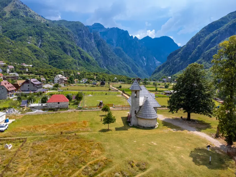
    Aerial View Catholic Church Valley Theth National Park Albania Albanian Alps

    Why the Albanian Alps works for stargazing

    The attraction of the Albanian Alps is not a single famous viewpoint. It is the combination of relatively small settlements, large natural horizons and landscapes that remain visually interesting after sunset. That means you can often create a memorable night without driving to an isolated coordinate. A quiet guesthouse terrace, village edge or established viewpoint can be enough.

    Stargazing is also one of the few activities where doing less can improve the experience. Once you have reached a safe position, give your eyes time to adapt and stop moving. Constantly checking a bright phone, driving between locations or shining a torch at the landscape makes faint stars harder to see and adds unnecessary risk.

    Best bases and practical areas

    • Theth: use the village as a base and look for a property slightly outside the brightest central cluster; the church and mountain walls can make strong photographic foregrounds without requiring a technical night walk.
    • Valbona: the broad valley gives open sky between steep peaks. A guesthouse with a clear yard or terrace can be more useful than chasing a remote viewpoint.
    • Vermosh and Lëpushë: these northern highland villages are quieter and can work well for travelers already exploring Kelmend, but road conditions and seasonal access deserve a daylight check.

    These are bases rather than guaranteed observation sites. The exact property, streetlight, tree line and horizon matter. Before booking, look at the map, read recent accommodation reviews and ask the host whether there is an open view within a short, safe walk. A slightly less remote property with a clear yard can outperform a more isolated stay surrounded by bright security lights.

    Do not confuse darkness with remoteness

    A map may show that a location is far from a major city, but that does not automatically make it suitable for a visitor at night. Local floodlights, road traffic, tree cover, cliffs, dogs, livestock and private land can matter more than the theoretical darkness. I would prioritize a place I understand over a place that merely looks empty on a satellite image.

    The biggest mistake is assuming that a famous daytime hiking viewpoint is automatically the best night location. Valbona Pass, exposed ridges and unfamiliar mountain trails introduce navigation, fall and weather risks that add nothing to a simple night-sky session. Scout in daylight, identify where you will stand, where the vehicle or guesthouse is, and how you will return without relying on phone signal.

    Moonlight, clouds and visibility

    A moonless or low-moon period helps when your goal is to see fainter stars or photograph more Milky Way detail. A brighter moon can still be useful when the landscape is the subject, because it reveals ridges, villages, trees and water without artificial lighting. There is no universally ‘bad’ moon phase; there is only a mismatch between the moon and the photograph or viewing experience you want.

    Check more than a simple rain icon. High cloud, low cloud, haze, humidity and wind can all change a night session. Mountain cloud can form locally even when a nearby city forecast looks clear. On the coast, humidity can soften the horizon. If the first night is clear, use it rather than assuming tomorrow will be better.

    A realistic evening plan

    A realistic evening in Theth starts with dinner before darkness, a short daylight walk to choose a safe composition, then one or two hours outside near your accommodation. In Valbona, I would favor the same approach: stay low in the valley, let the peaks form the skyline, and avoid turning stargazing into a late-night hike. In Vermosh, confirm road and local conditions with your host before leaving the village lights.

    Red Bridge Along River Valbona Valley Theth National Park Albanian Alps Albania

    Build in a clear finish time. After a long travel day, the point at which concentration drops is more important than the point at which the sky becomes marginally darker. Returning to accommodation while you are still alert is part of the plan, especially when rural roads are narrow or animals may be on the carriageway.

    Night photography ideas

    Theth church, dark mountain silhouettes, the Valbona valley and the open meadows around Vermosh can all serve as foregrounds. Keep artificial light subtle and brief. Long exposures do not require you to flood a church, guesthouse or meadow with bright lamps, and other travelers may be sleeping nearby.

    When possible, compose before full darkness. A good foreground is often more important than a theoretically darker sky. Stone houses, mountain ridges, a quiet lake, a river valley or a chapel can make the image clearly Albanian. Avoid stepping onto private property or into cultivated fields simply because the foreground looks better from that angle.

    Simple camera starting point

    With a mirrorless or DSLR camera, use a sturdy tripod, a wide lens and manual focus. Start with a wide aperture, a shutter time short enough to keep stars acceptably sharp for your focal length and an ISO that gives a usable exposure without destroying highlights. Then adjust from the histogram and a magnified review rather than from how bright the rear screen looks in darkness.

    Smartphone night photography

    Modern phones can produce surprisingly good night images if they are held completely still. Use the built-in night or astrophotography mode when available, disable flash, clean the lens and support the phone on a tripod or solid surface. Do not zoom digitally. If the phone offers RAW capture, it can provide more editing latitude, but a stable composition matters more than advanced settings.

    What to bring

    • A headlamp with a red or very dim mode for moving safely without constantly destroying night vision.
    • A warm layer even after a hot day; standing still feels much colder than walking.
    • A tripod or compact phone support if photography matters.
    • Offline maps and the accommodation address saved before leaving reliable data coverage.
    • Water and a small snack, especially if dinner finishes early in a rural area.
    • A power bank and spare camera battery because cold temperatures and long exposures drain batteries faster.
    • A small cloth for lens condensation or sea/lake humidity.

    Keep the kit small enough that you can carry it comfortably in the dark. A huge camera bag encourages unnecessary equipment changes and makes balance worse on uneven ground. For casual travel, one wide lens and one stable tripod are usually more useful than a collection of lenses.

    Where to stay

    For a night-sky trip in the Albanian Alps, location matters more than hotel facilities. Look for a guesthouse or small hotel that lets you step outside safely without driving again after dinner. Ask whether exterior lights stay on all night, whether the property has an open terrace or yard and whether dogs or livestock move freely around the grounds.

    You can compare current accommodation in the wider area on Booking.com. Check the map carefully before paying: a property described as being ‘near’ a park or valley can still be on the wrong side of a mountain road for your plan.

    Can you do it without a car?

    Sometimes, but the answer depends on the base. If a bus or shuttle can get you to a village where your accommodation has an open horizon, you may not need a car at all. This is actually ideal because you avoid night driving. The limitation is that public transport rarely helps with spontaneous late-night viewpoint hopping, so choose the accommodation more carefully.

    If you use a taxi or private transfer, arrange the return before leaving town rather than assuming a driver will be available late. In remote areas, ask the guesthouse whether they can recommend a local driver. Do not ask a driver to wait on a dangerous roadside shoulder while you photograph.

    Responsible night-sky travel

    Darkness is part of the habitat. Keep music off, minimize white light, never shine powerful torches at wildlife and avoid approaching nests, caves or animals for a photograph. If you hear or see wildlife, give it space rather than following it. A night-sky trip should have less impact than a daytime sightseeing visit, not more.

    Respect people as well. Rural homes, farm tracks, churchyards and guesthouse land are not automatically public observation platforms. Ask permission when in doubt, close gates, keep voices low and leave the area exactly as you found it. This is particularly important in small villages where one inconsiderate group can affect how future visitors are received.

    Seasonal planning

    Late spring through early autumn is the simplest period for most visitors because guesthouses and road access are generally easier, but clear winter nights can be beautiful for experienced travelers prepared for snow and limited services. Mountain weather can change quickly in every season, so treat the first clear night as the opportunity rather than waiting for a theoretically perfect final evening.

    The moon and weather are easier to adjust than a rigid hotel schedule, so try to spend two nights in an important stargazing region when possible. That gives you a backup for cloud and also makes the daytime trip less rushed. A one-night stop can work, but it turns ordinary weather into a bigger disappointment.

    Common mistakes

    • Driving an unfamiliar mountain or rural road for the first time after dark.
    • Assuming a remote-looking location has no local lighting or private-access issues.
    • Planning around an exact Milky Way photograph without checking the moon and sky direction for the travel date.
    • Standing on a road shoulder, cliff edge or unstable river/lake bank because the foreground looks dramatic.
    • Using bright lights continuously and disturbing other visitors, residents or wildlife.
    • Waiting until the final night of the trip and having no cloud backup.
    • Underestimating cold because the daytime temperature was warm.
    • Trying to combine a strenuous daytime hike with a very late night and an early drive the next morning.

    How to combine stargazing with the rest of the trip

    For more detailed daytime planning, see Theth and the Albanian Alps travel guide. It covers the transport, sights or route context that I would organize first; the night-sky session should fit around a solid daytime plan rather than replace it.

    Aerial Drone View Rustic Homes Hotels Theth National Park Albania Albanian Alps

    For more detailed daytime planning, see Valbona travel guide. It covers the transport, sights or route context that I would organize first; the night-sky session should fit around a solid daytime plan rather than replace it.

    For more detailed daytime planning, see Vermosh travel guide. It covers the transport, sights or route context that I would organize first; the night-sky session should fit around a solid daytime plan rather than replace it.

    For more detailed daytime planning, see best time to visit Theth. It covers the transport, sights or route context that I would organize first; the night-sky session should fit around a solid daytime plan rather than replace it.

    For more detailed daytime planning, see Albania stargazing overview. It covers the transport, sights or route context that I would organize first; the night-sky session should fit around a solid daytime plan rather than replace it.

    Tours and activities

    If you are combining the region with guided hiking, boat trips, cultural visits or transfers, compare current options below. For any activity that finishes after dark, verify the exact meeting point, return time and transport before booking.

    Frequently asked questions

    Is the Albanian Alps officially a Dark Sky Park?

    Do not assume so. This article does not use an official International Dark Sky certification as a selling point. It focuses on practical rural and mountain settings where local lighting may be limited. Certification status and actual sky quality are different questions, and local conditions can vary from one property to the next.

    Do I need a telescope?

    No. Binoculars can be enjoyable, but the easiest first experience is simply to let your eyes adapt and learn the major constellations with an astronomy app used at low screen brightness. A telescope adds weight, setup time and sensitivity to vibration, so it is not necessary for a travel-focused evening.

    What is the best moon phase?

    For faint stars and Milky Way detail, a darker moon period is usually preferable. For landscape photography, some moonlight can be helpful. Check moonrise and moonset as well as the phase, because a bright moon below the horizon will not affect your session in the same way.

    Is it safe to hike at night?

    I would not make an unfamiliar night hike the default plan. If a route is technical, poorly marked, exposed or far from help in daylight, darkness increases the consequences of a small mistake. Most visitors can get excellent results from a village edge, guesthouse, known viewpoint or short route scouted before sunset.

    Can families do this?

    Yes, especially when the observation point is at the accommodation or a short, flat walk away. Keep the session shorter for children, bring warm layers and choose a place without traffic, cliffs or water hazards. A simple hour outside identifying stars can be more successful than a complicated midnight expedition.

    Final thoughts

    The albanian alps can add a memorable night to an Albania itinerary precisely because the activity is simple when planned well. Choose a safe base, scout before sunset, use the weather you actually have and keep the night flexible. Darkness should make the landscape feel calmer, not make the logistics more complicated.

    The best plan is not the one that reaches the darkest possible coordinate. It is the one that lets you spend real time under the sky and then return comfortably to your room. That approach is safer, more respectful and usually produces better photographs too.

  • Fushe-Arrez Travel Guide: Forests, Iballa Valley and Northern Albania Road Trips

    Fushe-Arrez Travel Guide: Forests, Iballa Valley and Northern Albania Road Trips

    Fushe-Arrez is a small mountain town in northern Albania that most international travelers pass while moving between Puka, Kukes and the northeast. It does not have the fame of Theth or Valbona, yet its location among forests, valleys and rural villages makes it interesting for slow road trips. The area is best for travelers who enjoy quiet landscapes, local guesthouses and routes where the journey itself matters as much as a major attraction.

    The official Albanian tourism portal describes Fushe-Arrez as a mountain-tourism destination surrounded by dense forests and natural landscapes, with access toward the Iballa Valley and nearby highland areas. The official Fushe-Arrez tourism page is a useful source for regional attractions.

    Why stop in Fushe-Arrez

    The strongest reason is location. If you are driving from Puka toward Kukes, Kosovo or deeper northern regions, Fushe-Arrez provides a natural break for coffee, food and a short walk. Staying overnight turns a transit stop into a slower mountain experience.

    This is not a place for travelers who need a packed attraction list. Come for forest roads, local life, fresh air and access to villages rather than nightlife or polished tourism infrastructure.

    Explore the town center

    The town is compact. Walk around the center, stop in a café and use the opportunity to buy supplies before rural drives. Mountain towns often function as service hubs for a much wider area, and that is exactly how Fushe-Arrez makes sense.

    If you are driving, ask your accommodation about road conditions before leaving the main route. Local knowledge matters because a road marked on a map can vary considerably by season.

    Iballa Valley

    The Iballa area is one of the most interesting directions from Fushe-Arrez. Albania’s tourism agency highlights the valley for mountain scenery, rural character and nature. A car gives the most flexibility, though road quality can change.

    I would approach Iballa as a landscape and village excursion, not as a single monument. Take time for viewpoints, local food and conversations. Do not enter private land simply because a map shows a trail.

    Landscape View Gorge Albanian Mountain

    Forests and hiking

    The wider region is heavily forested and well suited to walking, but formal trail infrastructure is not as developed as in Theth. For that reason, I recommend shorter walks with local advice unless you already have solid navigation experience.

    Download offline maps, carry water and avoid relying on mobile coverage in remote areas. Our best hiking trails in Albania guide explains where the country’s more established routes are located if you want a major trekking objective.

    Link Fushe-Arrez with Puka

    Puka is the most natural companion destination. Its lake, cultural sites and surrounding villages offer a broader range of things to do, while Fushe-Arrez feels more like a quiet highland stop. A road trip can include both without duplicating the experience.

    Our Puka travel guide covers Lake Puka, mountain villages and local culture. If time is limited, sleep in Puka and stop in Fushe-Arrez during the drive. If you prefer very quiet places, reverse that balance.

    Continue toward Kukes

    Eastward, the road leads toward Kukes, Lake Fierza and the Kosovo border. The scenery shifts from forested highlands to broader mountain and reservoir landscapes. This makes Fushe-Arrez a good midpoint in a northern Albania route.

    Do not underestimate driving time. Curves, local traffic, weather and road works can make mountain journeys slower than the distance suggests. Start with a full fuel tank and daylight.

    Rural guesthouses and local food

    This is the kind of destination where a guesthouse can be more important than a list of restaurants. Ask whether dinner is available and what needs to be reserved in advance. Local meals often rely on meat, dairy, potatoes, seasonal vegetables, bread and preserved foods.

    If you have dietary restrictions, communicate before arrival because remote kitchens may have fewer alternatives than Tirana. Our food allergy guide gives useful planning advice.

    How long to stay

    A few hours is enough for a road-trip stop. One night is ideal if you want to explore the Iballa area or experience a quieter mountain evening. Two nights can work for walkers or travelers deliberately seeking rural immersion.

    I would not add several nights to a first Albania itinerary unless northern mountain travel is a main theme. The town is rewarding because it is understated, not because it competes with the country’s famous destinations.

    Getting there

    A car is by far the easiest option. Regional buses and minibuses may connect Fushe-Arrez with larger towns, but schedules and departure points should be confirmed locally. Public transport works better for point-to-point travel than for exploring side valleys.

    If you rent a car, check the contract before using rough roads. Our Albania car rental guide explains insurance and vehicle questions worth asking.

    Driving and weather

    Summer is generally easiest, while spring and autumn can bring rain and changing road conditions. Winter may involve snow or ice. Read our winter driving guide if traveling in the cold season.

    Never assume a mountain road is safe simply because another traveler drove it months earlier. Ask the guesthouse, municipality or local driver about current conditions.

    Mountain Landscape Albania Nature Adventure

    Best time to visit

    Late spring, summer and early autumn are the simplest periods for walking and road trips. Summer temperatures are usually more comfortable than on the lowlands, and evenings can be cooler.

    Autumn forest color can be beautiful, while winter creates a completely different atmosphere but demands stronger preparation. If snow is your goal, make the trip flexible rather than locking every activity in advance.

    Photography and nature etiquette

    Forests, mountain roads and villages create excellent photography opportunities. Ask before photographing people or private homes closely. Do not fly a drone without checking current rules; our Albania drone guide explains the basics.

    Pack out waste and avoid lighting fires in dry weather. Rural areas may have limited waste collection, so responsible behavior matters even more than in cities.

    A one-night road-trip plan

    Arrive from Puka in the afternoon, walk the town and have coffee. Drive a short scenic route if daylight allows, then stay in a local guesthouse. The next morning, explore toward Iballa before continuing east toward Kukes or returning west.

    This plan works because it keeps the driving realistic and lets you experience the highlands without turning the day into a race.

    Is Fushe-Arrez worth visiting?

    For travelers who love quiet mountain regions, yes. For a first-time visitor with only a week, it is optional. The value lies in the road-trip context and rural landscapes rather than a famous attraction.

    If you are already traveling across northern Albania, Fushe-Arrez can become one of those unplanned places you remember because it felt calm and real.

    FAQ about Fushe-Arrez

    Is Fushe-Arrez near Puka?

    Yes, both are in the same broader northern mountain region and combine naturally on a road trip.

    Mountain Landscape Hill Peaks Background Region Konispol Markat Albania

    Do I need a car?

    A car is strongly recommended for exploring villages and valleys. Public transport is more useful for reaching the town than for sightseeing around it.

    Is Fushe-Arrez good for hiking?

    The region has strong walking potential, but trail marking can be limited. Get local advice for routes and conditions.

    How many nights should I stay?

    One night is enough for most road-trippers; two can work for slower rural exploration.

    Where I would stay

    For forests, Iballa Valley and quiet northern road trips, I would choose accommodation for location rather than star rating alone. In a small town, being able to walk to cafés and shops is useful; in a mountain or rural area, easy road access, parking and a host who can explain current conditions may be more important than being in the exact center. Read recent reviews for noise, hot water, air conditioning or heating, breakfast and payment methods, because standards can vary between a city hotel and a family guesthouse.

    Compare current accommodation options on Booking.com. I would always check the map before booking: a property described as “near” a destination can still be inconvenient without a car, while a rural stay can be perfect when the host offers dinner or local transport.

    Tours and local experiences

    Organized activities make the most sense here when they solve a real logistical problem: canyon safety, mountain transport, borderland driving, a specialist historical visit or reaching a place with limited public transport. Compare pickup points, duration, what is actually included and cancellation terms. In lesser-known destinations, a private driver or local guide can sometimes add more value than a large group tour because the useful information is often local and current.

    Practical planning before you go

    Download offline maps, carry some Albanian lek, keep your phone charged and re-check road or transport information close to travel. Smaller Albanian destinations rarely need complicated planning, but they reward realistic timing. A road may be short in distance yet slow because of bends, local traffic or construction, and a museum or church may not operate with the same fixed visitor hours as a major attraction in Tirana.

    I also avoid building the day around one unverified opening time. Have a second reason to visit: a landscape, lunch, town walk, market or nearby attraction. That way the trip still works if a small site is closed. The less touristy the destination, the more useful flexibility becomes.

    Final thoughts

    These places are valuable because they widen the picture of Albania beyond the famous route. Not every traveler needs to add them to a first trip, but anyone with extra time can use them to connect major destinations, understand regional life and slow down. Verify details that can change, especially transport, access, weather and border requirements, then leave enough space for the small discoveries that make a lesser-known stop memorable.

    \n

    More local Albania guides

    \n
  • Albanian Alps Without Hiking: Scenic Villages, Drives, Ferries and Easy Views

    Albanian Alps Without Hiking: Scenic Villages, Drives, Ferries and Easy Views

    You do not need to cross the Theth-Valbona Pass to enjoy the Albanian Alps. Modern road access, village guesthouses, the Lake Koman ferry and scenic valleys make it possible to build a rewarding northern itinerary around views, short walks, local food and mountain villages. That is important for families, older travelers, photographers and anyone who simply does not want a demanding trek.

    Aerial Shot Valbona Valley National Park Reflecting Waters Albania

    Albania’s official tourism itinerary for the Alps includes Theth, Shkoder, Vermosh, Razem, Boge and Valbona, confirming that the region is broader than one famous hiking route. The practical challenge is travel time: mountain roads and ferry connections require realistic pacing even when the walking itself is easy.

    Official references used for the location-specific and activity-specific facts in this guide include official Albania tourism itinerary for the Albanian Alps. Conditions, access, opening patterns and seasonal services can change, so verify practical details close to travel.

    Why this theme is worth building into an Albania trip

    Nature-focused travel in Albania requires flexibility. Water levels, wind, snow, heat and recent rain can change access or conditions quickly. Build alternatives into the day, use local advice when entering protected or remote areas and avoid assuming that a social-media image represents normal conditions in every season.

    A themed trip also prevents a common planning problem: collecting famous places without understanding what connects them. When you organize part of the route around Albanian Alps without hiking, the country’s regional differences become easier to notice. The goal is not to turn the entire holiday into one activity, but to use the theme as a thread between cities, villages and landscapes.

    Key facts before you plan

    • The Albanian Alps can be experienced through road-accessible valleys and villages as well as long-distance hikes.
    • Theth is now reachable by a paved mountain road, although weather and seasonal conditions still matter.
    • Valbona offers a scenic valley road with guesthouses and short walks that do not require crossing the pass.
    • Lake Koman provides one of the most dramatic low-effort scenic journeys in northern Albania.
    • Razem, Boge, Tamare, Vermosh and Lepushe can add mountain scenery without committing to a major trek.

    These facts are a starting framework, not a substitute for current local information. In Albania, small operators, protected areas, mountain roads and seasonal businesses can change faster than guidebooks. Save official sources, confirm anything time-sensitive and keep enough flexibility to change a stop without damaging the whole itinerary.

    The best experiences and places to focus on

    Use Shkoder as the logistics base

    Shkoder is the easiest place to organize transfers, ferries, rental cars and a first or last comfortable night. It also gives you Rozafa Castle, the lake and museums, so bad mountain weather does not ruin the trip. Avoid planning a same-day international arrival and deep mountain transfer unless the timing is very generous.

    Do not rush this part of the trip. Give yourself time to notice how the experience changes with weather, season, local routines and geography. A slower stop usually creates better photographs, better conversations and fewer mistakes than trying to squeeze several similar places into one day.

    Drive to Theth and stop at Qafe Thore

    The road to Theth provides major scenery before you walk anywhere. Qafe Thore is the classic viewpoint over the valley. In Theth itself, the church, village lanes and short local walks can fill a day without attempting the pass. Surfaces are still uneven, so “no hiking” does not mean step-free.

    Do not rush this part of the trip. Give yourself time to notice how the experience changes with weather, season, local routines and geography. A slower stop usually creates better photographs, better conversations and fewer mistakes than trying to squeeze several similar places into one day.

    See Valbona from the valley floor

    Valbona works well for travelers who enjoy mountains from a guesthouse terrace or easy riverside sections. Drive through the valley, stop for lunch and use short walks according to ability. The famous pass is optional, not a requirement for appreciating the limestone peaks.

    Do not rush this part of the trip. Give yourself time to notice how the experience changes with weather, season, local routines and geography. A slower stop usually creates better photographs, better conversations and fewer mistakes than trying to squeeze several similar places into one day.

    Take the Lake Koman ferry

    The ferry compresses the drama of the north into a seated journey through reservoir and mountain scenery. It can form part of a Valbona loop or work as a stand-alone excursion with careful transport planning. Confirm current timetables and transfer arrangements rather than assuming a seamless connection.

    Do not rush this part of the trip. Give yourself time to notice how the experience changes with weather, season, local routines and geography. A slower stop usually creates better photographs, better conversations and fewer mistakes than trying to squeeze several similar places into one day.

    Add Razem, Boge or Kelmend for a quieter mountain stay

    These villages spread visitors beyond Theth. Razem and Boge are accessible from the Shkoder side, while Tamare, Vermosh and Lepushe open the Kelmend region. Choose one area and stay overnight instead of trying to drive a huge mountain circuit in a single day.

    Do not rush this part of the trip. Give yourself time to notice how the experience changes with weather, season, local routines and geography. A slower stop usually creates better photographs, better conversations and fewer mistakes than trying to squeeze several similar places into one day.

    When to go

    Spring and autumn are generally the easiest seasons for active travel because temperatures are moderate, while summer provides longer daylight but can be hot in valleys and crowded on the coast. Winter can be excellent for wetlands, cities and atmospheric mountain scenery, but snow, short days and reduced seasonal services require a different plan.

    Time of day also matters. Early starts reduce heat and traffic and can improve wildlife or water conditions. Late afternoon offers softer light, but remote drives, boat returns and unfamiliar trails should not be pushed into darkness simply for sunset.

    Transport and route design

    A car gives the most flexibility for linking small destinations, but it is not essential for every version of this theme. Major cities are connected by buses, while taxis, transfers, ferries and local operators can bridge the final section. Build the route around a few strong bases rather than changing accommodation every night.

    Map distance is a poor predictor of travel time on mountain roads, coastal approaches and rural lanes. Add margin for traffic, roadworks, photo stops and finding parking. If a route involves a ferry, guided activity or timed departure, put that fixed element first and keep the rest of the day deliberately light.

    Safety and responsible travel

    Match the activity to your experience and equipment. Use qualified local operators for technical water, mountain or remote activities; carry drinking water and offline navigation; and tell someone your plan when leaving normal tourist routes. Never treat lack of barriers as proof that a cliff, riverbank, ruin or shoreline is safe.

    Responsible travel is especially important in smaller communities and protected landscapes. Stay on established access where requested, do not disturb wildlife, respect worship and private property, take rubbish away and avoid moving stones, plants or archaeological material. Spend money locally when possible, but do not turn homes, farms or working harbors into photo sets without permission.

    Budget and booking strategy

    The cheapest day is not always the best-value day. A knowledgeable guide, safe boat, good transfer or well-located guesthouse can remove hours of logistical uncertainty. Compare what is included, read recent reviews and ask specific questions before paying. For seasonal activities, a clear cancellation or weather policy matters more than a small price difference.

    Keep cash for small businesses and rural stops, but avoid carrying all of your money in one place. Card acceptance is improving in Albania but remains inconsistent outside larger towns. If you are visiting producers or family-run properties, confirm in advance whether they accept cards and whether a tasting or visit requires a reservation.

    Useful related guides on Wonderful Albania

    Related guide: Theth and the Albanian Alps Travel Guide. Use it to turn this theme into a realistic route rather than a disconnected list of stops.

    Aerial View Catholic Church Valley Theth National Park Albania Albanian Alps

    Related guide: Valbona Travel Guide. Use it to turn this theme into a realistic route rather than a disconnected list of stops.

    Related guide: Lake Koman Ferry Guide. Use it to turn this theme into a realistic route rather than a disconnected list of stops.

    Choosing a base

    For one of the most useful bases for this theme, you can compare accommodation around Shkoder, Albania on Booking.com. Prioritize location, parking or transport access and recent reviews over star rating alone. A good base should reduce driving and make it easy to change the plan if weather or conditions shift.

    Common mistakes to avoid

    • Trying to cover every famous stop instead of choosing a few places that show genuine contrast.
    • Treating seasonal opening hours, water levels, road conditions or boat routes as permanent facts.
    • Relying on mobile signal instead of saving offline maps and essential contact details.
    • Planning the longest transfer for late afternoon and then arriving after dark on an unfamiliar road.
    • Choosing an operator only by price without checking equipment, passenger numbers, route changes or safety practice.

    The simplest correction is to make one experience the anchor of the day and let everything else remain optional. Albania rewards flexible travelers because the most memorable stop may be a market, a roadside view, a quiet village lunch or a change of plan suggested by someone who knows the area.

    A practical way to use this guide

    Choose two or three anchor regions, then match each with one major experience and one easier backup. Keep the first day in a region simple so you can learn road conditions, parking and local rhythms before attempting the longest excursion. If you are traveling in peak summer, start early and use midday for lunch, museums or shade rather than forcing every outdoor stop into the hottest hours.

    For a trip longer than a week, alternate intense days with lighter ones. A boat day followed by a long drive, or a mountain excursion immediately after a late arrival, creates fatigue that makes the itinerary less enjoyable and less safe. Building recovery time is not wasted travel; it is what allows you to notice the country rather than merely transit through it.

    Final thoughts

    Albanian alps without hiking is a strong way to see beyond Albania’s headline attractions because it connects landscapes, communities and practical travel choices. Use official information for time-sensitive details, ask locally when conditions matter and keep enough room in the itinerary for the unexpected.

    Aerial View Valbona Valley Theth National Park Albanian Alps Albania

    Wonderful Albania is designed around that kind of travel: specific enough to be useful, but flexible enough to respect how places actually work. The best result is not completing a checklist. It is leaving with a clearer understanding of why different parts of Albania look, taste and feel the way they do.

    Related cultural guide: Transhumance in Albania: UNESCO Pastoral Traditions, Mountain Routes and Rural Life.

    Related activity guide: Stargazing in Albania: Mountain Bases, Dark-Sky Planning and Night Photography.

  • Best Hikes Near Berat: Mount Tomorr, Osum Canyon, Bogova and Castle Walks

    Best Hikes Near Berat: Mount Tomorr, Osum Canyon, Bogova and Castle Walks

    Berat looks like a cultural destination first, but the surrounding region is one of central Albania’s strongest outdoor bases. You can walk straight from Mangalem to the castle, spend a half-day around waterfalls and canyon viewpoints, or make Mount Tomorr the focus of a full mountain day. The differences in effort are large, so this is a destination where “hiking near Berat” needs careful matching to fitness and transport.

    Albanian Old Berat View Berat Castle Walls Tiled Roofs Houses 2

    This guide uses “hike” broadly enough to include easier nature walks and tougher mountain days, but it does not pretend those activities carry the same risk. Distances, weather, trail markings and access roads can change. For remote or high routes, confirm conditions locally before leaving and carry a navigation method that works offline.

    Quick comparison

    RouteDifficultyBest forAccess
    Mangalem to Berat Castle and ridgeModerate urban hikeBest no-car walkOn foot
    Gorica hill and river-side walkEasy to moderateBest short sunset walkOn foot
    Mount TomorrStrenuous / mountain dayBest major hike near Berat4×4/driver or guided transport strongly useful
    Bogova Waterfall walkEasy to moderateBest cooling nature breakCar/taxi + short walk
    Osum Canyon viewpoints and rim walksEasy to moderateBest canyon sceneryCar/tour + short walks
    Sinec Canyon and poolsModerateBest quieter alternativeCar required + walking

    Which hike should you choose?

    If this is your first outdoor day in the area, choose the route with the simplest access and an obvious turnaround point. Save the highest or most remote objective for a day when the forecast, transport and your energy all line up. I would rather complete a shorter route comfortably than turn a holiday into a rescue problem by chasing a summit because it was on the original itinerary.

    Mangalem to Berat Castle and ridge

    Best no-car walk. Difficulty: Moderate urban hike. Access: On foot. The climb from the river to Berat Castle is the obvious first walk. It is steep rather than technically difficult, and once inside the fortress you can continue between churches, viewpoints and inhabited lanes. Use the Berat Castle guide and make the ascent early in hot weather.

    Aerial View Of Berat Castle Albania

    Gorica hill and river-side walk

    Best short sunset walk. Difficulty: Easy to moderate. Access: On foot. Cross Gorica Bridge and explore the quieter stone lanes and higher viewpoints of Gorica. This is the best option if you want elevation and views without committing to a mountain day.

    Mount Tomorr

    Best major hike near Berat. Difficulty: Strenuous / mountain day. Access: 4×4/driver or guided transport strongly useful. Mount Tomorr rises above the Berat–Skrapar region to more than 2,400 m and is a national park with hiking and climbing opportunities. Access roads and start points vary, and weather changes quickly at altitude. Read the Mount Tomorr guide and use local guidance for any summit-focused route.

    Bogova Waterfall walk

    Best cooling nature break. Difficulty: Easy to moderate. Access: Car/taxi + short walk. Bogova works well as a lower-altitude summer nature outing and is often combined with the road toward Skrapar. Water flow and pool conditions vary by season; avoid treating slippery rock around waterfalls as a casual swimming platform.

    Osum Canyon viewpoints and rim walks

    Best canyon scenery. Difficulty: Easy to moderate. Access: Car/tour + short walks. The safest general hiking approach is to use established viewpoints and short rim walks rather than improvising inside the canyon. Water levels, rafting conditions and access change. Plan with the Osum Canyon guide.

    Sinec Canyon and pools

    Best quieter alternative. Difficulty: Moderate. Access: Car required + walking. Sinec is a more local-feeling canyon/natural-pool outing west of Berat. Use the Sinec Canyon guide and carry water; infrastructure is much lighter than in the city.

    Do you need a guide?

    For an obvious low-elevation walk with clear local directions, most experienced travelers can usually walk independently. A guide becomes much more valuable when the route is high, remote, poorly signed, seasonally snow-covered, canyon-based or dependent on a vehicle pickup at a different endpoint. A guide can also turn a simple walk into a better cultural/nature experience because local place names and private-land boundaries are not always obvious on online maps.

    Never use “there are reviews online” as a substitute for current conditions. A route can be straightforward in July and inappropriate after an October storm or during late spring snowmelt.

    Getting to the trailheads

    A car or driver greatly expands the options outside Berat. For Mount Tomorr, Osum, Bogova and Sinec, transport is part of the plan. Avoid using a low-clearance rental car on a rough access road simply because navigation labels it as a road.

    Best hikes for families

    The castle/Gorica combination is easiest with children, followed by Bogova when conditions are good. Mount Tomorr is a mountain objective and should not be treated as a family sightseeing add-on.

    Best time of year

    April–June and September–October are excellent for hiking. July and August demand early starts and conservative water planning. Mount Tomorr can have winter conditions long after the city feels mild; verify locally before any high route.

    Heat, storms and mountain safety

    Start early in warm weather and carry more water than you expect to need. On exposed ridges, thunder is a reason to turn around, not an invitation to wait under the tallest tree. In canyons and near waterfalls, heavy rain upstream can change conditions even if the sky above you looks better. In the Alps and other high ranges, snow, fog and wind can make a familiar summer route a completely different undertaking.

    Tell someone where you are going when the route is remote, keep your phone charged, download offline mapping and do not count on mobile coverage. If the trail is beyond your navigation or scrambling experience, choose a local guide rather than learning those skills in a place you do not know.

    What to pack

    • Shoes with reliable grip rather than smooth city sneakers.
    • At least one extra layer, even on a warm valley day if the route gains altitude.
    • Sun protection: hat, sunscreen and sunglasses.
    • Enough water plus a small snack; do not assume every spring is safe to drink.
    • Offline map, charged phone and small power bank on longer routes.
    • Compact rain/wind shell.
    • Basic first-aid items and any personal medication.
    • Cash for rural cafés, taxis or guesthouse transfers where cards may not be practical.

    Where to stay for hiking

    Compare current accommodation in Berat on Booking.com.

    Albanian Old Berat View Berat Castle Walls Tiled Roofs Houses 3

    For area-by-area accommodation advice, read the local Where to Stay guide. For hiking trips I care more about early breakfast, vehicle access, luggage storage and the host’s current trail knowledge than about a small difference in room decoration.

    Guided hikes and outdoor tours

    Guided options are most useful when transport and hiking are bundled together, especially from a city base or on routes where the start and finish are different. Compare the current activity description carefully rather than assuming every tour includes the same trail or difficulty.

    How to plan a two-hike stay

    I use the first outdoor day for the easier route. That gives me a real sense of local heat, trail surfaces, driving and my own energy after travel. I put the harder objective on the second day with a backup plan. If the weather is poor, I swap the order rather than forcing the mountain day. This simple strategy is especially useful in Theth, Valbona, Tomorr, Nëmërçka and the higher Korçë/Pogradec ranges.

    Common hiking mistakes

    • Starting too late because the route looks short on a map.
    • Using road-driving time as if it were guaranteed trailhead access.
    • Following an old GPX track without checking closures, private land or changed paths.
    • Carrying too little water on exposed summer routes.
    • Treating a canyon, waterfall or river crossing as safe after heavy rain.
    • Assuming a famous high pass is snow-free because the valley is warm.
    • Wearing sandals on loose rock because the hike ends at a beach or thermal spring.
    • Booking an onward bus or flight too tightly after a mountain day.

    Official and related planning resources

    For the destination overview, see the official Albania tourism page. The national trail overview Best Hiking Trails in Albania is useful for comparing this area with the rest of the country.

    Frequently asked questions

    Can I hike here without a car?

    At least one of the routes in this guide can usually be done without owning a car, but the answer depends on your accommodation and the exact trail. City-adjacent walks are easiest; remote national-park and high-mountain trailheads often require a taxi, driver, shuttle or rental car.

    Do I need hiking boots?

    For easy dry paths, good trail shoes can be enough. For loose rock, wet canyon terrain, snow or a major mountain route, more supportive footwear is a better choice. Grip matters more than brand.

    Can I hike in July and August?

    Yes, but start early, carry substantial water and reduce exposed midday walking. Higher mountain routes may be cooler, while low canyon and coastal paths can become extremely hot.

    Is hiking safe after rain?

    It depends on the route. Rain can make stone, clay and roots slippery, and canyon or river conditions can change rapidly. Choose a lower-risk route or wait when conditions are uncertain.

    Should I download an offline map?

    Yes for anything beyond an obvious short walk. Mobile signal is not a reliable navigation strategy in mountain and canyon terrain.

    Final recommendation

    Build the hiking day around conditions rather than ambition. Choose one route that matches your transport, fitness and the forecast, start earlier than you think you need to, and keep a lower-risk alternative ready. Albania’s best outdoor experiences are not improved by rushing them.