Category: Mountains & Nature

Guides to Theth, the Albanian Alps, lakes, hiking routes and nature-focused travel across Albania.

  • Cem River Guide: Kelmend Valley, Clear Water and a Northern Albania Road Trip

    Cem River Guide: Kelmend Valley, Clear Water and a Northern Albania Road Trip

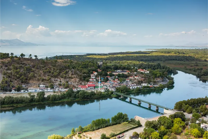
    The Cem River, also written Cemi, rises in the Kelmend mountains of northern Albania and continues across the border into Montenegro. The national tourism authority emphasizes the river’s clear water, green valleys and growing appeal for outdoor activities including canoeing, kayaking and light rafting where conditions and local operations allow. This guide is designed for travelers who want to visit with realistic expectations: the site is worth the effort, but it should be planned around current access, weather and the wider region rather than treated as a guaranteed turn-up-and-go attraction.

    • Best for: nature, hiking and landscape photography.
    • Best base: Tamarë.
    • Planning style: allow buffer time for rural roads or foot access and confirm the final approach locally.
    • Bring: water, shoes with grip, sun/rain protection, offline maps and enough daylight for the return.
    • Key rule: current local conditions matter more than an old social-media post or map pin.

    Why this place is worth adding to an Albania itinerary

    The Cem gives structure to a Kelmend road trip. Instead of treating Tamarë, Lëpushë and Vermosh as isolated pins, you can follow the valley and understand how settlement, agriculture and travel relate to the river. The water is visually striking in clear weather, but the best days also include a village meal, a viewpoint and enough time to stop safely rather than racing to the farthest destination.

    The appeal is strongest when you connect the site to the surrounding region rather than treating it as an isolated pin. The road through Kelmend offers several opportunities to see the river as part of a wider trip linking Tamarë, Selcë, Lëpushë and Vermosh. The river should not be reduced to one swimming spot: its value is the whole valley system, where mountain road, villages, bridges and changing water conditions create the experience. That context helps you decide whether it deserves a dedicated half day, a short stop on a road trip or a place in a longer hiking itinerary.

    What you are actually coming to see

    The Cem River, also written Cemi, rises in the Kelmend mountains of northern Albania and continues across the border into Montenegro. The national tourism authority emphasizes the river’s clear water, green valleys and growing appeal for outdoor activities including canoeing, kayaking and light rafting where conditions and local operations allow. The road through Kelmend offers several opportunities to see the river as part of a wider trip linking Tamarë, Selcë, Lëpushë and Vermosh. The river should not be reduced to one swimming spot: its value is the whole valley system, where mountain road, villages, bridges and changing water conditions create the experience.
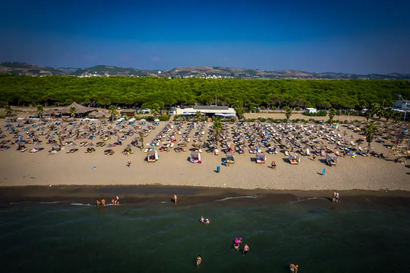
    Aerial Drone View Spille Beach Albania Pine Forest

    Smaller Albanian attractions rarely present themselves like polished open-air museums. Signage may be limited, the exact route can be informal and there may be no café, ticket office or staffed entrance. That is not necessarily a weakness, but it changes the way you should visit: read about the place beforehand, arrive with time, and use the landscape itself as part of the interpretation.

    I would avoid building the visit around a single photograph. Spend time looking at how the site relates to terrain, water, old routes, villages and the wider region. In many parts of Albania, geography explains history: defensive sites sit where valleys narrow, bridges occupy practical crossing points, and mountain lakes or rivers shape seasonal movement and settlement.

    How to get there from Tamarë

    The most straightforward approach is from Shkodër toward Tamarë, then farther into Kelmend according to your itinerary. Road quality has improved on main approaches, but mountain driving still requires attention to curves, weather, livestock and occasional works. Pull over only where there is a genuine safe space; do not stop in a blind bend simply because the river looks photogenic.

    If you use a taxi or private driver, agree on the return plan and total price before leaving the main town. In remote areas it can be difficult to summon another car on demand, and mobile signal may be weaker than expected. Save the driver’s number and your accommodation details offline. If you drive yourself, leave the vehicle only where it is clearly safe and legal, without blocking residents, farm access or emergency routes.

    Travel times in rural Albania are better treated as ranges than promises. A short distance can include steep gradients, livestock, road works or slow village sections. Build in at least thirty to sixty minutes of flexibility on a day that also includes another major attraction.

    How much time to allow

    For a focused visit, I would normally reserve two to three hours from arrival in the immediate area to departure. That is deliberately more than the time required to take a few photos: it gives you room to find the correct approach, walk at a safe pace, stop for context and adapt if a path or parking spot is different from what you expected.

    If the site forms part of a high-mountain hike, the simple two-to-three-hour rule does not apply. In that case plan the entire route by walking time, elevation, daylight and escape options. Remote alpine destinations may deserve a full day or an overnight stay even when the straight-line distance looks small.

    Best time of year and time of day

    Late spring through early autumn is the easiest period for road trips and village stays. Spring brings strong flow and green slopes, summer makes riverside breaks attractive, and early autumn often combines stable weather with fewer visitors. Winter can be beautiful in Kelmend but changes driving and hiking requirements substantially.

    For photography, early morning and late afternoon usually produce softer light and a quieter atmosphere. For safety, however, do not push a visit so late that you must return on an unfamiliar trail or rural road after dark. In the mountains, start earlier than you think you need; on exposed cultural sites, an early start also avoids the strongest heat.

    Always recheck the recent weather rather than relying only on monthly climate averages. Heavy rain can affect rivers, canyon approaches and dirt tracks for several days, while a hot dry period can make exposed hills much more demanding than the temperature in the nearest town suggests.

    Safety and terrain

    River conditions are not constant. Clear-looking water can be cold and fast, particularly after rain or during snowmelt. Swim only where local advice and conditions support it, and use a qualified operator for kayaking or rafting. Do not enter narrow sections when thunderstorms are possible upstream. Children need close supervision anywhere near current, slippery stones or steep banks.

    Closed footwear with grip is a better default than sandals for almost every lesser-known nature or ruin site. Carry a small first-aid kit, and if the visit involves real mountain terrain, add layers, emergency food and navigation redundancy. The absence of railings or warning signs does not mean an edge, cave, wall or river pool is safe.

    If local residents, park staff, guides or your accommodation advise against a route, take that seriously. Conditions on remote roads and trails can change faster than travel blogs are updated. Turning around is a normal part of good trip planning, not a failed day.

    Who will enjoy this place most?

    This stop is best for travelers who enjoy understanding place rather than collecting famous landmarks. It suits photographers, independent road-trippers, hikers and repeat visitors particularly well. If your priority is cafés, shopping, nightlife or a fully accessible attraction with predictable facilities, keep this as an optional addition rather than a core itinerary item.

    Families and older travelers should evaluate the final approach rather than the attraction name. A short visit can still involve uneven stones, steep paths, summer heat or a lack of toilets. Ask your accommodation for current practical details before committing the whole group.

    Photography and drones

    Start with a wide photograph that explains the landscape, then move to details: masonry, water texture, vegetation, ridge lines or the relationship between the site and the nearest village. Avoid climbing on ruins, moving stones or stepping into fragile vegetation for a cleaner composition.

    Drone rules and local sensitivities can change. Before flying, check current Albanian aviation requirements, protected-area restrictions, privacy and any site-specific rules. In quiet villages and wildlife areas, a drone can create much more disturbance than the operator realizes, so a handheld camera is often the better choice.

    Responsible travel

    The smaller the attraction, the more visible each visitor’s behavior becomes. Carry out all litter, keep noise low, close farm gates, avoid blocking local roads and buy something locally when a café, guesthouse or driver genuinely helps your trip. These choices make low-volume tourism more useful to the community.

    Do not remove stones, plants, pottery fragments or anything that looks archaeological. At protected natural sites, stay on durable surfaces where possible and do not approach wildlife for photographs. At religious or cultural sites, dress and behave respectfully even when no staff member is present.

    Where to stay

    For most travelers, the practical base is Tamarë or another established town/guesthouse area nearby. Compare current accommodation on Booking.com. Use the map view and recent reviews rather than choosing only by price, because a cheap room can be poor value if it adds substantial backtracking to a rural route.

    Check parking, road access, heating or air-conditioning, breakfast timing and late check-in before booking. In mountain areas, also ask whether the property can help with a local guide, transfer or current trail information. That kind of practical knowledge is often more valuable than a small difference in room price.

    Landscape View Gorge Albanian Mountain

    Food, water and basic services

    Carry water and a simple snack because smaller sites often have no shop or café at the entrance. Plan your main meal in the nearest town or village and keep some Albanian lek for family-run restaurants, taxis, parking or small purchases. Card acceptance is improving but is not universal in rural areas.

    Do not assume there will be a public toilet at the attraction. Use facilities before leaving your base, especially when traveling with children. In summer, bring more water than you expect to need; in the mountains, remember that cool air can hide how much fluid you are losing while walking.

    What to combine with the visit

    These existing Wonderful Albania guides fit naturally into the same regional cluster:

    A strong day usually needs one major anchor and one or two smaller stops. Trying to visit five remote attractions in one day often creates more driving than experience. Use actual road time and daylight to choose what fits, and leave room for an unplanned meal, viewpoint or conversation in a village.

    A realistic itinerary

    Start from Tamarë after breakfast and aim to reach the site while the day is still cool and flexible. Use the first part of the visit to confirm access and conditions rather than immediately pushing toward the most photogenic point. Explore only the sections that are clearly safe and permitted, then return with enough time to stop for lunch or a second nearby attraction from the links above.

    If weather, road conditions or local advice make the original plan unattractive, switch to the nearest established town, museum, village or scenic drive. Albania has enough variety that a flexible day is usually better than forcing a remote stop in poor conditions.

    Common mistakes to avoid

    • treating a map pin as proof of current vehicle or foot access
    • wearing beach footwear on loose, wet or rocky terrain
    • scheduling the return after dark on an unfamiliar rural route
    • entering water, ruins or protected areas because no barrier is visible
    • assuming a fixed old taxi price, opening time or road condition is still valid
    • leaving litter, moving stones or disturbing wildlife for photographs

    Tours and guided experiences

    Organized tours specifically naming this site may be limited, but private experiences from Tamarë or the wider region can sometimes be adapted. Ask exactly what is included: vehicle type, walking level, guide qualifications, entry arrangements and cancellation policy. For remote mountain or water-based destinations, choose an operator because of local competence rather than simply the lowest price.

    Mountain Landscape Hill Peaks Background Region Konispol Markat Albania

    Official information and last-minute checks

    For the core historical or natural background used in this guide, see Albanian National Tourism Agency – Cem River. Official tourism pages are a strong starting point, but they do not guarantee that a road, trail, interior, local service or water condition will be the same on your travel day. Recheck time-sensitive details shortly before departure.

    Frequently asked questions

    Where is the Cem River in Albania?

    It flows through the Kelmend area north of Shkodër before continuing into Montenegro.

    Can you swim in the Cem River?

    In some places and conditions people do, but temperature, current and depth vary. Ask locally and never assume a pool is safe from appearance alone.

    Is rafting available?

    The official tourism authority identifies the river as suitable for water sports in appropriate sections, but availability is operator- and condition-dependent.

    What is the best base?

    Tamarë is practical for the lower valley, while Lëpushë or Vermosh suit travelers continuing deeper into Kelmend.

    Do I need a 4×4?

    Not for the main paved Kelmend route in normal conditions, but side tracks and trailheads can be different. Never take a rental vehicle onto rough roads without checking both conditions and your contract.

    Final perspective

    Cem River is most rewarding when you treat it as part of a wider Albanian landscape rather than a checklist stop. Arrive with enough time, use local knowledge, respect the site and be willing to change plans when conditions demand it. That approach creates a better trip and helps protect the smaller places that make Albania interesting beyond its headline destinations.

  • Blue Eye of Theth Guide: Hiking from Nderlysa to the Alpine Spring

    Blue Eye of Theth Guide: Hiking from Nderlysa to the Alpine Spring

    The Blue Eye of Theth is one of the Albanian Alps’ most popular short hiking objectives, but it is important not to confuse it with the famous Blue Eye spring near Saranda. The northern Blue Eye lies in the Theth/Ndërlysaj area and is reached on foot through a mountain landscape of river, rock and forest. The official Albanian tourism itinerary for the Alps describes it as a deep-blue spring and includes it among the natural highlights around Theth. The walk is accessible to many active travellers, yet heat, uneven stone and the final climb mean it deserves proper shoes, water and enough time.

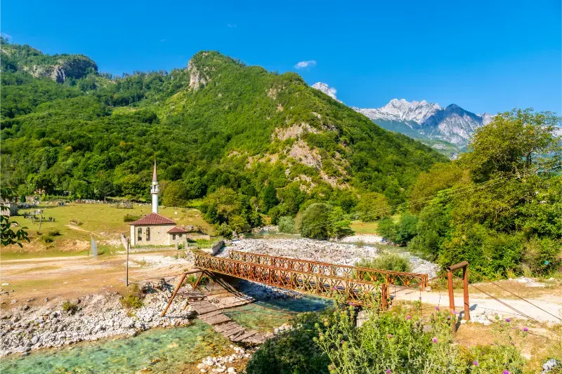
    Small Mosque Dragobi Valbona Valley Theth National Park Albanian Alps Albania

    The official Albanian tourism portal is the main public reference I used for the core place facts in this guide. Access, opening arrangements, roads, weather and local services can change, so I still confirm practical details shortly before travelling.

    Why add this to your Albania itinerary?

    This hike is ideal when you want a full nature experience without committing to the much longer Theth–Valbona crossing. It also pairs well with Ndërlysaj and the river landscape, giving you a different side of the valley from the church, tower and Grunas Waterfall. Because the water colour is the visual reward, good daylight matters more than simply arriving as early as possible.

    For a wider route, connect this guide with Theth and Albanian Alps travel guide, Grunas Waterfall guide, Theth to Valbona hike guide. These links are especially useful for deciding whether this stop deserves a half-day, a full day or an overnight rather than adding it simply because it appears close on the map.

    Theth Church And Albanian Alps Albania

    How to get there and plan the access

    Most visitors start from Theth and reach Ndërlysaj by vehicle, taxi or a longer walk before continuing on foot. The exact road and transfer arrangement should be confirmed with your guesthouse, especially if you do not have a car. Do not build your return around finding an unbooked taxi late in the afternoon. If walking from farther away, add that distance honestly to the day rather than treating the Blue Eye segment as the whole route.

    For this alpine day hike, I would leave more time than a navigation app suggests. Albania’s secondary roads, mountain weather, parking, seasonal traffic and short local stops can turn a simple transfer into a longer but more interesting journey. Download offline maps, carry some cash in lek and save the name of your destination in Albanian. If the final approach is uncertain, a current message from a guesthouse or local operator is more useful than an old travel-blog driving time.

    What to see and do

    Begin from Nderlysa with enough time

    The approach landscape is part of the outing. Allow time around the river and rock formations rather than rushing directly to the spring. Starting before the hottest part of the day makes the climb more comfortable and leaves margin for pauses.

    Wear shoes for polished rock and loose trail

    The route can include uneven stone, roots and steep sections. Trainers with grip or light hiking shoes are far better than sandals. After rain, surfaces can become slippery and the river environment demands more caution.

    Expect cold water, not a warm swimming hole

    The spring is alpine and the water can be extremely cold. Some visitors enter briefly, but cold-water shock is real. Do not jump blindly, do not pressure children or companions to swim, and remember that enjoying the place from the edge is completely valid.

    Manage crowds by timing, not by risky shortcuts

    In peak summer the Blue Eye can be busy. Leaving earlier or later helps, but do not leave the established route simply to reach a private viewpoint. The terrain is more important than getting a people-free photograph.

    Carry your own water and snacks

    Small seasonal facilities may exist along popular routes, but you should not rely on them. A simple packed lunch, water and a small rubbish bag give you independence and reduce pressure on the site.

    Return before fatigue changes your footing

    The way back can feel easier, which is when people stop paying attention. Keep enough energy and daylight for the descent and transfer back to Theth. If thunderstorms build or someone in the group is struggling, turn around early.

    A realistic plan for the day

    A good day begins with breakfast in Theth, transfer to Ndërlysaj, a steady hike to the Blue Eye, a long break at the spring and a careful return. Back in Theth, keep the evening simple. If you also want Grunas Waterfall, place it on a different half-day unless your fitness, daylight and logistics make a combined plan genuinely comfortable.

    The key is to protect the main experience from unnecessary transfers. I would rather spend an extra hour walking, eating or talking with a host than add a distant attraction that forces you to watch the clock. Albania looks compact, but valleys, winding roads and rural access make travel time more significant than the straight-line distance suggests.

    Best time to visit

    The main hiking season is generally late spring through early autumn, depending on snow, rain and road access into Theth. July and August are busiest and can be hot on exposed sections. June and September often give a better balance of temperature and visitor numbers. After heavy rain, ask locally about trail and river conditions before starting.

    Check the short-range forecast, not only monthly climate averages. Wind, recent rain, river level, cloud, heat and snow can matter more than the season printed on a calendar. In shoulder season, confirm that accommodation, restaurants and activity providers are operating before building the whole day around them.

    Where to stay

    Theth is the easiest base for most first-time visitors because it combines accommodation, food and transport options with access to the surrounding region. If a rural guesthouse is available closer to your objective, one night can make the experience slower and more atmospheric. Compare accommodation around Theth on Booking.com, then read recent reviews for road access, parking, heating or air conditioning and host communication rather than choosing on rating alone.

    Food, water and money

    Carry water and a small snack even when the day looks short, because rural cafés and shops may not be exactly where you expect them. Keep some Albanian lek for small restaurants, taxis, parking and guesthouses. In village areas, ask what has been prepared that day; local meals often work better around seasonal ingredients than around a long fixed menu. If you are vegetarian, vegan or have allergies, explain the restriction clearly before food is cooked.

    Photography without damaging the experience

    Early and late light usually produces better photographs and a calmer visit. Ask before photographing people, religious interiors or private homes. In natural areas, stay on durable ground and do not create a new path to reach a cleaner angle. A wider frame that includes the landscape, trail or village often tells more of the story than a close-up taken from an unsafe position.

    Families, older travellers and accessibility

    The practical difficulty of this alpine day hike depends less on the headline distance and more on heat, steps, uneven ground, toilet access and transport. Families should build in extra breaks and avoid turning a short outing into a race. Older travellers may find a taxi or private driver worthwhile. Step-free access is inconsistent in rural and historic Albania, so contact accommodation or a local guide directly if mobility requirements are essential.

    Safety and responsible travel

    Tell someone your plan when heading into the mountains or a quiet natural area, keep enough battery for navigation and do not depend on mobile signal everywhere. Turn back when weather, water, road condition or fatigue makes the original plan less sensible. Leave no rubbish, avoid disturbing wildlife and livestock, respect protected-area rules and never remove stones, plants or archaeological material. Responsible travel here is mostly simple: use existing paths, buy locally and leave the place looking unchanged.

    How to combine it with a wider Albania trip

    Use this article together with Theth and Albanian Alps travel guide, Grunas Waterfall guide, Theth to Valbona hike guide. I prefer regional clusters: two or three nights in one area, with one demanding day and one lighter day, rather than changing hotels every evening. That approach reduces driving and creates room for the small experiences—coffee, a viewpoint, a village meal or an unexpected conversation—that often become the strongest memories of Albania.

    Christian Church in Theth and Accursed Mountains Albania

    Practical checklist

    • Transport: confirm the final road, trailhead or pickup point.
    • Weather: check recent rain, heat, wind and mountain conditions.
    • Navigation: download offline maps and carry a charged power bank.
    • Cash: keep some lek for rural businesses and local transport.
    • Footwear: choose grip and comfort over city style.
    • Water: carry your own reserve rather than assuming a source is available.
    • Timing: leave daylight and a margin for a slower return.
    • Respect: follow local, religious, private-property and protected-area rules.

    Final thoughts

    The best reason to include this alpine day hike is not to collect another pin on a map. It is to understand a different layer of Albania at a pace that suits the place. Confirm the few details that can change, keep the schedule flexible and give the main experience enough time. That usually produces a better trip than trying to fit one more famous stop into an already full day.

  • Best Hikes Near Tirana: Dajti, Bovilla, Pellumbas and Easy Nature Walks

    Best Hikes Near Tirana: Dajti, Bovilla, Pellumbas and Easy Nature Walks

    Tirana is one of Albania’s easiest places to combine city sightseeing with genuine mountain scenery. Within a day you can move from Skanderbeg Square to oak forest on Dajti, limestone country around Bovilla, the canyon path to Pellumbas Cave or the rural landscape around Shengjergj. The key is choosing a route that matches your transport and mountain experience rather than judging distance only from the map.

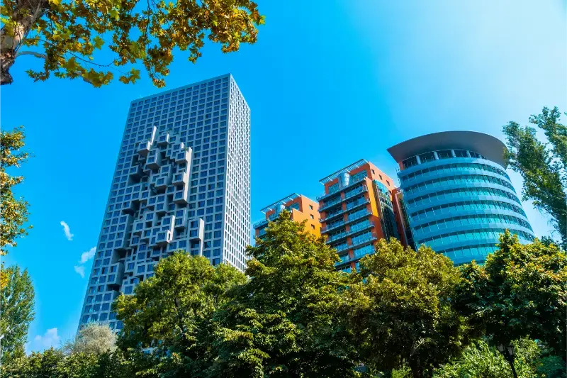
    Modern Buildings Center Skanderbeg Square Tirana Albania

    This guide uses “hike” broadly enough to include easier nature walks and tougher mountain days, but it does not pretend those activities carry the same risk. Distances, weather, trail markings and access roads can change. For remote or high routes, confirm conditions locally before leaving and carry a navigation method that works offline.

    Quick comparison

    RouteDifficultyBest forAccess
    Mount Dajti to Tujani PeakModerateBest all-round hike from TiranaCable car + walking
    Lake Bovilla and Gamti viewpointModerateBest for dramatic reservoir viewsCar, taxi or guided tour
    Pellumbas Cave trailModerateBest canyon-and-cave walkCar/taxi + marked trail
    Shengjergj WaterfallEasy to moderateBest relaxed countryside walkCar/taxi or tour
    Farka and eastern Tirana hillsEasyBest low-effort nature walkTaxi, bicycle or local transport

    Which hike should you choose?

    If this is your first outdoor day in the area, choose the route with the simplest access and an obvious turnaround point. Save the highest or most remote objective for a day when the forecast, transport and your energy all line up. I would rather complete a shorter route comfortably than turn a holiday into a rescue problem by chasing a summit because it was on the original itinerary.

    Mount Dajti to Tujani Peak

    Best all-round hike from Tirana. Difficulty: Moderate. Access: Cable car + walking. Use the cable car to remove much of the road access, then follow the established mountain trail toward the Tujani/Cherry Pass area. The official tourism portal describes a well-trodden oak-forest route to Tujani Peak at about 1,580 m, with broad views over Tirana and toward Bovilla. This is my first choice when you want a proper hike without renting a car. Read the Mount Dajti guide before going.

    Lake Bovilla and Gamti viewpoint

    Best for dramatic reservoir views. Difficulty: Moderate. Access: Car, taxi or guided tour. Bovilla is the photogenic option north-east of the city. The road access is the complicated part, not simply the walking distance, and the final terrain can feel exposed in heat. The Lake Bovilla guide covers the Gamti viewpoint and access. Treat it as a half- or full-day nature trip rather than a quick stop between city museums.

    Pellumbas Cave trail

    Best canyon-and-cave walk. Difficulty: Moderate. Access: Car/taxi + marked trail. The marked trail to Pellumbas Cave follows the Erzen/Skorana canyon landscape. It is more adventurous than an urban walk and the cave itself is dark and slippery, so a headlamp and sturdy shoes matter. Use the Pellumbas Cave guide and do not enter deeper cave areas if conditions or your equipment are unsuitable.

    Shengjergj Waterfall

    Best relaxed countryside walk. Difficulty: Easy to moderate. Access: Car/taxi or tour. Shengjergj is a softer alternative when you want green countryside and a waterfall rather than a summit. The final walk is shorter than Dajti or Bovilla, but the experience still depends on recent rainfall and season. See the Shengjergj Waterfall guide for the current approach.

    Farka and eastern Tirana hills

    Best low-effort nature walk. Difficulty: Easy. Access: Taxi, bicycle or local transport. For a lighter day, the hills and reservoir-side roads east of central Tirana give you space and views without committing to a mountain summit. I use this kind of walk after a travel day or in winter when higher trails are wet, windy or snowy.

    Football Stadium Tirana Air Albania Stadium

    Do you need a guide?

    For an obvious low-elevation walk with clear local directions, most experienced travelers can usually walk independently. A guide becomes much more valuable when the route is high, remote, poorly signed, seasonally snow-covered, canyon-based or dependent on a vehicle pickup at a different endpoint. A guide can also turn a simple walk into a better cultural/nature experience because local place names and private-land boundaries are not always obvious on online maps.

    Never use “there are reviews online” as a substitute for current conditions. A route can be straightforward in July and inappropriate after an October storm or during late spring snowmelt.

    Getting to the trailheads

    You do not need a car for Dajti. A car, taxi or tour is much more useful for Bovilla, Pellumbas and Shengjergj. If you rent a car only for one hiking day, compare the full rental/parking process with a driver or guided excursion.

    Best hikes for families

    Dajti is the easiest family mountain option because the cable car shortens the approach and you can turn around whenever needed. Farka and Shengjergj are also flexible. Pellumbas Cave and the steeper Bovilla/Gamti sections are better for older children who are confident on rough ground.

    Best time of year

    April–June and September–October are the easiest hiking periods around Tirana. Summer requires early starts, more water and less exposed midday walking. Winter can be excellent on lower routes, but Dajti can receive snow and wind, so conditions—not the city forecast alone—should decide the route.

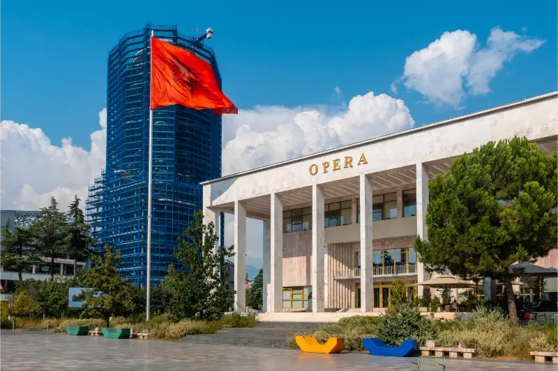
    Palace Culture Opera Skanderbeg Square Tirana Flag Albania Moving Wind

    Heat, storms and mountain safety

    Start early in warm weather and carry more water than you expect to need. On exposed ridges, thunder is a reason to turn around, not an invitation to wait under the tallest tree. In canyons and near waterfalls, heavy rain upstream can change conditions even if the sky above you looks better. In the Alps and other high ranges, snow, fog and wind can make a familiar summer route a completely different undertaking.

    Tell someone where you are going when the route is remote, keep your phone charged, download offline mapping and do not count on mobile coverage. If the trail is beyond your navigation or scrambling experience, choose a local guide rather than learning those skills in a place you do not know.

    What to pack

    • Shoes with reliable grip rather than smooth city sneakers.
    • At least one extra layer, even on a warm valley day if the route gains altitude.
    • Sun protection: hat, sunscreen and sunglasses.
    • Enough water plus a small snack; do not assume every spring is safe to drink.
    • Offline map, charged phone and small power bank on longer routes.
    • Compact rain/wind shell.
    • Basic first-aid items and any personal medication.
    • Cash for rural cafés, taxis or guesthouse transfers where cards may not be practical.

    Where to stay for hiking

    Compare current accommodation in Tirana on Booking.com.

    For area-by-area accommodation advice, read the local Where to Stay guide. For hiking trips I care more about early breakfast, vehicle access, luggage storage and the host’s current trail knowledge than about a small difference in room decoration.

    Guided hikes and outdoor tours

    Guided options are most useful when transport and hiking are bundled together, especially from a city base or on routes where the start and finish are different. Compare the current activity description carefully rather than assuming every tour includes the same trail or difficulty.

    How to plan a two-hike stay

    I use the first outdoor day for the easier route. That gives me a real sense of local heat, trail surfaces, driving and my own energy after travel. I put the harder objective on the second day with a backup plan. If the weather is poor, I swap the order rather than forcing the mountain day. This simple strategy is especially useful in Theth, Valbona, Tomorr, Nëmërçka and the higher Korçë/Pogradec ranges.

    Common hiking mistakes

    • Starting too late because the route looks short on a map.
    • Using road-driving time as if it were guaranteed trailhead access.
    • Following an old GPX track without checking closures, private land or changed paths.
    • Carrying too little water on exposed summer routes.
    • Treating a canyon, waterfall or river crossing as safe after heavy rain.
    • Assuming a famous high pass is snow-free because the valley is warm.
    • Wearing sandals on loose rock because the hike ends at a beach or thermal spring.
    • Booking an onward bus or flight too tightly after a mountain day.

    Official and related planning resources

    For the destination overview, see the official Albania tourism page. The national trail overview Best Hiking Trails in Albania is useful for comparing this area with the rest of the country.

    Frequently asked questions

    Can I hike here without a car?

    At least one of the routes in this guide can usually be done without owning a car, but the answer depends on your accommodation and the exact trail. City-adjacent walks are easiest; remote national-park and high-mountain trailheads often require a taxi, driver, shuttle or rental car.

    Do I need hiking boots?

    For easy dry paths, good trail shoes can be enough. For loose rock, wet canyon terrain, snow or a major mountain route, more supportive footwear is a better choice. Grip matters more than brand.

    Can I hike in July and August?

    Yes, but start early, carry substantial water and reduce exposed midday walking. Higher mountain routes may be cooler, while low canyon and coastal paths can become extremely hot.

    Is hiking safe after rain?

    It depends on the route. Rain can make stone, clay and roots slippery, and canyon or river conditions can change rapidly. Choose a lower-risk route or wait when conditions are uncertain.

    Should I download an offline map?

    Yes for anything beyond an obvious short walk. Mobile signal is not a reliable navigation strategy in mountain and canyon terrain.

    Final recommendation

    Build the hiking day around conditions rather than ambition. Choose one route that matches your transport, fitness and the forecast, start earlier than you think you need to, and keep a lower-risk alternative ready. Albania’s best outdoor experiences are not improved by rushing them.

    More local Albania guides

    More local Albania guides

  • Tirana Grand Park Guide: Artificial Lake, Walking, Running and a Green City Break

    Tirana Grand Park Guide: Artificial Lake, Walking, Running and a Green City Break

    Tirana Grand Park and the Artificial Lake are where the capital changes pace. After the traffic, museums and dense central streets, the park gives you broad promenades, mature greenery, running routes, playgrounds, cafes and water views within the urban area. The lake was created in the 1950s as part of a flood-control project and today sits at the center of one of Tirana’s most-used recreational spaces.

    Streets Avenues Center Tirana Albania

    I like the park most as a piece of everyday Tirana rather than as a checklist attraction. Come early and you will share the paths with runners and walkers; arrive before sunset and the lake edge becomes a social space for families, couples and groups of friends. It is also a useful reset on a longer city itinerary, particularly if you have already spent several hours underground at the bunker museums or inside galleries.

    Albania’s official tourism portal is the main reference used for the core historical and location facts in this guide. I still recommend checking current opening arrangements, ticketing, local access and any temporary restrictions close to your travel date, because those details can change faster than the heritage itself.

    Why this place is worth adding to your Albania trip

    Tirana Grand Park earns its place in an itinerary because it adds a layer that broad destination guides often miss. Instead of collecting another famous viewpoint, you get a more specific understanding of southern central Tirana: how people lived, moved, worshipped, worked, relaxed or understood power in that setting. I would choose this stop when you have enough time to look closely rather than squeezing it into the final twenty minutes of a crowded day.

    One of the best habits when travelling in Albania is to separate distance from travel time. A place can look close on the map but still require slow urban traffic, steep walking, village roads or time to find parking. Build a buffer into the day and keep one optional stop rather than making every stop compulsory. This is especially valuable in historic centers, where the walk between two attractions may be short in kilometres but demanding in heat or on stone paving.

    Historical and cultural context

    The Artificial Lake dates from the 1950s and covers roughly 55 hectares according to the national tourism authority. Around it, the Grand Park developed into a major green and recreational zone. Its importance is social as much as scenic: this is a place used daily by Tirana residents for exercise, walking, family time and informal meetings, which makes it a good counterpoint to the monumental center.

    Context matters because Albanian heritage is layered. Ancient, Byzantine, Ottoman, royal, communist and contemporary periods often occupy the same small area. Try not to force every building into a single national story. Ask what function the site had at the time, who used it, what changed later and why it survived. That approach produces a much more accurate travel experience than repeating a legend without distinguishing it from documented history.

    What to notice during your visit

    Walk the lake edge

    Do not worry about completing every path. A partial loop is enough to understand the scale and enjoy the water. Choose the side that best fits your next stop and use the park as a flexible part of the day rather than a race around the shoreline.

    Run or cycle

    The park is one of the easiest places in Tirana to exercise away from busy traffic. Early morning is especially pleasant in warm months. Cyclists should still ride considerately because many paths are shared with walkers, children and dogs.

    Family time

    Playgrounds, open space and broad promenades make this one of the easiest central areas for a family break. It works well after a museum morning because children can move freely without the logistics of a full day trip outside the city.

    Cafes and slow time

    Use a lakeside or park cafe as a pause, not as the only reason to come. The best experience is combining a drink with a walk and watching the rhythm of local life change through the day.

    How much time to allow

    For Tirana Grand Park, I would protect at least 60 to 90 minutes in the schedule unless you already know the visit is very short. That gives you time to orient yourself, read interpretation, take photographs without blocking other visitors and notice details that are invisible on a quick pass. If the place includes steep walking, a museum interior or a guided component, allow longer. The goal is not to manufacture a fixed duration but to avoid turning a meaningful site into a rushed checkbox.

    If you are travelling in summer, the useful day is often split into a cooler morning, a slower middle of the day and a second active period later in the afternoon. Museums can be ideal in the heat, while exposed bridges, castle lanes and rural churches are usually more pleasant outside the strongest sun. In winter, daylight becomes the limiting factor instead, especially if you still need to drive on unfamiliar roads.

    A realistic way to combine it with nearby sights

    From the center, I would pair the Grand Park with Blloku or the Pyramid area rather than trying to combine it with a distant day trip. Walk south from the central districts, spend one to two relaxed hours around the lake, then return through Blloku for dinner. If you want more nature, keep Dajti or Bovilla for a separate half-day because both deserve more time than a rushed extension.

    I prefer geographic clustering to zigzagging. Two or three related stops in one district usually produce a better day than five famous places scattered across the map. Keep food, coffee and unplanned discoveries inside the itinerary rather than treating them as delays. In Albania, the unscheduled bakery, viewpoint, market stall or conversation can be as memorable as the attraction you planned six months earlier.

    Getting there and moving around

    Use Tirana as the practical reference point for this visit. In a city, walking is often the best final approach because parking and one-way streets add unnecessary stress. For rural or regional sites, a rental car, driver or carefully arranged taxi gives more control, but always confirm the return plan before setting off. Public transport can work well between major towns, yet the last few kilometres to a village, monastery or trailhead may require a separate solution.

    Tirana City Skyline Albania

    Download the destination and surrounding streets for offline use. Mobile data coverage is generally useful but should not be your only navigation plan, particularly underground, inside thick stone buildings or in rural valleys. If you drive, avoid assuming that the fastest-looking road on a map is the best route. Ask your accommodation about current road conditions when the final approach is minor or mountainous.

    Best time of day and season

    Spring and autumn are especially comfortable for cultural sightseeing because walking temperatures are usually easier and the strongest summer crowds are reduced. Summer gives long daylight but can make stone cities and exposed sites very hot around midday. Winter is often quiet and atmospheric, though shorter days, rain, snow at elevation and reduced seasonal services can change plans. There is no single perfect month; match the season to the kind of experience you want.

    For photography, early morning and late afternoon usually provide softer light, but museums and interiors depend more on opening hours than golden hour. If your priority is an uncrowded experience, arriving near opening time is often more effective than searching for a supposedly secret season. Always respect any local rule that restricts tripods, flash or photography of sacred objects.

    Where to stay

    Tirana is the logical base for most travellers visiting Tirana Grand Park. Check accommodation in Tirana. When choosing a property, read the most recent comments about location, parking, stairs, noise, heating or air conditioning rather than relying only on the overall score. In historic areas, a hotel that looks very close on the map can still involve a steep climb with luggage.

    Food, coffee and local rhythm

    Do not over-plan meals. If you are in a major city, save a few promising places but choose according to where you actually are when hungry. In rural areas, meal times and seasonal opening patterns can be less predictable, so ask hosts for current recommendations. Carry some cash in lek for small purchases. Card acceptance has expanded, but it is still sensible not to depend on a single payment method.

    Coffee is part of the travel rhythm in Albania rather than merely fuel. A short stop can become a useful planning reset: check the next opening time, review your walking route, drink water and decide whether another attraction will improve the day or simply make it busier. This is particularly important in places with emotionally heavy history, where a pause between museums can help you process what you have seen.

    Families, older travellers and accessibility

    Tirana Grand Park may be interesting for families, but the experience depends on age and attention span. Children often engage better when adults turn details into questions—how a room was used, why a wall is so thick, how a bridge carries water around its piers—rather than expecting them to read every label. For older travellers, reduce the number of stops and prioritize shade, seating and easy transport between neighborhoods.

    Accessibility in Albania varies greatly. Historic houses can have narrow stairs, castles have uneven stone, rural churches can lack step-free entrances and underground museums may have confined passages. If mobility is a decisive issue, contact the attraction directly before visiting. A private driver can be a worthwhile upgrade because it reduces walking between transport nodes even when the attraction itself is not fully accessible.

    Photography and respectful behaviour

    Take photographs in a way that does not turn the site into a stage set. Do not climb walls, sit on fragile structures, move objects, block narrow circulation or photograph people closely without permission. At religious sites, modest dress and quiet behaviour matter even when no service is taking place. At places connected with dictatorship or persecution, avoid playful bunker poses that trivialize the experiences being documented.

    A useful photography strategy is to make three kinds of image: one establishing view showing the setting, one architectural or object detail, and one image that records how the place relates to the surrounding city or landscape. That small discipline usually creates a stronger travel record than taking fifty nearly identical wide shots.

    Safety and practical details

    The park is free-form urban space rather than a controlled attraction, so facilities and path conditions can change. In summer, use the cooler morning or late-afternoon hours and carry water. After rain, shaded sections can stay damp. At night, stick to well-used, well-lit routes and use normal city awareness with valuables.

    • Check current information: opening hours, tickets and temporary closures can change.
    • Carry some cash: small sites and local services may not always accept cards.
    • Wear suitable shoes: stone, stairs, polished floors and uneven lanes can be slippery.
    • Save maps offline: useful in bunkers, thick buildings and rural areas with weak signal.
    • Keep the day flexible: leave room for traffic, weather, queues or a slower visit than expected.
    • Respect the site: follow photography, dress, touching and access rules even when enforcement looks informal.

    Useful related Wonderful Albania guides

    Continue planning with our Tirana travel guide, Farka Lake guide, Mount Dajti guide, best day trips from Tirana. These articles are designed to work as a cluster, so you can move from the specific attraction to accommodation, transport, food and wider regional planning without rebuilding the itinerary from scratch.

    Tirana Skyline And Dajti Mountains Albania

    Final thoughts

    Tirana Grand Park is most rewarding when you give it enough time to explain something about Albania rather than using it only as a backdrop. Look closely, separate documented history from legend, ask practical questions and connect the site to the surrounding neighborhood or landscape. That slower approach produces a richer trip and is also more respectful to the people and institutions preserving the place for future visitors.