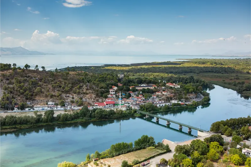
The Cem River, also written Cemi, rises in the Kelmend mountains of northern Albania and continues across the border into Montenegro. The national tourism authority emphasizes the river’s clear water, green valleys and growing appeal for outdoor activities including canoeing, kayaking and light rafting where conditions and local operations allow. This guide is designed for travelers who want to visit with realistic expectations: the site is worth the effort, but it should be planned around current access, weather and the wider region rather than treated as a guaranteed turn-up-and-go attraction.
- Best for: nature, hiking and landscape photography.
- Best base: Tamarë.
- Planning style: allow buffer time for rural roads or foot access and confirm the final approach locally.
- Bring: water, shoes with grip, sun/rain protection, offline maps and enough daylight for the return.
- Key rule: current local conditions matter more than an old social-media post or map pin.
Why this place is worth adding to an Albania itinerary
The Cem gives structure to a Kelmend road trip. Instead of treating Tamarë, Lëpushë and Vermosh as isolated pins, you can follow the valley and understand how settlement, agriculture and travel relate to the river. The water is visually striking in clear weather, but the best days also include a village meal, a viewpoint and enough time to stop safely rather than racing to the farthest destination.
The appeal is strongest when you connect the site to the surrounding region rather than treating it as an isolated pin. The road through Kelmend offers several opportunities to see the river as part of a wider trip linking Tamarë, Selcë, Lëpushë and Vermosh. The river should not be reduced to one swimming spot: its value is the whole valley system, where mountain road, villages, bridges and changing water conditions create the experience. That context helps you decide whether it deserves a dedicated half day, a short stop on a road trip or a place in a longer hiking itinerary.
What you are actually coming to see
The Cem River, also written Cemi, rises in the Kelmend mountains of northern Albania and continues across the border into Montenegro. The national tourism authority emphasizes the river’s clear water, green valleys and growing appeal for outdoor activities including canoeing, kayaking and light rafting where conditions and local operations allow. The road through Kelmend offers several opportunities to see the river as part of a wider trip linking Tamarë, Selcë, Lëpushë and Vermosh. The river should not be reduced to one swimming spot: its value is the whole valley system, where mountain road, villages, bridges and changing water conditions create the experience.
Smaller Albanian attractions rarely present themselves like polished open-air museums. Signage may be limited, the exact route can be informal and there may be no café, ticket office or staffed entrance. That is not necessarily a weakness, but it changes the way you should visit: read about the place beforehand, arrive with time, and use the landscape itself as part of the interpretation.
I would avoid building the visit around a single photograph. Spend time looking at how the site relates to terrain, water, old routes, villages and the wider region. In many parts of Albania, geography explains history: defensive sites sit where valleys narrow, bridges occupy practical crossing points, and mountain lakes or rivers shape seasonal movement and settlement.
How to get there from Tamarë
The most straightforward approach is from Shkodër toward Tamarë, then farther into Kelmend according to your itinerary. Road quality has improved on main approaches, but mountain driving still requires attention to curves, weather, livestock and occasional works. Pull over only where there is a genuine safe space; do not stop in a blind bend simply because the river looks photogenic.
If you use a taxi or private driver, agree on the return plan and total price before leaving the main town. In remote areas it can be difficult to summon another car on demand, and mobile signal may be weaker than expected. Save the driver’s number and your accommodation details offline. If you drive yourself, leave the vehicle only where it is clearly safe and legal, without blocking residents, farm access or emergency routes.
Travel times in rural Albania are better treated as ranges than promises. A short distance can include steep gradients, livestock, road works or slow village sections. Build in at least thirty to sixty minutes of flexibility on a day that also includes another major attraction.
How much time to allow
For a focused visit, I would normally reserve two to three hours from arrival in the immediate area to departure. That is deliberately more than the time required to take a few photos: it gives you room to find the correct approach, walk at a safe pace, stop for context and adapt if a path or parking spot is different from what you expected.
If the site forms part of a high-mountain hike, the simple two-to-three-hour rule does not apply. In that case plan the entire route by walking time, elevation, daylight and escape options. Remote alpine destinations may deserve a full day or an overnight stay even when the straight-line distance looks small.
Best time of year and time of day
Late spring through early autumn is the easiest period for road trips and village stays. Spring brings strong flow and green slopes, summer makes riverside breaks attractive, and early autumn often combines stable weather with fewer visitors. Winter can be beautiful in Kelmend but changes driving and hiking requirements substantially.
For photography, early morning and late afternoon usually produce softer light and a quieter atmosphere. For safety, however, do not push a visit so late that you must return on an unfamiliar trail or rural road after dark. In the mountains, start earlier than you think you need; on exposed cultural sites, an early start also avoids the strongest heat.
Always recheck the recent weather rather than relying only on monthly climate averages. Heavy rain can affect rivers, canyon approaches and dirt tracks for several days, while a hot dry period can make exposed hills much more demanding than the temperature in the nearest town suggests.
Safety and terrain
River conditions are not constant. Clear-looking water can be cold and fast, particularly after rain or during snowmelt. Swim only where local advice and conditions support it, and use a qualified operator for kayaking or rafting. Do not enter narrow sections when thunderstorms are possible upstream. Children need close supervision anywhere near current, slippery stones or steep banks.
Closed footwear with grip is a better default than sandals for almost every lesser-known nature or ruin site. Carry a small first-aid kit, and if the visit involves real mountain terrain, add layers, emergency food and navigation redundancy. The absence of railings or warning signs does not mean an edge, cave, wall or river pool is safe.
If local residents, park staff, guides or your accommodation advise against a route, take that seriously. Conditions on remote roads and trails can change faster than travel blogs are updated. Turning around is a normal part of good trip planning, not a failed day.
Who will enjoy this place most?
This stop is best for travelers who enjoy understanding place rather than collecting famous landmarks. It suits photographers, independent road-trippers, hikers and repeat visitors particularly well. If your priority is cafés, shopping, nightlife or a fully accessible attraction with predictable facilities, keep this as an optional addition rather than a core itinerary item.
Families and older travelers should evaluate the final approach rather than the attraction name. A short visit can still involve uneven stones, steep paths, summer heat or a lack of toilets. Ask your accommodation for current practical details before committing the whole group.
Photography and drones
Start with a wide photograph that explains the landscape, then move to details: masonry, water texture, vegetation, ridge lines or the relationship between the site and the nearest village. Avoid climbing on ruins, moving stones or stepping into fragile vegetation for a cleaner composition.
Drone rules and local sensitivities can change. Before flying, check current Albanian aviation requirements, protected-area restrictions, privacy and any site-specific rules. In quiet villages and wildlife areas, a drone can create much more disturbance than the operator realizes, so a handheld camera is often the better choice.
Responsible travel
The smaller the attraction, the more visible each visitor’s behavior becomes. Carry out all litter, keep noise low, close farm gates, avoid blocking local roads and buy something locally when a café, guesthouse or driver genuinely helps your trip. These choices make low-volume tourism more useful to the community.
Do not remove stones, plants, pottery fragments or anything that looks archaeological. At protected natural sites, stay on durable surfaces where possible and do not approach wildlife for photographs. At religious or cultural sites, dress and behave respectfully even when no staff member is present.
Where to stay
For most travelers, the practical base is Tamarë or another established town/guesthouse area nearby. Compare current accommodation on Booking.com. Use the map view and recent reviews rather than choosing only by price, because a cheap room can be poor value if it adds substantial backtracking to a rural route.
Check parking, road access, heating or air-conditioning, breakfast timing and late check-in before booking. In mountain areas, also ask whether the property can help with a local guide, transfer or current trail information. That kind of practical knowledge is often more valuable than a small difference in room price.

Food, water and basic services
Carry water and a simple snack because smaller sites often have no shop or café at the entrance. Plan your main meal in the nearest town or village and keep some Albanian lek for family-run restaurants, taxis, parking or small purchases. Card acceptance is improving but is not universal in rural areas.
Do not assume there will be a public toilet at the attraction. Use facilities before leaving your base, especially when traveling with children. In summer, bring more water than you expect to need; in the mountains, remember that cool air can hide how much fluid you are losing while walking.
What to combine with the visit
These existing Wonderful Albania guides fit naturally into the same regional cluster:
A strong day usually needs one major anchor and one or two smaller stops. Trying to visit five remote attractions in one day often creates more driving than experience. Use actual road time and daylight to choose what fits, and leave room for an unplanned meal, viewpoint or conversation in a village.
A realistic itinerary
Start from Tamarë after breakfast and aim to reach the site while the day is still cool and flexible. Use the first part of the visit to confirm access and conditions rather than immediately pushing toward the most photogenic point. Explore only the sections that are clearly safe and permitted, then return with enough time to stop for lunch or a second nearby attraction from the links above.
If weather, road conditions or local advice make the original plan unattractive, switch to the nearest established town, museum, village or scenic drive. Albania has enough variety that a flexible day is usually better than forcing a remote stop in poor conditions.
Common mistakes to avoid
- treating a map pin as proof of current vehicle or foot access
- wearing beach footwear on loose, wet or rocky terrain
- scheduling the return after dark on an unfamiliar rural route
- entering water, ruins or protected areas because no barrier is visible
- assuming a fixed old taxi price, opening time or road condition is still valid
- leaving litter, moving stones or disturbing wildlife for photographs
Tours and guided experiences
Organized tours specifically naming this site may be limited, but private experiences from Tamarë or the wider region can sometimes be adapted. Ask exactly what is included: vehicle type, walking level, guide qualifications, entry arrangements and cancellation policy. For remote mountain or water-based destinations, choose an operator because of local competence rather than simply the lowest price.

Official information and last-minute checks
For the core historical or natural background used in this guide, see Albanian National Tourism Agency – Cem River. Official tourism pages are a strong starting point, but they do not guarantee that a road, trail, interior, local service or water condition will be the same on your travel day. Recheck time-sensitive details shortly before departure.
Frequently asked questions
Where is the Cem River in Albania?
It flows through the Kelmend area north of Shkodër before continuing into Montenegro.
Can you swim in the Cem River?
In some places and conditions people do, but temperature, current and depth vary. Ask locally and never assume a pool is safe from appearance alone.
Is rafting available?
The official tourism authority identifies the river as suitable for water sports in appropriate sections, but availability is operator- and condition-dependent.
What is the best base?
Tamarë is practical for the lower valley, while Lëpushë or Vermosh suit travelers continuing deeper into Kelmend.
Do I need a 4×4?
Not for the main paved Kelmend route in normal conditions, but side tracks and trailheads can be different. Never take a rental vehicle onto rough roads without checking both conditions and your contract.
Final perspective
Cem River is most rewarding when you treat it as part of a wider Albanian landscape rather than a checklist stop. Arrive with enough time, use local knowledge, respect the site and be willing to change plans when conditions demand it. That approach creates a better trip and helps protect the smaller places that make Albania interesting beyond its headline destinations.
Leave a Reply