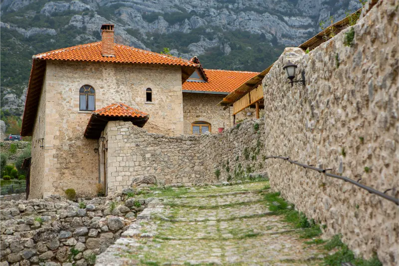
Krujë is already a hillside destination, so hiking begins almost at the edge of the old town. The strongest routes combine the historic city with Mount Kruja and the forested Qafë Shtamë area. This is not a place where you need to chase ten named trails: two or three well-chosen walks give you the best views and leave enough time for the castle and bazaar.

This guide uses “hike” broadly enough to include easier nature walks and tougher mountain days, but it does not pretend those activities carry the same risk. Distances, weather, trail markings and access roads can change. For remote or high routes, confirm conditions locally before leaving and carry a navigation method that works offline.
Quick comparison
| Route | Difficulty | Best for | Access |
|---|---|---|---|
| Krujë to Sari Salltik | Moderate to strenuous | Best panoramic hike above town | On foot or taxi up / walk down |
| Mount Kruja ridge viewpoints | Moderate | Best for wide plain-and-Adriatic views | On foot with local route knowledge |
| Qafë Shtamë National Park walks | Easy to moderate | Best forest day near Krujë | Car/taxi required for practical access |
| Castle to old-town viewpoints | Easy to moderate | Best short walk without a car | On foot |
| Foothill village walks | Easy to moderate | Best for quiet rural scenery | Car/taxi + walking |
Which hike should you choose?
If this is your first outdoor day in the area, choose the route with the simplest access and an obvious turnaround point. Save the highest or most remote objective for a day when the forecast, transport and your energy all line up. I would rather complete a shorter route comfortably than turn a holiday into a rescue problem by chasing a summit because it was on the original itinerary.
Krujë to Sari Salltik
Best panoramic hike above town. Difficulty: Moderate to strenuous. Access: On foot or taxi up / walk down. The classic mountain objective above Krujë is Sari Salltik, a Bektashi pilgrimage site high on Mount Kruja. The ascent is sustained and exposed in hot weather, while a taxi/driver can reduce the climb if you mainly want the ridge views. Read the Sari Salltik and Mount Kruja guide before choosing the full ascent.
Mount Kruja ridge viewpoints
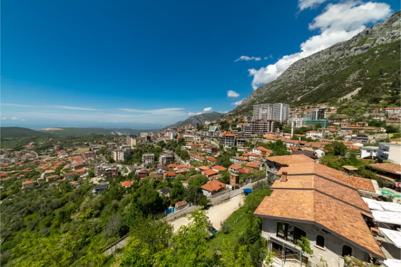
Best for wide plain-and-Adriatic views. Difficulty: Moderate. Access: On foot with local route knowledge. The slopes above Krujë open toward the central plain and, on clear days, the Adriatic. Rather than inventing a summit circuit, I treat this as an extension of the Sari Salltik hike and turn around according to daylight, weather and navigation confidence.
Qafë Shtamë National Park walks
Best forest day near Krujë. Difficulty: Easy to moderate. Access: Car/taxi required for practical access. Qafë Shtamë changes the scenery completely: forest, springs and mountain roads instead of the dry exposed slopes above town. The Qafë Shtamë guide is the place to plan a picnic, short forest walk or longer nature day. It is also a better summer option when shade matters.
Castle to old-town viewpoints
Best short walk without a car. Difficulty: Easy to moderate. Access: On foot. For a lower-effort day, use the steep lanes between the Old Bazaar, castle and upper viewpoints as a cultural hike. It is not wilderness, but the gradient is real and the views explain Krujë’s strategic position. Good shoes matter on polished cobbles.
Foothill village walks
Best for quiet rural scenery. Difficulty: Easy to moderate. Access: Car/taxi + walking. The villages and springs around Krujë provide shorter rural walks away from the main visitor flow. Ask locally for the best current approach rather than following an unverified online GPX track through private land.
Do you need a guide?
For an obvious low-elevation walk with clear local directions, most experienced travelers can usually walk independently. A guide becomes much more valuable when the route is high, remote, poorly signed, seasonally snow-covered, canyon-based or dependent on a vehicle pickup at a different endpoint. A guide can also turn a simple walk into a better cultural/nature experience because local place names and private-land boundaries are not always obvious on online maps.
Never use “there are reviews online” as a substitute for current conditions. A route can be straightforward in July and inappropriate after an October storm or during late spring snowmelt.
Getting to the trailheads
A car is unnecessary for the town and Sari Salltik if you are happy to walk, but very useful for Qafë Shtamë and rural foothill routes. Parking in historic Krujë is a separate issue from mountain access, so read the Krujë driving and parking guide.
Best hikes for families
Families should start with the castle/old-town walk or Qafë Shtamë. A full Sari Salltik ascent is better for active older children. In summer, do not underestimate the combination of steep grade and reflected heat from rock.
Best time of year
Spring and autumn are ideal. Summer works with an early start; winter can bring cold, wind and occasional snow on higher slopes. Qafë Shtamë is often the better warm-weather choice because of forest shade.
Heat, storms and mountain safety
Start early in warm weather and carry more water than you expect to need. On exposed ridges, thunder is a reason to turn around, not an invitation to wait under the tallest tree. In canyons and near waterfalls, heavy rain upstream can change conditions even if the sky above you looks better. In the Alps and other high ranges, snow, fog and wind can make a familiar summer route a completely different undertaking.
Tell someone where you are going when the route is remote, keep your phone charged, download offline mapping and do not count on mobile coverage. If the trail is beyond your navigation or scrambling experience, choose a local guide rather than learning those skills in a place you do not know.
What to pack
- Shoes with reliable grip rather than smooth city sneakers.
- At least one extra layer, even on a warm valley day if the route gains altitude.
- Sun protection: hat, sunscreen and sunglasses.
- Enough water plus a small snack; do not assume every spring is safe to drink.
- Offline map, charged phone and small power bank on longer routes.
- Compact rain/wind shell.
- Basic first-aid items and any personal medication.
- Cash for rural cafés, taxis or guesthouse transfers where cards may not be practical.
Where to stay for hiking
Compare current accommodation in Kruje on Booking.com.
For area-by-area accommodation advice, read the local Where to Stay guide. For hiking trips I care more about early breakfast, vehicle access, luggage storage and the host’s current trail knowledge than about a small difference in room decoration.
Guided hikes and outdoor tours
Guided options are most useful when transport and hiking are bundled together, especially from a city base or on routes where the start and finish are different. Compare the current activity description carefully rather than assuming every tour includes the same trail or difficulty.
How to plan a two-hike stay
I use the first outdoor day for the easier route. That gives me a real sense of local heat, trail surfaces, driving and my own energy after travel. I put the harder objective on the second day with a backup plan. If the weather is poor, I swap the order rather than forcing the mountain day. This simple strategy is especially useful in Theth, Valbona, Tomorr, Nëmërçka and the higher Korçë/Pogradec ranges.
Common hiking mistakes
- Starting too late because the route looks short on a map.
- Using road-driving time as if it were guaranteed trailhead access.
- Following an old GPX track without checking closures, private land or changed paths.
- Carrying too little water on exposed summer routes.
- Treating a canyon, waterfall or river crossing as safe after heavy rain.
- Assuming a famous high pass is snow-free because the valley is warm.
- Wearing sandals on loose rock because the hike ends at a beach or thermal spring.
- Booking an onward bus or flight too tightly after a mountain day.
Official and related planning resources
For the destination overview, see the official Albania tourism page. The national trail overview Best Hiking Trails in Albania is useful for comparing this area with the rest of the country.
Frequently asked questions
Can I hike here without a car?
At least one of the routes in this guide can usually be done without owning a car, but the answer depends on your accommodation and the exact trail. City-adjacent walks are easiest; remote national-park and high-mountain trailheads often require a taxi, driver, shuttle or rental car.
Do I need hiking boots?
For easy dry paths, good trail shoes can be enough. For loose rock, wet canyon terrain, snow or a major mountain route, more supportive footwear is a better choice. Grip matters more than brand.
Can I hike in July and August?
Yes, but start early, carry substantial water and reduce exposed midday walking. Higher mountain routes may be cooler, while low canyon and coastal paths can become extremely hot.
Is hiking safe after rain?
It depends on the route. Rain can make stone, clay and roots slippery, and canyon or river conditions can change rapidly. Choose a lower-risk route or wait when conditions are uncertain.
Should I download an offline map?
Yes for anything beyond an obvious short walk. Mobile signal is not a reliable navigation strategy in mountain and canyon terrain.
Final recommendation
Build the hiking day around conditions rather than ambition. Choose one route that matches your transport, fitness and the forecast, start earlier than you think you need to, and keep a lower-risk alternative ready. Albania’s best outdoor experiences are not improved by rushing them.
Leave a Reply